Kathleen was a bit of a damp squib where we are so we decided to go for a walk to post some letters and get milk etc.
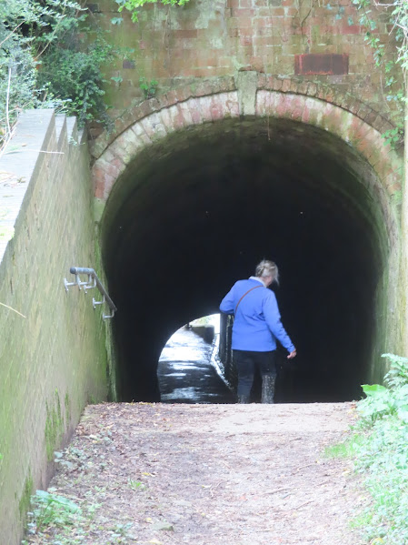
It was about 1/2 mile to Shrewley Tunnel and the village above. The tow path was too bad, other than in patches.
Shrewley Cutting and tunnel revealed bedding layers that excited the geologists of the area. There are three main areas in layers the top being red mudstones that were laid down in very dry conditions. The next is made up of several thin bands of rock laid down in much more wet conditions and containing fossils and foot prints. The third layer indicates a return to arid conditions with the moisture going and no fossils.
It seems that the work may have started here at the Warwick end of the canal as in July 1797 there was an advert in the local paper to employ men to making the Rowington Cutting, than in April 1798 an advert for bricklayers, stonemasons, dealers in timber and lime and jobbing smiths for work on the cut between Warwick and Turner's Green. In April 1799 100 to 150 men were needed to build the Rowington embankment. In November 1799 a tender went out for a supplier of bricks for 19 locks each to be 10" x 5" x 3" after leaving the kiln.
We went up the horse tunnel to the road above. The gradient is quite steep and at the top end it has obviously got too steep for men as they have put steps in
Just to the right of the horse path is the post office/shop/deli. They have ready made curries etc and pastries as well as the usual. We got a balti and a biryani to feed us after the locks, and they were delicious, we will stop again.
You can see where they have had to alter the slope of the path and put in the steps.
In my looking through the papers last night and found an old boatman talking about going through Shrewley Tunnel. We said that they didn't leg through the tunnel as I have read but it seems once the momentum of the horse slacked off they would pull themselves through by heaving on bars set in the walls of the tunnel. I can see bolts near the entrances but the flow stone may well have obscured them elsewhere. I also read about the first person to swim through the tunnel. It was G. W. Pearson in July 1933. He was a member of a gang working on the widening scheme and did it for a bet. He was a strong swimmer but nobody had ever got more than half way previously. His mates followed him in a boat just in case he got into difficulties
The wind was a bit gusty making things not so easy working the locks, and it also meant that the gates blew open easily on their own. Nobody at the top waiting and we had to start off on our own. No sign of a voluntary lock keeper either. Helen set to with a will. By the time we were near three locks and by the 'Welcome Station' a bloke (volunteer?) looked at us and opened a gate and never said a word and then went back inside! As Helen went to check the next lock another 'volunteer' told her to stay were she was as there were two boats coming up. They were just leaving the third lock below us and we could easily have got down especially as all the by washes were running anyway. They never lifted a finger. Very different to the lady lock keeper on the way up. I wouldn't have minded bu the boats coming up had two ashore and each had bow thrusters that should have made it easier for them, but for some reason they were still using ropes.
The dragonfly in Dragonfly pond must get a regular polish. The
tow path was busy with walkers but few wanted to talk and even fewer wanted to lend a hand!Here come the two uphill boats and we have the lock ready for them.
Well named 'Stairway to Heaven' looking quite smart in the distance and a bit of sun.
I wonder how many boaters go straight on here rather than round to the left. In truth the only way was ahead at one time as the Warwick and Birmingham canal was completed in 1793 and Saltisford Basin was the terminus. The Warwick and Napton Canal was completed in 1794. I'm not sure when the two were connected though. The basin beyond the railway bridge at Saltisford was filled in in the 1970's but the existing bit was the result of a successful campaign to preserve it in 1983.
From this OS map abstract from 1886 you can see the forked basin at the lower right. It served the oldest gas works until filled in back to the railway line.
The Cape pub around 1900.
We moored up after Bridge 41 with a bit of difficulty due to the funneling of the wind. It had taken us 3 hrs and 45 mins to come down Hatton Locks if we take off the the 20 mins needless wait near the top and the 30 mins break for a cup of tea and a bite to eat.


No comments:
Post a Comment