Total Pageviews

Friday 30 June 2017

Work at the wharf, and we are off.

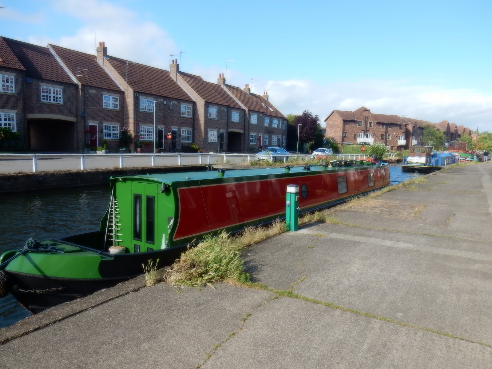
On Wednesday the weather was not very good at all. There were high winds and continuous rain. However about 1000 the intrepid members of the Driffield Navigation Trust turned up with a crane and trailers to carry out their promise to lift out any boats that wanted to attend the Driffield Navigation 250th Anniversary event at Driffield Basin but were stymied by the fixed bridges. It took me a while to convince them that their crane would not be able to lift our boat out even if I was going to attend!

As it was one boat, 'Rose of Yorkshire' had braved the elements to arrive at North Frodingham Wharf the night before. We moved down to the end of the quay to be out of the way. The bank that had been put in to prevent seepage through the wharf, that can be seen to the left of the line of stone in from the water, was needed by the Environment Agency made it a little difficult for the crane to set up.

Up and over; the 'Rose of Yorkshire' rose out of the water and onto the trailer. The bales were perfect for resting the hull on and protecting it to.

The only other boat to be lifted out was a 'trip' boat of the Trust that was going to be carrying passengers over the weekend. It was an ex Marines/Army craft with the fantastic timber framed greenhouse fitted.. They were telling me about an anniversary cruise that was coming up with candle and flowers, champagne etc. I thought what a great night cruise that could be had with all that glass, a slow pootle along with a candle and a wine and just stare out at the stars.

Our plans for a good walk in the lovely country came to naught as it never stopped raining all day. We did venture into the village for 'Pie and Pint' night at the local, The Blue Post. It was good home cooking and was a real bargain. Later we were joined by some friends and whiled away the night.

Next day the rain had stopped and the 40mph winds had fallen away. Unfortunately there was not a glimmer of sun to be had. We were off back to Beverley  and it was time to leave the wharf that was built in 1826. Just the other side of the bridge above the Frodingham Beck splits into the Keld Beck and the Old Howe. For us there is a spot big enough for us to wind, otherwise it would be 3/4 mile, with many bends, back to the junction.

Whilst being at the wharf we had watched a barn owl hunting and sitting by the barn in the farm opposite. Yesterday was a wash out for it so it was out in broad daylight hunting now the rain had stopped. This is the best shot we could get, but it is always a pleasure to see these birds.

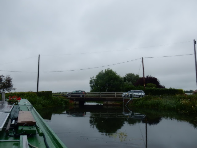
After joining the cut that goes on towards Driffield at Fisholme Junction we headed south. The next feature is at the Emmotland Junction where I think the original river headed off under the West Beck Bridge. On the way up the canal cut there is Brigham Sailing Club and I understand that this foot bridge had to be so high to allow their dinghies to pass under it. It was one of the last jobs undertaken by the former Humberside County Council. It seems that it's location was wrong so that on end is on private property and is very close to the water so it has remained closed since it was built!

As we approached Bethell's Bridge, where there are many moorings laid out, and plenty of the empty I managed to get this picture of a swan just having taken off. Best I could do, but we would see many more swans later in the trip.

We were going so slowly that one of the local moorers saw us approaching as he was taking his rubbish to the bin and very kindly swung the bridge for us. This saved a bit of careful maneuvering to get Helen landed and picked up.Apparently the bridge was built to provide access to  land that was cut off by the building of the Navigation. The Bethell's were the local Lord's of the Manor.

As we approached the lock there are two modern buttresses built into the river on either side with the signs as above. Apparently in the season when they cut the reeds and weed to ensure the flow of the river in winter they put a boom across the river here. They then have a long reach digger that then lifts it all out as it collects, rather than let it clog up the lock and weir.

Here you can see thre weit to the left and lock to the right. You can also see that in the wind and rain of yesterday we succumbed to lighting the fire again as the chimney is back in place. (At the end of June!!).

Here you can see the 'tool' that is needed to work the gate paddles. We were very grateful to the Beverley Barge Preservation Society for lending us these. I'm not sure who fabricated these gates but I haven't seen the like before. The sign at the lock states it is Hempholme Lock, but elsewhere it is called Struncheon Lock, so take your pick!

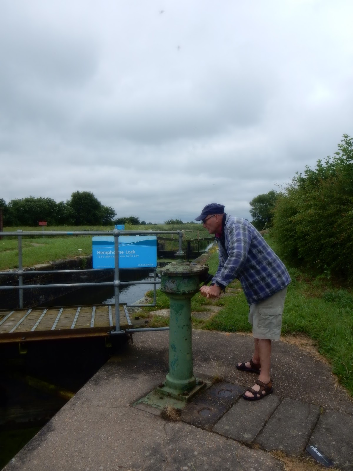
The gates are opened by these mechanisms working on a quadrant arm to the gate. Once again the tool required is not standard at all.

Here are the tools that are required. The two handled large piece is about 21/2" square to fit over the boss in the top of the stand. The spindle then raise through the middle so you don't have to lift the weight of the 'windlass all the time. The other windlass is normally shaped but the square section is about 13/8" which is smaller than a normal canal windlass.

As we had plenty of time we stopped on the lower landing for lunch.


Thursday 29 June 2017

As far as Frodingham.

The clouds started to become more numerous as we headed further up the River Hull towards Driffield. It started getting a bit cool when the sun was hidden. We had passed the half way mark in the last blog.

We were now passing Linley Hill farm that looked as though it had become a private residence as the barn conversion looked lovely. and I could spend hours sitting on those seats watching the river pass by. Just a little further down the road leading to the 'farm' is the grass airstrip of Hull Aero Club. This is of interest to me as the club started in 1930 at the airport near where I live that had been a race course then in 1930 it became Hull Aero club's base and in that year it was where Amy Johnson flew into to claim the Freedom of the City of Hull following her pioneer flight to Australia in her Gypsy Moth plane 'Jason'. The original is in the Science Museum in London but hanging from the roof of Hull's Paragon Station is a replica built by prisoners of HMP Hull, and it is tiny.

We now arrive at Wilfholme Landing where there are these moorings, many of which have little chalets on stilts attached. Technically it seems that the Driffield Navigation Navigation starts just south of here where the Aike Beck joins the River Hull. The 'Sun' was starting to get a bit of weed trouble around the plot, but she is a lot deeper than us. We could see the weed as the water was still gin clear but we were well clear of it. At the landing is a pumping station that can pump 161 million gallons of water a day from the Beverley and Barmston Drain that runs very close to the river. Apparently it is unable to pump water into the river when the river levels are high and as such will not be funded by the Government. It costs £80,000 per year to run and they were just going to close it despite the certainty of moor land become waterlogged and higher risk of flooding. The plan was shelved until 2013 but not sure how it was resolved.

Both John and Chris had a steer of the boat, and did very well keeping us out of the deep weed and lilies near the sides. Both commented on the amount of concentration that was required.

We passed Tophill Low water works and Nature Reserve where there are 300 acres that have 160 species of birds. There is a new 10m long viewing gallery too. We then arrived at Struncheon Hill Lock. This is the limit of the tidal River Hull. The lock takes you up over the weir that can be seen on the right of the photograph. The sun is on the lock landing readying the lock and we are just waiting.

It was then our turn whilst the 'Sun' was turning round to take our empty lock. Here we are winding the gate paddles on the bottom gates. These are just about normal and you can use a normal windlass and push the beam to open them. However the top gates are another kettle of fish, and require a very different windlass for the gate paddle it has a square section of about 2" and the spindle comes up through the middle. The one for the mechanism to open the gate is also a bit different. Very kindly we have been lent them by the Beverley Barge Preservation (BBPS) guys. 

We have cleared the lock and the 'Sun'is taking our place to return to the Beck. as you can see there is a landing at top and bottom of the lock. It had taken us about 2.5 hours to arrive here and the HW here should have been around 1030 but the tide continued for some time after this. Speaking to Ian of the BBPS I was surprised to hear that there was plenty of water in the river, even after the dry period we have had. It seems that there is a bit of a blockage in the River down stream, near Ennerdale, probably encroaching mud banks and reeds, that limits the amount of water passing through so keeping levels high up river.

Above Strincheon Lock it seems that the navigation runs above the surrounding land. This must partly be because the land has shrunk once it has dried out with the drainage being in place. It means that the views are even better up this end of the waterway. Above the lock it is an artificial cut to get round the weir and then rejoins the River Hull .

The next obstacle is Bethell's Bridge, after the same family of Leven canal fame! There are many moorings along both banks here, but once again they have left no room for a narrow boat to land. Fortunately there was a vacant mooring that I just fitted in to land folk. You have to put cones out to stop cars when you are opening and the mechanism is an endless windlass with a wire that opens and closes depending on the way you turn it. The bridge keepers house had been for sale but seemed to be suffering a little subsidence, but had sold. A lovely spot and we had a bit of a chat to some of the local moorers too. Here we are just passing through

Up stream there is a little landing that you can see at the stern here. Despite it being a remote spot and  the road being un-adopted we caused a two car and a tractor queue!

At Emmotland the river passes under a footbridge and passes to Corpslanding but the Navigation transfers to the Frodingham Beck. The land seems to fall even further below the canal and you can see meandering route of the canal astern by the line of the banks. You can also see the weed growing.

At Fisholme Junction the Frodingham Beck goes off to the right towards the North Frodingham Wharf and the navigation continues in a cut to the left to Snakeholme Lock. There are a further three locks to reach Driffield and I think all have been restored. The only stumbling block left to full navigation is a bridge a Wansford that was fitted with a fixed bridge and requires about £2 million to remove and replace with a movable one. The last cargo to Driffield was the keel 'Caroline' with 50 tons of wheat, and the last commercial cargo was 'Ousefleet' that brought coal to North Frodingham Wharf in 1951. We turned right.

We are getting close to our destination, the Wharf as this is the nearby Church. When I spoke to them at the Driffiled Navigation I was told that we should stop at North Frodingham Wharf as there was no winding hole for our length further on. From Fisholme Junction to the lock is about 2 miles, that is a longway to go astern. I also thought that this meant that there was a winding hole for the wharf. When we arrived it was clear there wasn't! Mind you it is only 3/4 mile back to the junction, which is much better than 2 miles.

Wednesday 28 June 2017

Lost shipyards, villages and canals

Sunday had been a day of visitors and then an evening concert with me singing. It went pretty well with a very full venue, St. Augustine's church in Hedon. We had to be up early to leave the Beverley Beck and head north up the River Hull.

We were following the @Sun', the trip boat for the Beverley Barge Preservation Society's trip boat. It was built at Goole for British Waterways as a maintenance vessel on the broad canals. She is 53' long and as she has windows she is well suited for travelling up the River Hull towards the Driffield Navigation. Here the 'Sun' is in the lock ready to start penning down. As you can see there is no room to land anywhere to put somebody ashore.

For our journey today we had two guests, John and Chris and John gets involved straightaway with holding the centre line as we pen down to the river. The weather was lovely but the wind was a little cool when the sun went in.

The sun penned out and I noticed they had gone head down to the Humber and then used the incoming tide to swing the boat round to head up river. The river was still flooding as we were leaving just about 0900 and HW was supposed to be after 1000.

Just up from the lock were several boats moored, and several sunk. Recently RCR have been contracted to remove the wrecks from the River Hull and have lifted two already. The locals were a little scornful as they were only 20' long and they haven't attempted any of the larger ones, such as this steel hulled barge, and a wooden one a little further down river.

The main reason for us accompanying the 'Sun' was to utilise the same lifting of the bridge at Weel. The single file bridge is lifted by the East Riding Council and so we didn't want to call them out twice. As you can see there are plenty of boats.moored here and just past the bridge are plenty of steel boats. It was up river of the bridge that the shipyard of Cook, Welton and Gemmell built mainly trawlers and tugs on the banks of the Hull, where they were launched sideways. They were then towed down to Hull and Princes Dock to be fitted out. Cook Welton and Gemmell's started in 1883 on the Bank of the Humber but moved to Beverley in 1902. The yard changed hands after 1963 onwards a few times and finally closed in 1977.

Once clear of the shipyard the scenery become much more open and rural. On the left bank is the open access land of Swinemoor. The water gently meanders through the landscape and as the tide is high the views are nice and long.

The next moorings are next to the Crown and Anchor pub at Hull Bridge. Although fixed there is still plenty of room for us and the 'Sun'. Just after the old bridge is the new bypass bridge.

The River Hull continues to wander around the flood plain and through the reeds. The birds were very noisy as we passed the reeds and the sun was very pleasant as we continued at a speed just above tick over so as not to get right up the tail of the 'Sun, seen here across a bend. Just here was the medieval village of Eske. There are mounds and crop marks still here. It was founded in around 1087 and grew for a while but by 1457 it started to reduce, being abandoned in 1700's. There are over 2000 lost villages in England.

The flood plain of the River Hull is extensive and drains a large area. In the distance can be seen the chalk uplands of the Yorkshire Wolds. It is the same formation as the Lincolnshire Wolds and was only separated when the Humber estuary was formed following the last ice age when the massive melt water lake that was trapped to the west of the chalk finally broke through. The Humber Bridge spans the spot now. You can see that the tide is high as this was a spring tide

The ings, or pasture land that flooded in the past is mainly given over to grazing in this area and these cattle seemed to be wandering with a bull  enjoying the weather. The farmsteads were quite away from the river and there were no roads close as it will have been only relatively recently that the river has been contained. 
This is the route into a flood relief lake. I thought it might be the entrance to the Leven canal, but I missed it when we past in later. The Leven Canal was built for Mrs. Charlotta Bethell by William Jessop. It opened in 1805 and connected the village of Leven to the River Hull and hence to the rest of Yorkshire. Mrs. Bethell's family lived at nearby Rise Hall that is now home to Sara Beeny from the TV. The canal ran from a basin by the village, where two warehouse were built, one of which still exists as a private home, in an almost straight line to the River Hull where there was a lock after about three quarters of a mile.. The lock originally had three sets of gates, two as a normal lock and the third to act as a flood lock when the level of the canal was above that of the river. Later a further gate was added for when the river was higher than the canal. It carried wheat away from the village and brought coal, lime and construction material. It was busy until the 1930's when the Humber keel trade declined and was closed in 1935. The waterway is now a SSSI as it supports more biodiversity than any other similar environment at 42. In 2004 the High Court prevented development of the waterway to protect this site.

The nice thing about our part of the world are the big skies. We may not have mountains etc but you have a feeling of space and openness that gives you long views. With the nice fluffy clouds in a blue sky it really lifts the mood.

We continued ever northwards through the bird filled reeds, keeping the 'Sun' in sight but not getting too close. We were nearly half way to our destination so there is enough for another a blog, next time.

Tuesday 27 June 2017

Markets and Masons.

Our stay in Beverley coincided with a busy period for us with commitments elsewhere so we had gone to collect the car from home.

The Beverley Beck is a dead end and was just a tidal side shoot of the River Hull. That was until 1802 when the land started to be seriously improved for agriculture and drainage schemes were constructed. The large Beverley and Barmston Drain was constructed and this had a level below the LW height of the Beck. Therefore a lock was constructed and an aqueduct passing under the Beck near to the lock at the junction with the River. It is first recorded by name in 1296 and the sculpture at the end of the Beck represents the Medieval Guilds of Beverley, of which there were 39 and included hatters, candle makers, and that of the above sculpture the creelers that worked the ship's cargoes and carried it into the town.

This is the end of the Beck. On the left was the Richard Hodgeson tannery that the 'Syntan' was built for. They had 16 vessels at their peak. The company closed in the 1970's. However the last tannery in Beverley closed in 1986. On the right was an oil and cattle feed company that also used the waterway to move raw materials and finished products. You can see 'Holderness' on the right.

We walked into town on Saturday to do some shopping and passed the Old Friary that has been part of the YHA since 1986. I liked the roof lines that included the east end of the Beverley Minster. I am looking forward to showing you this magnificent church when we come back to Beverley.

 On Eastgate there is this relic of the past. About as far away from a supermarket self service garage of today. The original ones would have been hand pumped but they would then have an electric pump. I suppose it was these simple fuel stations that would really assist with the growth of the use of the car, much like the installation of electric recharging points of today.

There is a pretty good Market in Saturday Market place and the Market Cross looks very fine following a recent £2.5 million refurbishment. The Doric columns support the roof that are embellished with the coats of arms of Sir Charles Hotham (it was he that closed the gates of Hull to Charles I, but was MP for Beverley) and Sir Michael Warton as well as those of the Beverley Town and Queen Anne. In the background is St Mary's Church that often gets over looked for the Minster. St. Mary's is a beautiful church with connections to many of the Guilds and is well worth a look.

I had previously noticed the Freemason's Hall, and lo and behold last Saturday was a Freemason's Open Day to celebrate 300 years of it's founding. The Hall on Trinity Lane is home to at least six lodges which share. We were made very welcome and were greeted with cups of tea, and they had a nice bar, along with sandwiches nibbles and cakes etc. These were most welcome as we missed lunch. Next to the bar was a dining room where the Mason's had their festive boards and it can be rented out for weddings etc. A nice space for a party.

Up stairs is the Lodge Room. This is the senior wardens chair and behind it can be seen the board recording the names of the Past Masters of lodges. The oldest lodge at Beverley can go back to 1793. Due to it's connection to the Guild of Masons of the past there is much symbolism using masonary tools etc. The rooms are corned and angular with black and white chequered floors, set squares, dividers mallets etc etc.

This is the chair of the Worshipful Master with the warrants and banners of each lodge displayed. My Father was a Mason and he loved to learn the ritual speeches and procedures and was able to recite much from memory, which made him very popular. Really it always seemed to me that it was just another sort of Rotary or Round Table. They said that Masonary is only second to the National Lottery in money given to charity!

Part of the ritual that they continue in Masonary is the 'uniform' they wear. There are sashes, cuffs, aprons medals etc. This is a collection of those from the lodge here in Beverley. You can often tell when folk are off to a meeting as they all seem to have little attache cases with this kit in. My Dad had several sets for the different lodges he belonged to. It never really appealed to me but it was great to get an insight into a Hall that is not normally open to the public.

On the corner of Blucher Lane is this model of the barge 'Syntan' that was part of the Hodgeson's Tannery fleet and is preserved today and moored in the Beck.

This is the real thing as we pass. It is open quite often when the volunteers are working there. It is well worth a look. The hold is converted to a work and display space with the history of the fleet and the 'Syntan'. The volunteers are well informed and chatty. You can hire the whole boat for a day down to the Humber and back to complete the journey that we have recently done!

Sunday 25 June 2017

Brilliant in Beverley.

I was relieved to see that we had managed to duck under the Ennerdale bridges. This had been the unknown in the equation and I had to decide when to leave the marina to make sure we would not miss this. I wasn't sure if I would have to leave the marina 3 hours after the last HW or manage to leave 3 hours before the HW we were travelling up on. To leave on the former would mean we would have to hang about somewhere for the flood tide to start. I chose correctly and all was well.

Once clear of the Hull boundary the area becomes very rural and the the tide was high enough for us to have a bit of a view. However the land is very flat here so the vista wasn't massive. The rain had stopped but there was still a cool breeze and Helen was taking no precautions.

In places the trees encroached on the channel that had been further restricted by reeds. There is not a lot of traffic up here so no doubt they will stay like this. It does make the run more attractive but the tide is still incoming and you have to be aware of being pushed into the bights.

One or two farms are found near the river, this is Sicey Farm. Roads end at the banks too. There were a couple of boats moored here and there that I couldn't work out whether they were being lived aboard or not. It is certainly a quite mooring.

We caught our first glimpse of the day's destination. Beverley Minster in the distance has two towers and is increasingly being used for filming locations that call for Westminster Abbey, which also has two towers. It is a wonderful church and hopefully later we will be visiting and can post some photos.

I'm glad to say the smouldering sky was being blown away from us and we were bathed in sun as we past through the water pastures. There were plenty of young cattle and we were among bird song making a pleasant trip.

We arrived at the Grovehill Lock on to the Beverley Beck at High Water Hull so the trip had taken us just over three hours. HW Beverley is about an hour later, so we were an hour before HW here. The landing is under the standing crane of the Environmental Agency. The other side has no access. Once in the mouth of the neck, despite the incoming tide, we didn't seem to be pulled off the wall. I went ashore to see what was what.

You are obliged to inform the 'harbour master' and East Riding of Yorkshire Council by email, at least 24hrs prior to arriving that you will be entering the Beck. By return we given the combination to the padlocks that secured the mechanisms on the lock. There was about a 4' difference in water levels and I had soon sussed out how everything worked and brought 'Holderness' in. We only needed one gate as the dimensions were much like a Calder and Hebble lock.

There is a pin to remove that locks the two inner gates and then everything else is familiar. I couldn't undo one of the paddles so we had a very easy rise up the lock.

Here you can see that the wheel on the shore opens the gate and those on the lock operate the paddles. They were well maintained, and once I had worked out that on one of the gates to open you had to wind it the opposite way they were easily worked. Just behind the white cottage in a small dry dock with a keel inside. Just out of the lock there is an aqueduct where the Beverley and Barmston Drain passes under the canal. The land is so flat that there are many drains that would be called dykes or ditches in other parts of the country.

Moored just by the lock is this mini submarine. It has been here since at least 2014 but other than that I can't really find out anything about it. Just to note that there is no room for picking up the lock wheeler here other than from the stern on the lock. In any wind it might be interesting to try to stay off the moored boats.

The run down the Beck has paths on both sides and is lined with water lilies that were just starting to come out. We both thought that it reminded us of the Runcorn Arm. By now the evening was nice and warm and journey's end was close.

The Beck was an industrial canal but the factories have long gone and houses have replaced them. They don't seem to hem you in though and as we are near mid summer and the canal runs almost east/west the sun rises and travels above the roof line which is good for solar panels. There are mooring rings set at odd distances and there are three electric posts that work on the card system. There is also a water tap on the column. The tap is very slow though. Behind us are the vessels of the Beverley Barge Preservation Society are moored by the third electricity column. They are the 'Sun', and ex British Waterway's maintenance vessel converted to a trip boat, the 'Syntan' that was built here in Beverley for the local tannery Richard Hodgson's. She carried the hides and all the other raw materials required for the tannery until the 1970's when she was sold to Waddington's for carrying steel. This didn't last long and she was laid up at Doncaster Power Station where she was vandalised and robbed before being spotted by a former crew member. She was brought back to Beverley and renovate by the Society and now also does trip up towards Driffield and down to the Humber. She is also used for fund raising in the annual barge pull when teams compete to pull her a set distance in the fastest time. The other vessel is the 'Mermaid' that is mused for trip up and down the Beck.

The Town centre is not to far away, which was handy as I had to get the train to go back and pick up the car as we have commitments during our stay here. There is no winding hole indicated but talking to locals it seems there is a plce wide enough to spin round in before the bypass bridge so we will have to reverse up there and come back to the moorings as we are here for a few days.