Total Pageviews

Tuesday 29 June 2021

Taking in Tamworth.

 All the exercise down the Atherstone and a very quiet mooring meant that I didn't wake up until 0800. We were still away by 1000 though.

Just a little further on from our mooring is the little sign that announces the past presence of the Lees and Atkins boat yard from 1912 to 1957. It seems that the yard was set up by the Sephton Family. Francis started a boat building business at Hawkesbury Junction. He had 5 sons and 6 daughters, and one of the lads Frank, started up the yard here in Polesworth. It seems he later went back to Sutton Stop and the business was taken over by W.H. Basset Green whose Mum had a general store near the canal, close to what is now called Basset's Bridge. He left to go into quarrying and did very well. It was this man that presented the statue of Lady Godiva to Coventry. I don't think it is the current one through. The yard was then taken over by Henry Lees Atkins. They were well known for their work and their style of boat painting roses and castles.

There weren't many boats really in Polesworth as they had already gone. The trees make this a quite closed in mooring for us.

Above the canal is another obelisk. This one was paid for by the men and villagers of Polley Hall Colliery to crememorate the 32 men lost in WWI. It states; 
This pillar of remembrance is erected by the work people and owners of he Pooley Hall Colliery to the undying memory of those from this mine who answered the nations call and fell in the great war 1914 - 1919.

Pooley Hall was erected in 1509. It was close to the hall itself that the first shaft was dug in 1849, and the first coal extracted in 1850. In 1897 the Pooley Hall Colliery Co. was started and large scale production started. This pit ammalgamated with nearby Tamworth and Amington pits to form the North Warwickshire Colliery in 1951. Pooley Hall closed in 1965, and the site is now a country park. Parts of the hall had to be demolished due to subsidence but it is in private hands again and Edwin Starr once lived there, the soul and Motown singer.

There was a a wharf for loading into boats as well as several sidings for the railway.

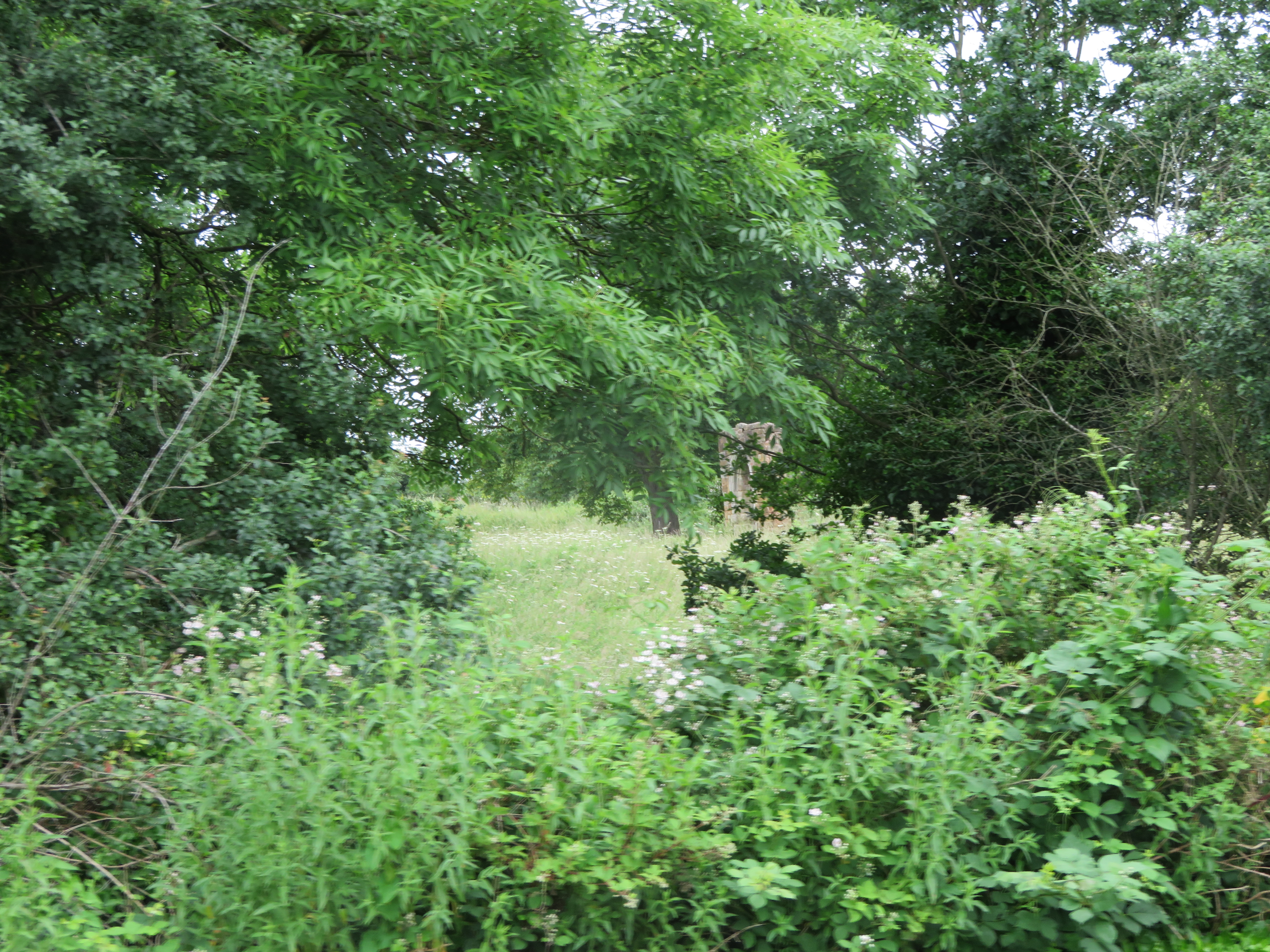
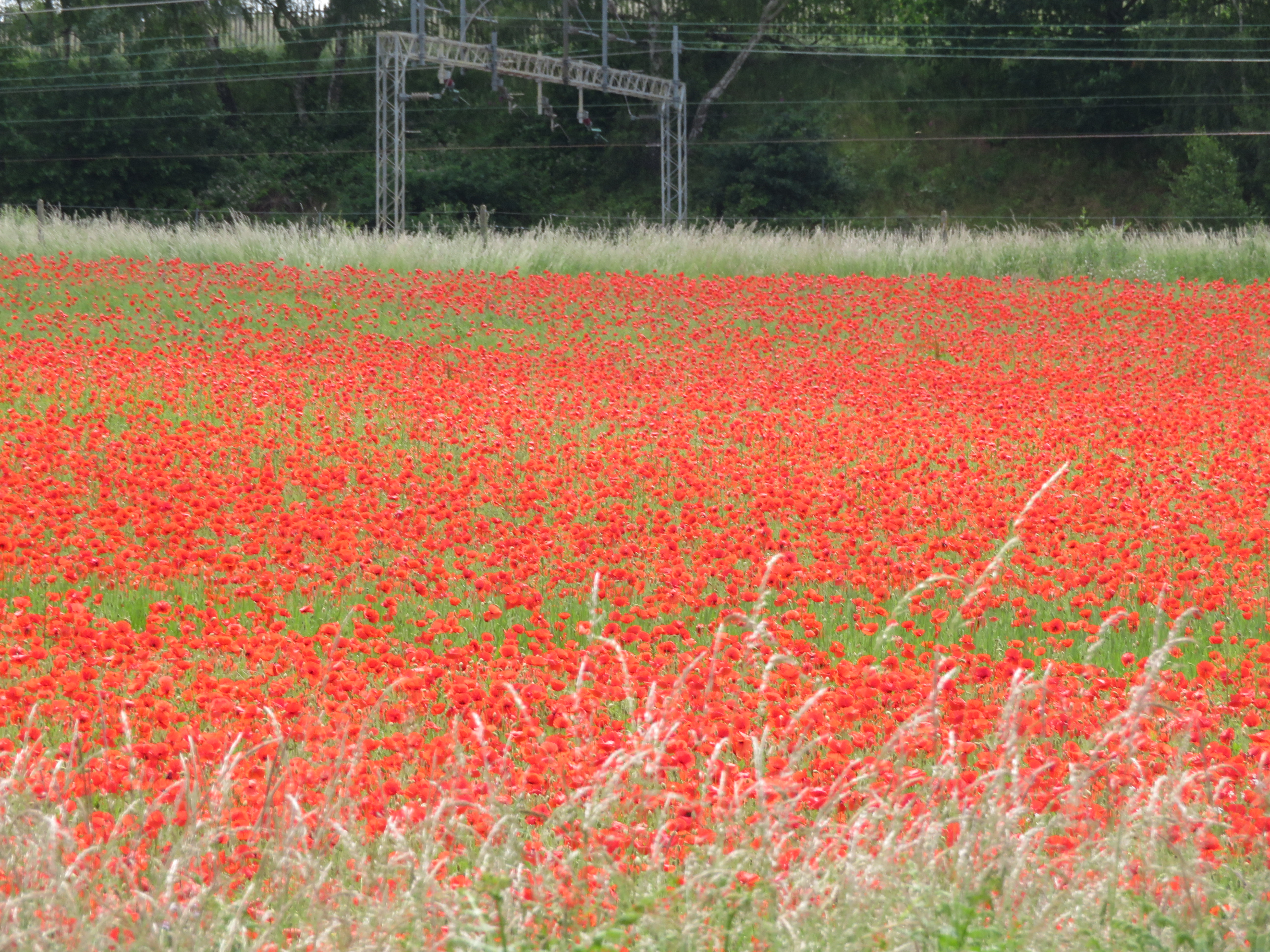
I'm not sure if I am alone in this, but to me this year seems to be a real bumper one for the trees and shrubs along the canal. We have noticed that many things we saw in previous years are now hidden by foliage. Obviously tree and shrubs grow, but it seems they have really shot up this year. Maybe it is another effect of global warming as they will really like the excess CO2 in the atmosphere. You can barely see the ruins of the Alvecote Priory now.

There is always something to see when passing Alvecote and the basin.

Despite the tree growth I spied this substantial brick wall. It looked like a station platform so when I had a chance I had a look at old maps to see if I was right. Needless to say I wasn't! It was an old canal basin!!

I have just realised that in my blog of 18th June I have put this picture of the basin in 1882, but called it the one that is much nearer the Samuel Barlow pub and the marina. That one is bigger and more square, and doesn't have the railway bridge next to it. The track went to the Amington and Glascote Collieries and there is still evidence of it today.

There is a lot of house building going on a little further on. I think this was a golf course at one time, following mining etc. I'm not sure if the mix of houses is what is needed as these look far too big for most people, certainly the younger and older members of society.

This is the sight of our collisionon the way up. I hadn't realised it was the gnome garden house. I can also confirm that the view through the bridge goes for quite a way so there was no excuse for not seeing me.

We moored up before bridge 73, just a little past the old Samuel Barlow Yard. We then walked in to Tamworth to get some steps in. The walk is quite pleasant as it passes through gardens by the River Anker and away from the ring roads etc.

When I first saw this new pub I thought that it was an old cinema. The Art Deco building is like many old picture house you see converted. In fact it was built as the local Electicity Board.s showroom and officers. It later became a Weatherspoon's called the Silk Kite after Benjamin Franklin's experiments with lightening and electricity. The name Lighthouse was chosen in a competition. You can't even see it from the canal?

I was taken by this obviously nautically  themed monument. It is dedicated to AB Colin Grazier RN. He was aboard HMS Petard, a destroyer that attacked a U Boat and having abandoned the submarine he, a Lieutenant and a NAAFI assistant, all part of the boarding party, swam to the sub and managed to get aboard and searched the boat for interesting articles. They managed to recover code books for the Enigma Machine. These were passed to the NAAFI assistant as the sub was going down. He was the only one saved. The codes allowed the Enigma codes to be broken and probably shortened the war by around 1 a year, saving countless lives. They were awarded the George Cross. Secrecy meant that even Colin's parents didn't know about the significance of the act until a local journalist and author galvanised the public and had the art work raised in his honour.

We called in to the Tamworth Brewing Company Tap, curiously they had none of their own beer on sale. We also went to a local micro pub called the King's Ditch, before walking back to the boat, and tea. 


Sunday 27 June 2021

Downhill all the Way.

 Strangely we were woken early by a cockerel! I'm pretty sure it wasn't in the old hat factory so it must have been in somebody's garden. I wonder what the neighbours think! We weren't in a rush today as Helen was walking into Atherstone to get the paper and some milk whilst I did some jobs including my COVID test. By the time she got back there was chaos at the lock as there were seven waiting to go down. It was gone 1100 by the time the queue was down to two boats so we let go and headed to the top lock.

Rothern's Wharf next to the water point and services looks good with its preserved wharf office. It is a shame the basin opposite has been filled in and built on. It was known as Minnion's Wharf and would have caused trouble with boats heading up and down the locks as in and out of the basin and the water point.

Not a very good photo of the nice flower beds looked after by one of the volunteers. The old basin entrance was about where the bow of the boat in front is. When we got to the lock it looked like there had been 12 boats down and only two up.

We usual work with Helen driving when we are going down locks as I can leap across lock gates, plus I can quite often close the off side gate from the boat when going up.

Getting close to the bottom Helen approaches Lock 9.

The end is insight and for the last few we have had boats to swap with, all be it we had to wait for them to leave their lock. We got to the bottom in just shy of three hours. Just a tad over two hours on the way up! I'm glad it wasn't raining.

As we approach Hoo Hill and the outskirts of Polesworth the poppy field was even more full of them. A really colourful sight.

I thought Polesworth moorings would be scarce today so we stopped in the open before the houses. We had a pretty good view of the Obelisk.

The monument on Hoo Hill was raised to mark the site of the Chapel of St. Leonards. An inscription on it states it is the site of the chapel of St. Leonards at Hoo. Demolished 1538, 30th Henry VIII. Doesn't quite work as Henry Vii became King in 1509! It is thought that the burial ground of the church was uncovered when the Trent Valley Railway Line was being constructed in 1847. It is likely Sir George Chetwynd of Grendon Hall commissioned the obelisk in the 1850's/60s. Wen the railway line was doubled the monument was moved to the present site.

in 827 King Egbert of Mercia founded an Abbey in Polesworth and his daughter Edith was the Abbess. The place was demolished during the Dissolution and over time the stones were largely robbed.  This is the Abbey Church of St. Editha seen from the Abbey Gardens.

The coming of the Coventry Canal stimulated mining in the area, and during WWII due to the shortage of coal this area of {olesworth was opened for open cast mining. Later it was landscaped and is not the lovely Abbey Gardens with the River Anker running through it.

The Gatehouse led through to the Benedictine Abbey and was built mid to late 1300's and leads through to the Abbey Church. Parts of the church and this gatehouse are all that is left above ground of the Abbey.

Just down the road is the Nethersole School for Paupers. It was first endowed by Sir Francis and Lady Lucy Nethersole in 1638. This building was opened in 1818 by the Nethersole's Trustees and remained as a school until 1973! It was then used by the community before being converted to apartments.

Down the side of the doctor's surgery is the Tithe Barn, despite looking quite modern and seems to be used as a 'space' the tithe barn has been here from at least the 1880's.

We walked back to the boat without seeing anywhere to buy an ice cream so I had to make do with a bowl of cherries!

Saturday 26 June 2021

Hello Atherstone.

 There was a bit of rain in the early hours but when we woke up it was sunny and not as cold as I was expecting.

We were soon passing this wide area that looks like a winding hole. It is this sort of thing that I really enjoy. This looks like nothing, all that can be seen is an overgrown brick wall!

But when you look into it it was a busy stone wharf, with a tramway bringing the product fro  a quarry on the Hartshill Road. If you walk up from the C&RT Harts Hill Yard there are some new houses on the right. The track from Br.33 goes through them). This is where the quarry was. In fact by 1913 when this map was made another tramway was built up to another smaller quarry nearer the castle. However by 1923 the wharf was closed and the tramway removed. I suspect the stone was taken to the wharf at Hartshill, just to the west of Br. 32 by cart.

This is a pleasant stretch of the canal, especially around Rawn Hill on the outskirts of Atherstone. I had another Specsavers moment at Br.40. I lingered at the wide just before the bridge to allow a boat to pass the moored boats and come out into wider water. Once more I was sure they had looked at us waiting there, but they just kept on coming down our st'bd side!! Fortunately we were both going slow, and I was going astern by the time they realised I was there. I managed to get clear and as he passed down our st'bd side he said that he had been thinking of going in to moor at a gap, but had changed his mind. I don't think so. Should there be a compulsory eyesight test to drive a boat? Or is it just me??

Anyway we found a spot before the locks and pulled in. After a coffee we took the rubbish to the pound (no recycling), and walked into town. The top of the locks is very well provided for with lovely flower beds and is looked after by one of the volunteers.

Every boater on the Coventry Canal will be familiar with this old hat factory, the last one working in Atherstone that was renowned for hat making, that closed in 1999. It seems that it wont be there much longer as the local council have agreed that it should be demolished. There are plans for a 70 bed care home on the site. 

This is what it looks like from the road side. It was built in the early 1800;s and was called the Britannia Works. The original plane was to retain the facade, but after hearing that to conserve the frontage would add £500,000 to the costs they said it could be knocked down and rebuilt in the same design as the original. It may soon look a lot tidier once work starts.

Atherstone grew up in Roman times as Watling Street goes right through it. In fact it is 100 miles from London.

he A5 today, joined Holyhead and with London and vastly improved by Thomas Telford so that Governance of Ireland following the Act of Union in 1800, was quicker as the mail coaches got to the ferry to Ireland from London, much quicker. In 1815 Government passed an Act to improve the road to the port and thus the first public funded road scheme got under way with Thomas Telford as the engineer in charge. Much like road schemes today it caused disruption for many a year as it wasn't completed until 1826 when the Menai Bridge was opened in 1826. This milestone outside the Red Lion on Long Street is from the middle of the 1700's though.

On the Bubble Inn pub window the glass was advertising a long gone brewery. The Phillips and Marriotts Brewery from Coventry was created in 1900, probably by the joining of a couple of smaller brewery. The brewery was in Coventry. By 1924 they had acquired about 110 pubs and were bought out by Bass, Ratcliff and Gretton Ltd and the Coventry Brewery closed. This is the name of the famous Bass brewery that started in Burton on Trent in 1777.

This is the Albert Hall in Long Street. It was designed as a meeting place for the Independent Temperance and Evangelical Church in 1876. It had seating for 500 so there must have been plenty of 'dissenters' in Atherstone as there are at least two other chapels. It is now a gym, with a turnstile at the door!

A bit further out of town was the building of Atherston Grammar School. I believe that the building opened in 1863 where it had moved from the Chancel of St. Mary's Church on the Market Square. It had been in the church since the Dissolution by Henry VIII as it had been in at a religious order.

Above the door is this plaque with the motto that looks like 'Loyal Suisise' which I am translating as 'Loyal 'til death', but I may be well off the track there. If there are any Latin Scholars out there please correct me. The date suggest the year it was established at St. Mary's as it is well after the Dissolution.

The old Swan is the oldest timber framed building in Atherstone, and still has the mark of a cruck-framed wall. There is a New Swan in town too.

St. Mary's Church was built on the site of an old chapel in 1375 by Augustine Friars. The Friary was next door and it is to this chancel that the Grammar school moved after the Friars were turfed out.

This is Swan Archway andleads through to where the Friary once was, hence Friar's Gate. Atherstone Hall was built on the site of the Friary in 1619 and in 1798 the owner decided he didn't like people passing n front of his house so diverted the road through the yard of the Swan Inn. Money talks. Mind you there are some places I would love to do this too.


Friday 25 June 2021

Collieries, Castles and cream crackered!

It rained a little in the night but was dry when it was time to wake up, there was even a bit of sun, and plenty of boats had passed, both ways before we got going.

Under the turn over bridge, No.18 and you come to the Griff Arm. This went 3/4 mile to Griff Hollow and a terminal basin near Bermuda. It was opened in 1787 to give access to several mines in the area.

The coal from about 5 collieries was brought to the wharf by tram roads. You can see the Griff Colliery and pump wrks in the bottom left corner with the tramway to the basin. The tramway that leads off to the top right corner went to further mines and the Griff Blue Brick and Lime Works. It can also be seen that the basin must have been a hive of industry as there were many lime kilns there too. The arm staid working until 1961 and navigation was loct in 1973 when a road was built. However the bridge is high enough and there is talk of reopening the arm for passage.

There seems to be a growing trend around the network where folk decorate their gardens with manikins etc facing the canal. I suppose the first I remember is Charity Dock, not too far away. They do bring a smile  don't they.

This was an old wharf and the road next to it has the interesting name of Black a Tree road, with Wash Lane bridge just behind me. There was another wharf that side of the bridge too. Where the flats are were at one time some lime kilns.

Just past Judkin's Quarry and we are back at the telegraph pole. The darkening skies set off the sun lit green trees ahead.

We stopped at Harsthill Wharf and topped up with water. I loved these lovely roofs and chimney just by the house on the bridge. We didn't go much further, just through Bridge 32 and moored just past there.

After lunch we went for a walk into Hartshill via the path over Bridge 23. Carry on up the road, past the green and when the houses end on the right there are steps down to a path to Hartshill Castle. It was built in 1125 as a motte and bailey castle. The owner died at the Battle of Evesham alongside Simon de Montford in 1265 and the castle fell into disuse. It was refurbished in 1330 ans in Tudor times a timber framed manor house was built into the corner of the walls. It is thought that around the Battle of Bosworth Henry VII stayed here. The castle is in private hands and is on the at risk register. Access to the site is not possible and views are fleeting.

Some of the walls are still intact and there is evidence of a very deep ditch or moat on three sides.

We were then in Hartshill Hayes Country Park. This is a large wood with many trails, but there are no sign posts or markers to guide you. The best plan is to head NE and up hill all the time, until you come out at the edge of the wood, on a road or a track, and then you know where you are. The trees are very calming and there are plenty of squirrels about. In the spring the woods must be stacked full of bluebells and they must be a fantastic display.

We came across this seat in the middle of the wood. It has all the local parishes on it.

We came out at the road with houses and continued up hill past the car park and toilets and then past the covered reservoir near the top.

At a shrap bend in the road you pass through onto a track again and are greeted with this view. It is said you can see four counties on a good day. There is a community wood just down the will. Hartshill Hayes Wood is to the left and the smaller St Lawrence's Wood is down to the left, and we went that way.

On the hill in the distance to the left is Hartshill Hayes Wood, and closer is St. Lawrence's Wood. On the top of the near hill is Oldbury Camp. This is late Bronze Age early Iron age (8th to the 5th Century BC) and is classed as a univallate hill fort, meaning thsat it onoy has one ditch round it. There are only 150 in the country and only this one in Warwickshire. Unfortunately access is not possible. 

On the way down to the canal you get a view towards Atherstone.

You get a good view of the new Rothern's Mancetter Marina and the Anker Valley.

On an old wharf by Bridge 36 the daisies are doing well. The steel footpath bridge by the brick and stone bridge was actually built for the tramway that took the stone from the nearby quarry down to the main railway line.

It is then a towpath walk back to the boat. We are moored with a very low tow path and is ideal for washing and polishing the st'bd side. I set to and finished it just as it started to spot with rain. Again it looks better for doing, but I will sleep well tonight. Only the bow and stern to do now, and lots of paintwork to fettle next.

I would just like to give a big shout out to all those that work at sea. They work regardless of weather, politics, pandemics etc etc and never get given a second thought unless they thoughtlessly loose their containers, or sink loosing their lives and thoughtlessly polluting a beach. They bring 98% of everything to this country, and the seamen of the world deserve your thoughts for at least today, International Seafarer Day.