After out excursions down the Humber, River Hull, Driffield Navigation, Ouse, Derwent, Pocklington Canal, Ure, Ripon Canal and Selby Canal, all new waterways for us, we were now back on familiar ground, or water, as we have often been on the Aire and Calder.


There is always an interesting collection of craft at the yard opposite the junction of the Aire and Calder and the Selby Branch. It used to be the Harkers ship yard where many barges were built and repaired between 1929 and 1979. In the distance can be seen Shepherd's Bridge and the way towards Ferrybridge and to the left is the way to Goole and the South Yorkshire Navigations.

Ferrybridge is a flood lock that lets you down onto the Aire proper. I love the way that the cooling towers overlook the lock.

Just through the lock and out on to the river you pass under the new A1 road bridge. The original road bridge is the stone one beyond and again it can be seen just how much road transport has grown so helping to reduce the use of the waterways, even this 'motorway' of a river/canal system. There is even another addition to the great trunk road system further along the river as a further bridge has been erected to carry the A1M over the river.

The railway bridge at Fairburn still takes traffic from Castleford towards York and also has a footpath walk way for crossing the river that can be seen on the south side of it.

At the other end of the Fairburn Ings nature reserve is the old railway bridge that was last used to bring slag and ash to the pits at Fairburn. It is now disused. I have been told that you should always check mthat there is nobody above as you pass under as once a fridge was dropped from the bridge like a bomb! Personally I always look to see if there is any sort of a threat from above as we pass under any bridge.
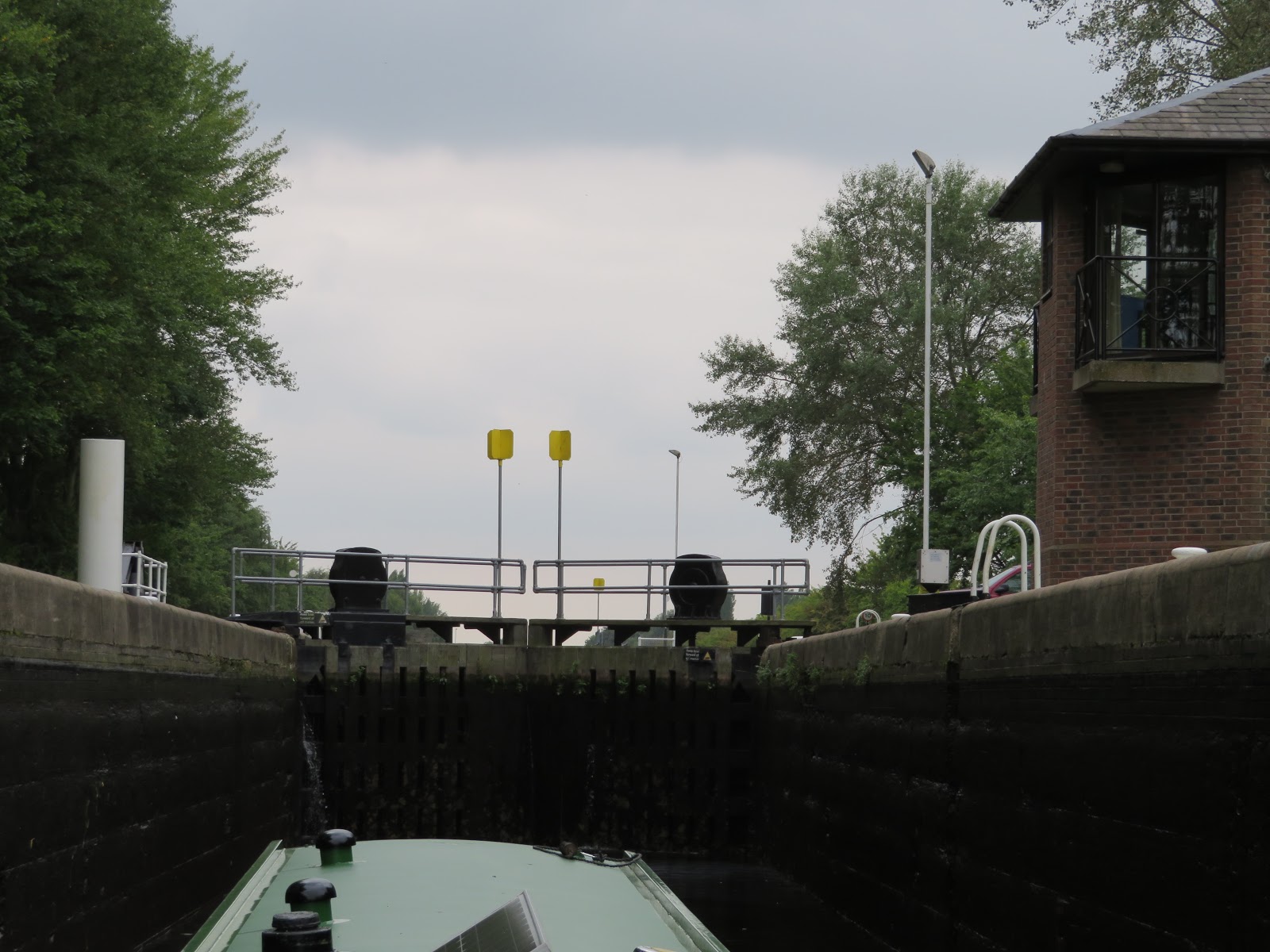
Bulholme Lock takes youn up from the river Aire into the Castleford cut. The lock keepers bungalows are on stilts to keep them from flooding. The yellow markers on the gates are there so that commercials (and hence all vessels) can see whether the lock gates are open or closed from a good distance away.

After stopping for a night or two at Castleford with a visit to the Junction pub, where all beer is served from the wood, we continued on our way passing through the Castleford flood lock and back onto the River, and turning right to continue up the River Aire towards Leeds.

It was a lovely day for a river cruise and between Castleford and Lemonroyd Lock much of the river has been rerouted in an artificial cut to enable cola to be extracted using open cast mining. More was built when the workings flooded and the route of the river had to be better defined. For some reason Lemonroyd lock looks much larger than the ones we have passed through already.

Just above Lemonroyd Lock is Fleet Bridge and an oil terminal that was fed by barge at one time. It was also the site of a lock down into the river, called Kippax Lock

The next lock is Woodlesford Lock and I think it is here that John Sergeant was filmed opening a lock side garden during one of his 'Barging round Britain' TV programmes in 2015. It is still well kept. There are always people to chat to on this stretch as there seem to be plenty of walkers about.

This concrete bridge was built to provide railway access to the Skelton Grange Power station that was on the north bank of the navigation and to the west of the M1 that can be seen through the old rail bridge.

There has been big changes at Knopstrop flood lock to prevent future floofing. In the past the river ran right next to the canal. This picture has 'Holderness' running in the river. The canal used to pass through the flood lock that was where the three pipes on the left was. There were many modern warehouses in the area too.

There are moorings near the services below Leeds Lock but we decided to see if there was any room inside the old Potato Wharf, now called Granary Wharf by the Armouries. Here you can see the top gates of Leeds Lock in the bottom right with the river running to the right. The height of the weir is being made adjustable to assist with flood elimination. The entrance to Granary Wharf is on the left just after the flags. The picture is taken from the Armouries museum that I had never been to before.
No comments:
Post a Comment