Total Pageviews

Tuesday, 5 September 2017

Out and about.

It was a nice still night and a lovely red in the sky so we have high hopes for a good day as we were going on another walk of exploration.

Just as it got dark the sun caught the underside of the few clouds in the sky and gave a flash of heat to the colour and hopefully we will have a good day tomorrow.

Just round the bend from our moorings, near Bridge 159 are two sets of coal tips. Round the corner is a one bay store. Here is a two bay. I'm not sure whether that would be two consignees or perhaps two different types of coal, maybe steam and house coals. The coal would be barrowed out of the barge over the tow path and down the tip. The ground drops and each side is enclosed by a wall. The road runs at the lower level so the coal would be largely enclosed, helping to prevent theft, until it was sold on and placed in carts for distribution.

Barnoldswick, or Barlick in local speak, has several sites of the Rolls Royce company. It seems that over a 1000 folk are employed by them and the factories are involved in research and development and construction of jet engine fan blades. The name of some of the engines RB 211 and RB199, apparently the RB stands for Rolls Barnoldswick as they were developed there.

St Mary Le Ghyll church is a handsome church with an extensive graveyard. It is handsome enough to be granted Grade I. The present church was built to replace an earlier church, but that was in 1160 and by Monks from Fountains Abbey too. The tower is very modern though. It was added in 1524!

As we walked along past the church we could hear a horse moving quickly and soon saw a a horse pulling a two wheeled buggy round a fine gravel track. It looked like a training session for trotting races or harness racing as it is sometimes called. The horse never gets above a trot, and if it does it has to slow and pull over in a race. The horses are small and very fit. I didn't know that they held races in the UK so maybe the local farm breeds the horses for else where. Mind you I only saw one other horse on a merry go round getting exercised. They were still whirring round as we passed out of site.

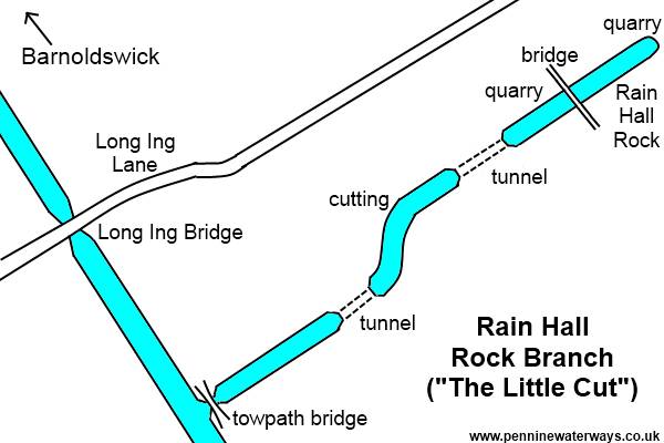
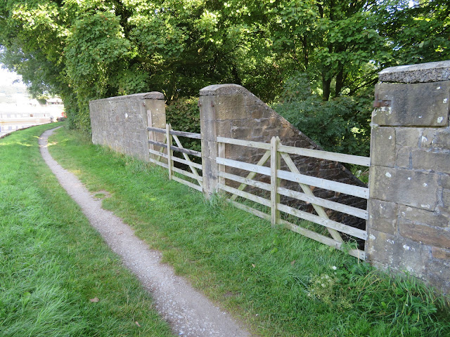
Rain Hall Rock Canal was built off the main line around 1850. As you can see from the plan below for such a short canal, about half a mile, it had a lot of interest. A towpath bridge two tunnels and a very high bridge to get to the quarry where the limestone was dropped straight into the barges. It seems that it closed around 1920. By the canal a mill was built on the site, and in turn has now been demolished.  The picture above is the central section that remains.

map of Rain Hall Rock Branch
http://www.penninewaterways.co.uk/ll/ll46a.htm

The bridge and terminus site has disappeared and no trace even of a indentation remains. It has been filled in with refuse and now has a methane collector and burner that is behind the metal railings to the left.

I love this old milestone that was on a little country lane leading from the Rain Hill Canal. It must have been the main route at one time.

On the way to Thorton in Craven and I'm not sure who is the more cautious, Helen, who hates fields of cows or the young bullocks. The views are distant and the sun was glorious. 

These alms houses were on the outskirts of Thorton where the Pendle Way and the Pennine Way coincide. Today you would just have a brass plaque by the door. It is nice to think that folk that had 'made it big' in the south hadn't forgotten their roots and put something back. As well as the dwelling they got 3s 6d a week and coal.

This was the view from the front door of Old Cote Farm on the Pennine Way. How could you get tired of that ever changing view.

The stunning undulating landscape of the area is actually a field of drumlins that were formed by glaciers. There are two thoughts as to how these spoon bowl shaped hills, no more than 50m high and  about twice as long as they are wide., are formed. Some say that they are from under the ice and they are built up around a rock core that then has sediment etc built up round it. The other idea is that it is glacial till that has been left when the glacier recedes and is then eroded into the shape by flood water etc.

The walk was about 6 miles and the only drawback was there was no pub or cafe in Thorton in Craven! It was nice to have a walk around the area and stretch the legs. 

Monday, 4 September 2017

Worth the effort to get here.

The day dawned with plenty of sun and it was supposed to stay that way all day. Mind you I think we had the coldest night of the season so far. My thermometer registered 4.1C! Even the Hurricane heater thought so as it came on on the thermostat this morning and soon had the boat warm to get up.

We were soon into the locks as right after the next bridge we were at the fourth on round Gargrave and soon followed by the next one. There was a pole barn close to the canal that seemed to be full of wooden potato crates, the big ones that they are stored in. However I think they were logs been seasoned. I have often wondered how they dried logs for sale in wood burners. I'm not sure that kiln dried logs are very ecological but there you are.

The route from Gargrave is a dog walkers super highway and generally it seems that they are all well behaved. Something that puzzles me about dog walkers who 'always pick up after their animals' though is when did they develop eyes in the backs of their heads? When the dogs are off the leads the human just wanders on and doesn't watch the dog behind them, especially if gossiping to a fellow mutt mate. The views start to get really breath taking as you leave the town behind and to be honest they only get better.

Once again the canal crosses the River Aire which has grown somewhat from when it bubbles up from under Malham Cove.

There not quite as many turnover or snake bridges on the Leeds/Liverpool as on the Macclesfield but they are just as sinuous and beautifully made except that the rail is wooden here rather than a stone wall on the Macc. Canny Yorkshiremen saving money I have no doubt.

The countryside is so lovely in the sun and the fields dotted with sheep and lambs. It wont be too long before their numbers are reduced. I think that lambs around here are produced around April. Lamb is less than a year old, (hogget is what they are called over a year old) and they are ready for market as lamb after about five months.

The Leeds and Liverpool Canal Company completed the canal from Leeds to Gargrave by 1777. Work had been delayed due to war and by 1790 work had restarted. The date on the Bank Newton bottom lock house may reveal when this set of lock was completed and they needed a lock keeper. This flight of six that sweeps round corners and has some that can't be seen for the one below are one of the most picturesque group of locks on the system.

There were signs by the second lock up warning against some leaks from the lock wall and to close your windows and ports. When we got there they weren't too bad at all, and if that was it they would have to have the same notice on a majority of the locks we pass through. Here we are at the top lock of the Bank Newton after a bit of help from the lock keeper at the bottom end and passing a couple of boats coming down to swap with.

Between Bank Newton and East Marton the scenery is at it's best and the canal wriggles around the contour giving you a view in every direction. The TV mast seems to be in every direction as you round the heads of valleys. The stone wall in the middle distance is the canal we have just traveled on.

The views of the Pennine Hills are very appealing and certainly seem to call you to go and walk up them, or is that just me and in my head?

Some bullocks for fattening take advantage of the canal for a drink and a paddle. They must be used to boats passing as they didn't bat an eye as we slid past.

Once again the canal loops round and you can see some moored boats on the other side of the valley. We were very tempted to moor here with the view but continued on wards looking for a spot before Greenberfield Locks.

Here is the obligatory phtograph of the double bridge at East Marton. As road traffic got bigger and more frequent the A59 had to be modernised and this meant reducing the gradient down to the bridge and up the other side. This was achieved by just building another bridge on top of the old one. This meant that disruption to the canal was minimised and the cost of a total rebuild was avoided. The first bridge must have been substantially constructed to take the weight of the new bridge and it's new traffic.

The tow path becomes part of the Pennine Way  around East Marton but we didn't see anybody who was likely to be walking it. The 268 mile route between Edale and Kirk Yetholm was originally opened in 1965 and so celebrated it's 50th birthday in 2015 and it was thought that in 1990 about 12000 walkers were walking it from end to end. When A. Wainwright completed his guide book to the Pennine Way in 1968 he wrote that anybody who completed it could claim a beer on him at the pub in Kirk Yetholm. We walked it in 1978 and I think that we claimed a drink. I'm sure that at some time it was stopped as more people completed the route. I wonder if my memory is correct?

We found this mooring a little before bridge 159. It seems that water is being pumped back into the canal here, (see the water fountain),  but I'm not sure where from as the next locks take you up to the summit pound so water would perhaps be pumped to the top not the bottom of the lock, and there are no reservoirs close by.

It was a lovely quiet night and it wasn't quite as cold as the night before, but there were several extremely loud explosions and then small arms fire for several minutes. The flashes of the explosions lit the sky from a long way away. I wondered if there had been war declared or some outrage in Keighley or Bradford, but nothing on the news today so must be an Army range somewhere.

Sunday, 3 September 2017

Limestone looks lovely.

We decided to take a day off today. The weather was wet this morning but supposed to brighten up later. We thought we would catch a bus to Malham and have a walk round the Cove. The bus was a Dales Bus minibus and was quite full when we got in at Gargrave. There are only two a day so we had three hours to complete our walk which just worked out nicely.

I remembered the camera today but forgot to replace the SD card so all these photos are courtesy of Helen's phone. It is always impressive when you come across the cove on the walk from the village. The first time I can remember seeing it was in 1978 when two of my brothers and I walked the Pennine Way. This climbs the west side of the Cove. Then it was a very muddy path you you climbed up two steps and slid back down one. Now there are stone built steps.

The area was probably covered with glaciers three times in the last one and a half million years, and the Cove formed along the Middle Craven Fault where the land had slipped down. As the glaciers plunged over the fault the limestone rock would have been plucked away. When it melted the water would have rushed over in a massive cataract, further eroding the cliff face.

Now a days the water sinks through the cracks in the limestone and flows out from under the Cove as in this photo. Believe it or not this is the infant River Aire that actually starts at Malham Tarn and then sinks below the ground to emerge here and start it's journey to the sea past Hull (City of Culture 2017, if you didn't know). The cliffs are home to peregrine falcons  which we didn't see, and rock climbers of which there were two sets shinning up and a route of belays could be traced up the face. Cave divers have entered the system of caves through the cave where the water emerges and have travelled through a system about a mile in length so far. Are they mad?

By the time we climbed to the top of the Cove the weather had faired up and the views were lovely down Malhamdale. The hills beyond those visible were just coming into view too as the cloud dissipated. The view from 230ft up is worth the climb.

Bill Bryson lived in Malhamdale when he was in the UK and he stated that 'I wont know for sure if Malhamdale is the finest place there is until I have died and seen heaven (assuming they let me at least have a glance), but until that day comes, it will certainly do." So good I have posted it twice!

The ice and melt water stripped off what top soil there was at the top of the Cove and revealed the slabs of limestone. Since then erosion has been slow and top soil hasn't been replaced. How ever the slightly acidic rain water has cut down through tiny cracks and ended up make deep cuts through the bed rock. This is called a limestone pavement. The flat bits on the top are called clints and the deep ruts are called grykes. The deep ruts develop a micro climate of their own and a very individual flora develops there making them even more special.

The walk over the fell to the east over the springy turf is great and limestone and chalk landscapes are great for walking. We got to Gordale Scar which is another glacier/melt water feature. It may be also a collapsed cavern. Instead of a cataract Gordal is like a gash in the cliff with a walk up to it. There was a coach load of Germans going to see and there is a campsite at the start of the scar, a lovely spot to wake up. There were some more climbers hanging off the walls here. I think if you suspend bags of horse chestnuts it may well keep them away!

The walk back to Malham was via Janet's Foss. Gordale Beck falls over an outcrop of limestone and falls into the pool below. In times past the pool was used for sheep dipping in the past. It is called Janet's Foss possibly because a Fairy Queen called Janet lived in the cave behind falls. The word Foss is a Nordic Word for waterfall and is used widely in North Yorkshire and Scandanavia.

The four and a half mile walk just gave us time to go to the Buck pub and have a lovely pint of Dark Horse bitter, which was very drinkable indeed and comes from Hetton in the Dales. We didn't have long to wait to sit in the sun until the bus came and whisked us back to Gargrave.

I was in good humour so after a cup of tea I washed the side of the boat too.

Today, Sunday 3rd September, is Merchant Navy Day so I hope that you all think about where 97% of everything you have are probably brought to you via ships, and their crews at some stage of their life. And we owe a debt to the largely forgotten men in the Merchant Navy during conflicts. In WWII they had the largest percentage losses rather than the Royal Navy, Army or RAF.

Saturday, 2 September 2017

Walk in the Woods.

We decided to go for a walk round the Skipton Castle Woods which we hadn't done before.

To the south of the canal seems to be the working part of the town, and these old warehouse buildings have been converted very nicely. Stone buildings always seem to be more cosy than brick built for some reason.

We walked down the Springs Branch that was built to bring limestone from a quarry to the Leeds Liverpool canal. It was only about a third of a mile long but was later extended a little. There was a tramway from the quarry to the end of the canal. I think that the real name of the canal is Thanet Branch as the castle was owned by Lord Thanet in the 18th Century. The branch was opened very soon after the Act of Parliament was obtained in 1773.

This little causeway has the Eller Beck on the left and the Branch Canal on the right.

This is the rear of Skipton Castle and now the branch is on the left.

The walk is through the woods and is very pleasant, more so as there was hardly anybody about. The stream coming down the side of the bath runs into the Eller Beck a little further down.

The paths were very well made and the sun was trying to come out. It was a great circular walk and took less than an hour.

On the way back to the boat we filled up with pork pies sausages and other pies to see us through the next few days, and Helen found a couple of bargains in the market that was going on. After setting off after a bite to eat we passed Pennine Cruisers at the start of the Springs Branch and saw the statue that we hadn't seen when we walked this way. It is of Fred Truman, the first man to take over 300 Test Match wickets and lived in the town for many years. He died in 2006 and the statue, by Ibberson who also made the statues of Eric Morecambe and Les Dawson, was unveiled in 2010.

Just at the start of the Niffany Moorings the farmer had got his second cut of silage in and the straight lines appealed to me.

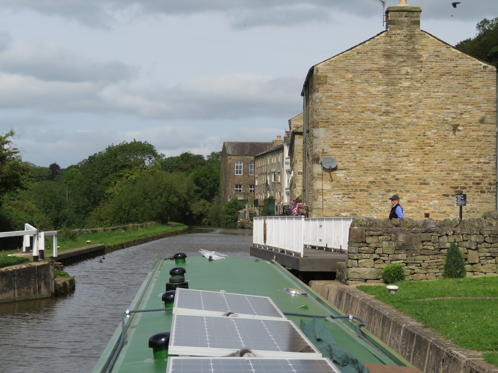
On another day this stretch would be good moorings as it is nice and quiet with lovely views. As we approached swing bridge 173 it opened with no boat there. There was a guy painting it and opened it for us.

As we approached Gargrave we came to the first lock of six that take you round the town the sun was glinting on the gold lettering of another poem on a beam at Holme Bridge Lock. The canal crosses over the Aire once more on an aqueduct.

As we got to Higher Land Lock this little rabbit stood his ground as everybody passed by to get his mouthful of grass.

The use of these cloughs or clows as ground paddles seemed to have taken over from the box paddles that are down at the Bingley 5 Rise etc. The far clow is in the open position and the nearest closed. The use of timber made me think of the Calder and Hebble hand spike!

We found a mooring up by the school playing fields as it was in the sun for most of the day. We walked down to the village later and had a couple at the Mason's Arms before tea. I even fixed up the TV for Celebrity Master Chef for Helen.

Friday, 1 September 2017

Skipping along to Skipton.

A day in Saltaire was a very nice break and we now set off up into the hill.

It is not very far from our overnight mooring until we come upon our first of 15 bridges of the day. They all seem to be pretty well maintained as only one needed an extra push to get it moving.

The undulating countryside gives some nice views as the ground rises. These are Alder Carr Woods and the geese seemed to be quite tame!

On the approach to Silsden is the Waterloo Mill. It was built around 1870 as a worsted mill and then became Waterloo Room and power mill. That is when small businesses paid the owner of the building rent for space for their machines and the power from the engine or water wheel to drive them. The mill building has been converted to apartments but the attached engine house still has a vertical steam engine in it and is being preserved.

The Scott and Hodgson steam engine was built tom power the loms in the Union Mill at Guide Bridge on the Ashton Canal near Manchester. After a fire there it was bought and brought to Silsden in 1916. It last powered looms here in 1977.

As we got further in to the country there were good views down the Aire Valley. The River Aire rises at Malham Tarn and drops 1300 ft in it's 92 mile length to Airmyn near Goole.

As we continued through swing bridges we actually got to one that was opened for another boat coming the other way. Why does this not happen more often?

The canal seems to add a street through Kildwick and is very 'intimate' with the houses.

There are swing bridges acting as gateways on the canal to Kildwick. The easterly one is by the church with the graveyard on the other side of the canal, and this one with what looks like weavers cottages to pass.

As we pass Famhill the old quarry means that there is a beautiful tree-scape in the sun.

Near Low Bradley and swing bridge 183 is a memorial to an aircraft that crashed on the bank of the canal in 1943. The Wellington bomber was on a training mission following being picked up from Skipton on Swale. The entire crew were Polish. Locals saw a wing shear off and the plane exploded on contact with the ground. The two locals preserved with their research and in 2007 the memorial was erected and visited by families of the dead. 

It is always a thrill to see the hills from a flat canal and with stone walls and stone houses you know you aren't in Surrey! The day boat could maybe have found a place to get better along side just round the corner.

Another mill on the outskirts of Skipton that has been saved by conversion for other uses. I am also pleased that it seems that they have tried to save as many chimneys as possible. Many of them are not attached to anything as their engine houses have gone.

We found moorings in Skipton near to the Bus station. It remained busy on the water almost until dark. We went for a walk around the town and found that Tuesday seems to be like an half day holiday. Remember half day shopping?