After the unpleasant woman in Shardlow who incidentally lived on a boat called 'Tranquility' (shame it didn't rub off) we had a lovely night near Aston Lock .
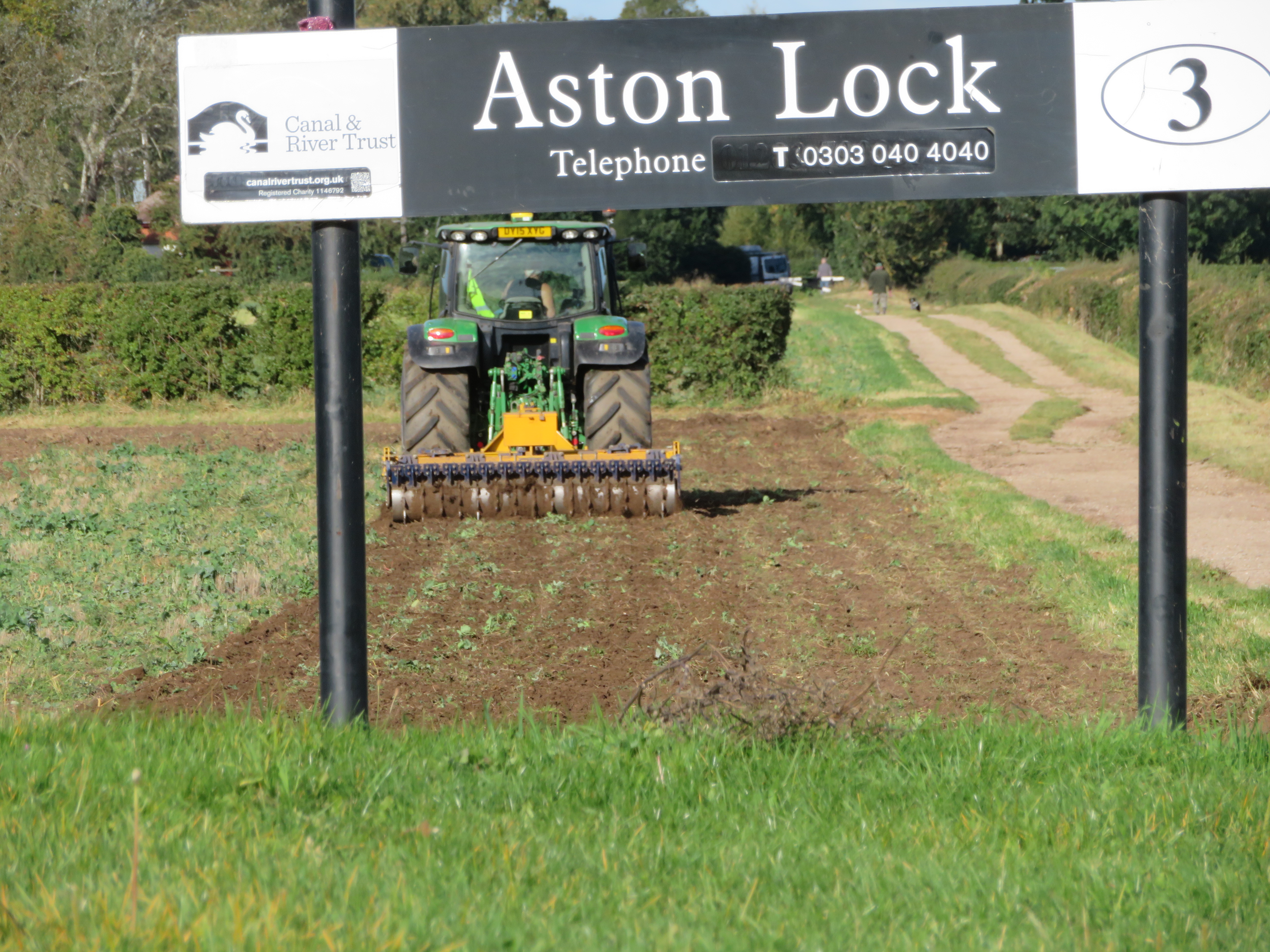
As we waited for Aston Lock I was reminded of the passing of the seasons with tractor busy in the field. There is definitely a different light after the height of summer and the colour starts to fade from the landscape.

As we passed Weston on Trent, the more southern one as there is another up towards Stone, there is a beautiful stretch of canal round Weston Cliff, but more of that at the end of this blog.

Swarkestone Stop is always handy for a top up of water and dropping the rubbish off. As we approached a man was walking away and much relieved he explained they had left their C&RT key in the water point and hadn't realised until they had got about three miles away. He was very pleased to see it still there as they were hirers and only had one. I expect that the warehouse, the nearer building is the one owned by the Soresby Co of Shardlow in the early 1800's. I wonder if the crane was there then too! Looking on the map it first appears in the 1920 edition.

We got to Stenson Lock and there was a slight delay as we waited for boat movements. There was a voluntary Lock keeper working. I have always wondered why the name of the pub and cafe is the Stenson Bubble. Apparently it is due to the noise the canal by-wash/overflow makes as it enters the canal below the lock. I can't recall ever hearing it bubble but it is a big lock and the flow can be vicious. I always put out a short head line to ensure that the boat doesn't get washed off the jetty and I can't hold it on just a centre line.

We were getting quite worried about fuel now so we were relieved when we turned into Mercia Marina. It was very windy but managed to get into the arm under the bridge okay, and then swung her round on to the fueling berth okay. There was a short delay as we waited for them to come and serve us but we had lunch to prepare. The fuel was a very good price, which surprised me for some reason, and we were allowed to stay on the wharf until we had finished our lunch.

As we approached the entrance to the marina folk were flagging us down, thinking that we were jumping the queue I think, and telling us that there was a tree down ahead. It was still across the cut when we came out again but some folk coming in the opposite direction were busy hacking away at it when C&RT arrived. As usual with little suitable equipment. However between them all they had it sufficiently cleared to pass in short order. Helen and I looked at each other and deiced to continue as were were on a bit of a schedule.
We were soon passing through Willington and I have always wondered why there is such a big gap between the Dragon pub and the canal. I now know why.

In this 1920 map you can see the canal running across the top with MP mile post in it. You can see the long warehouse that was built in the 18th century and the wharf managers house to the right of it. (Where the car park is now I think). A cattle pen shows one of the cargoes moved. WM stands for weighing machine/bridge and you can see where the pub still is by the PH public house.

A fire destroyed the warehouse in 1935 and it was pulled down the following year. The managers house survived until the 1960's.

The River Dove is not so full when we cross on Brindley's twelve arched aqueduct with the Medieval Monks bridge next to it. Just beyond is the much more mundane A38.

Just a pretty picture as we approach Burton on Trent. It was pretty dark as we penned up Dallow Lock and pitch black as we passed Shobnall Fields Park so it was just as well there was room for us to moor up. It was very dark and cold when we pulled the door shut behind us and enjoyed the warmth of the stove.
In previous visits to this area we had stooped at Weston on Trent and had a nice walk around and a pint at the pub. By Weston Cliff there is a footbridge and the River Trent comes close by to the south. Here there was a ford and later a ferry across. There is evidence of a ferry being here from the 11th and 12th Century and I can find newspaper references from 1846. In these later years it seemed to have been a rowing boat type affair that could carry around 20 people and occasionally horses. It was guided across the river by pulling on a rope across the width to prevent the boat getting washed down stream. By 1901 the ferry had been repaired but was difficult to use as the water levels were so low as the weir at Kings Mill had failed. Problems were found as to who was responsible for the ferry as a landing stage was required to take passengers out to the boat in deeper water but who was going to pay for this? A member of the local council suggested contacting the Landlord of the Cliff Inn. This was because the pub was a busy venue for trippers that either came by charabanc or train to Weston and wandered by the river and across to Melbourne.

On this 1881 OS Map you can see the footbridge over the canal that leads up to the Old Cliff Inn. The path from the canal leads to a boat house and a foot bridge to arrive at the ferry point. On the far right between the canal and the river is a wharf where cargoes were transferred between the two, maybe to service the mills a a little down stream at Kings Mill
In 1890 there was a report that a Hannah Leak, a servant at the pub, was ferrying people across the river. Seemingly the Inn had taken on the ferry to promote business. In 1906 the ferry was in use as the Robin Hood Rifles Old Boys came on a trip to Weston Station, walked down and crossed on the ferry to Melbourne Hall and had a visit there then a meal at the Melbourne Hotel before heading back. By October 1908 the jetties had been washed away and the ferry was not in use and the local Wesleyan Ministers were complaining as it interfered with their ministry
By 1910 locals were raising the issue with local and district councils as the lack of a ferry meant a large detour and a loss of public right of way. In 1911 the signs pointing to the ferry were removed and this prompted more action, but still with no results. Whilst some wanted the ferry reinstating as an easier and cheaper option Councils really wanted a 10' wide bridge as it had to carry a bridle way. Funding, as always, was the sticking point. Meetings were held and petitions written up. However in the meantime a bridge had been erected privately.

The Sphere was an Illustrated weekly newspaper that ran from 1900 to 1964 and carried the story of the Trent College Officer Training Corp in February 1910 installing this suspension bridge over the Trent at Weston Cliff with no help from outside. It was still there in July 1912 but whether crossings were allowed by the general public I doubt. It was most likely just for a camp exercise and I'm not sure how long it lasted.
In 1922 and 1923 once again there was rumblings from some of the locals to get something done. They thought a ferry would be quick and easier to get going but much research could not confirm who was responsible for the ferry. It seems that hopes were pinned on the brewery, Offilers of Derby, who owned the Cliff Inn as the pub had been operating the ferry for a few decades. The Cliff Inn had been a manor house but with the coming of the canal it had become a boatman's watering hole. In the end it was felt that it would have to be carried out by a 'trust' and financed by public subscriptions It obviously never happened.

At the bottom of the map is an immense area of railway sidings! I wondered what sort of factory they would service that had just sprung up from nothing, but there are few buildings. It seems that they were for the war effort but what was it?
It turns out that it was the Melbourne Military Line. The War Department took over the stretch of railway between Asby de la Zouch and Swarkestone for their own purposes. The 2nd Railway Training Centre was set up. Here, individuals at first, and then whole companies of men were trained how to destroy and then rebuild railway infrastructure and then maintain and run them. Canadians forces were also trained. There was a bridge building school at Kings Newton too. You can see a bridge across the River Trent on the map as it was necessary for troops to cross as the main accommodation camp was north of the river. It was another suspension bridge. You can see the Nissan huts on the map to the top of the map. Training for the railway engineers was in blocks of eight weeks and for construction engineers a further 8 weeks on the bridge building course. Over the course of the war more and more sidings were added, presumably for readiness of the D Day Landings. The depot had eight old steam locomotives on site and military stores were a common cargo as well as coal and lime from local places You can also see that the wharf seems to have moved a little nearer the footbridge over the canal. To the north of the camp and over another railway line there were two prisoner of war camps for Germany prisoners, so in this little quiet corner of Derbyshire the war was close at home.
In 1st January 1945 the line was returned to the London Midland and Scottish Railway. There is very little to show it was ever there. They must have removed the bridge when they left too. In the field by the river is an old rusty boiler that is thought to have come from the old engine that powered the bridge building crane and there are some vertical piles still in the water. Very little remains of the sidings. After the war the camp was used by Ukrainian and Latvian refugees and the Cliff Hotel became the social club and youth hostel for them. As far as I know it is still used by members of the old Russian Baltic States.
No comments:
Post a Comment