We woke up to the wireless at 0630 and I was up by 0700. I had decided that we would leave Beverley about 2 hours before LW Hull. The idea was to get to the River Humber as soon after LW as possible to get the full length of the flood tide to get to Barmby. However I had been told that the lower reaches of the River Hull were a bit of a handful at LW. We hadn't touched the bottom over night so we were in fine fettle to set off.


Helen is trying to catch up with our log as we edge down the River Hull. I had given myself rough timings to be at certain stages of the river so I could monitor progress easily. It was obvious very quickly thet we would only need tick over to make those speeds.

The Rivber Hull does vary in its length and there are parts that you are only seeing the flood wall and others with a better panorama. There are one or two narrow bits and one or two boats berthed too.

As we approach urbanisation we come to Ennerdale bridges. We easily pass under them and cautiously push onwards.

The channel becomes narrower and so the current picks up a little. As I am on tick over I need to watch some of the bends so that I don't get washed sideways. There doesn't seem to be any new piling at all on this ection and those that could be seen were very old.

I had been warned that after Stoneferry Bridges the current picks up. Our first test was to get round this moored barge. Last week it had broken adrift and was blocking the river so I suppose this is better. To clear the stern of the barge I had to rub along the soft mud bank on the left but we hardly slowed at all, just a slight list to indicate we had touched the bottom.

This digger was removing the sediment close to the wall and flinging it out into the river. There was actualy a new bank a couble of metres out from the wall. I assume they are continuing the piling. I had to sound our horn a couple of times so that he wouldn't fling the spoil over us!

The next obstacle was the 'Swinderby' moored on this bend, and with the mud bank next to it. There was very little room to pass and miss the mud. The current was also pressing us down onto the barge. We touched the barge's side and as we cleared it's bow we were being driven down on to the wall ahead of him. It took alot of astern to arrest progress and come to the mud and get the bow round to continue.

By the time we got to the railway bridge there wasn't much water in must of the river, but plenty of mud.

The 'Rix Eagle' had moved berths from when we headed up and she was on a good bit for us to get round her with no problems. It is now a little after two hours since we left Grovehill Lock.

They wouldn't make a control cabin like this anymore. It is alike a chalet bungalow on a bridge!

As we swept past the new digester power station there were meany blokes that stopped and starred at our passing. I wonder when it will be on line?

On this fairly straight bit of river was the only place we touched bottom when not forced to. At first the stern stuck a little and the bow swung off, then the bow stuck and the stern swung out. Very quickly we were lined up again and had just slid over the mud. It seems it is much easier to judge where the deepest water in round bends than on a straight bit!

This is where we met the flood tide and the water started getting deeper, and I had to use a bit more than tick over.
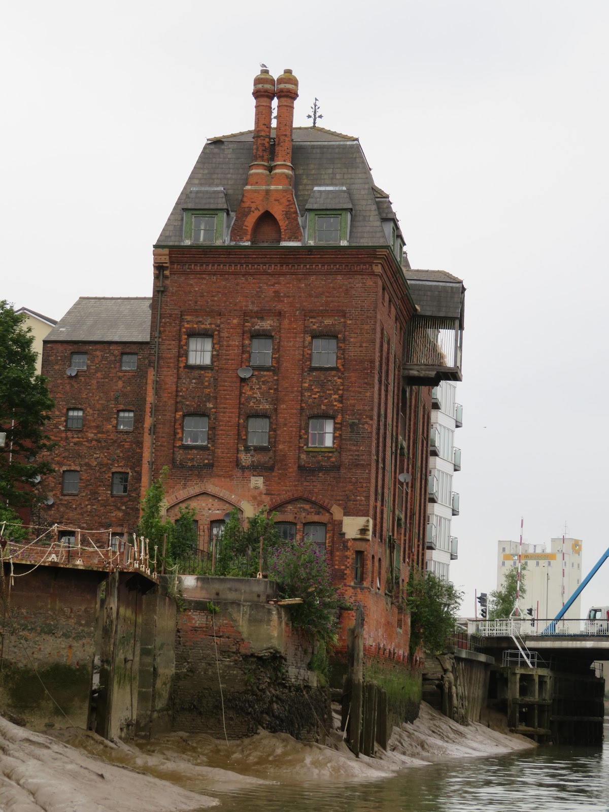
Just after North Bridge is this old chandlers warehouse and the remains of the bridge abutments previous to the present one. It is apartments now.

Newly painter Drypool Bridge and dedicated to John Venn who created the Venn diagrams. His father and grandfather were priests and friends of William Wilberforce. The River Hull entrance to Victoria Dock was just through the bridge and to the left.

The Old Harbour Master's office is just past Drypool bridge and he had come out to give us a wave. I had left him a phone message to tell him we were coming down so he must have waited for us as he is supposed to be only on duty around HW times. You can just see the stern of the last sidewinder trawler, 'Arcitc Corsair' to the right. There is the Scale line bridge in black and the Tidal Barrier behind that. Much to our surprise there was a narrow boat called the 'Annapurna' alongside the 'Dovedale' waiting for the tide. It just goes to show that narrow boats aren't as rare up here as you may think. I think he moors at the boat club on Beverley Beck.

We have just passed under the Myton Gate dual carriageway bridge and you can see that the mud is almost covered now. and we are nearly at the Humber.

Just clearing Sammy's P:oint, or the Deep and into a slightly choppy Humber bang on my predicted time of 1200, just over three hours after leaving Beverley. Today's tide was fairly neapish so LW was not so low. I could easily have left an hour later so as to meet the flood tide by Stoneferry where it seems to be more of a problem.
It was a relief to be out on the Humber in our narrow boat, something I hadn't thought I would be saying last year! We now have the trip all the way past Goole to Barmby Barrage on the River Derwent. More next time.
No comments:
Post a Comment