Woke up to another wonderful morning, cool and crisp and sunny. We were off for a walk just after 10:00. We ambled down the towpath back to Sandon Lock and onto the road


Sandon station was opened in 1849 by the North Staffs. Railway. It was later called Sandon and Salt Station as the Uttoxeter opened another one in 1869 called Salt and Sandon Station! It was built in grand Jacobean style with a porte cochere for the Duke of Harrowby to dismount from his carriage in shelter. At the time he was building a new house at Sandon Park.

At the crossroads with the main dual carriage way are the Village Rooms and cricket pitch. The building was designed by Guy Dawber in the Arts and Crafts style in 1904. He also built a row of cottages in the village as well as the Dog and Doublet pub in 1906, that is just behind the camera. You can also see the Sandon, Gayton and Marston War Memorial that was dedicated in 1921. It is sobering to see that 80 left to fight and 23 gave their lives. They not only fought in France and Belgium but also Gallipoli, Salonica, Mesopotamia, South Russia, Egypt, Palestine, Italy, East Africa and India. A little outside the village, towards Stone is another memorial that is for the crew of a Lancaster bomber that crashed nearby in May 1945. The plane was from 428 Squadron of Middleton St. George, which is now Teeside Airport.

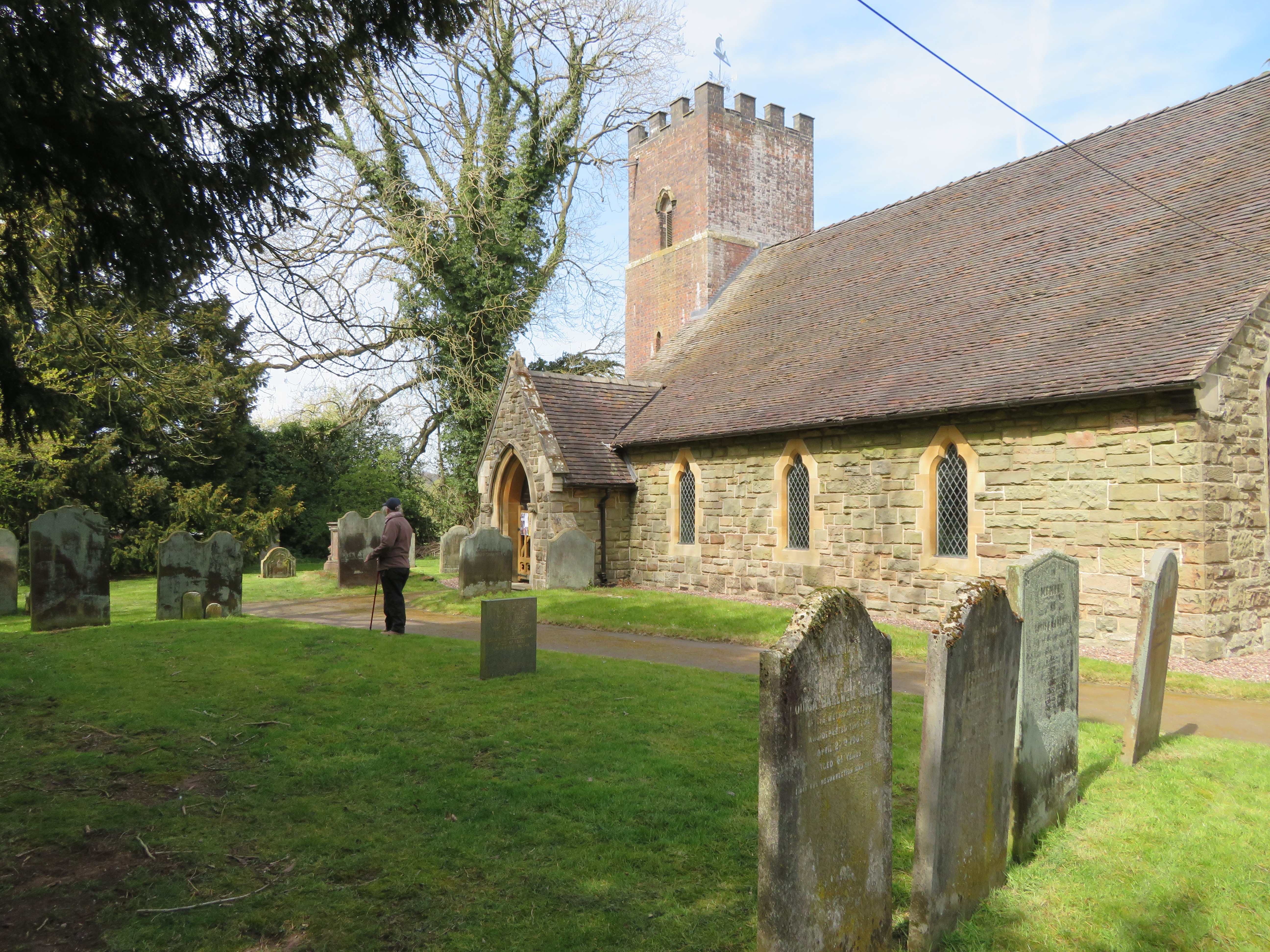
We crossed the dual carriageway and went up the minor road past the gates to Sandon Hall. We passed the school that is undergoing renovation to a private home at the moment. You could tell it was a school as it had bracket for a bell above the gable end. We walked across the field to All Saints Church that was rebuilt in the 1300's The north aisle was added in the 14th Century and later, 1817, converted into a family chapel. The whole church was rebuilt again in 1923. It has a great view and the vicarage is next door.

Down the hill from the church is the site of a moated hall. The moat is stone lined and can be seen easily. It dates from between 1250 and 1350. The original building had more or less gone by 1854.

The photo was taken from the top right corner, you can see the foot bridge that gives access to a house close by, but the original entrance was via a drawbridge to the east. This map was surveyed in 1879 and you can see it had been taken for a summerhouse and fountain.

Up the hill past Stonehouse Farm, another Listed building, and at the top was a great view of the Trent Valley with Cannock Chase to the right and Rugeley to the right of middle. (You can just see the coolling towers).

We then walked through Sandon Wood which has extensive bluebells. I reckon we are a week early as they are just starting to come out, but will soon be a real carpet of them.

Having left the wood and across a field we came to Stocking Brook. It is not true that the bridge collapsed after Helen crossed and we both got to the other side.

Climbing up the valley side again there were several ponds or tarns that came as a bit of a surprise as it has been so dry. The underlaying rock is sandstone and seems to stop the water percolating down. Over field paths you come to a by-road at Hartley Green. We could hear it along time before we got there as they had several peacocks that were extremely loud. The road is where you join the Stone Circles Challenge Way which is a 36 mile walk in Staffordshire that is a circular walk with Stone at its centre.

Leaving the road we follow the Stone Circles route to the rear of Gayton village where there is a ford and footbridge. The Gayton Brook is very attractive. I wonder if the place gets busy with families in the summer holidays?
We made a short detour to have a look at Gayton Church, St. Peters. The oldest part of the church dates from 12th Century and the tower was added in 1732, along with internal alterations there was another rebuild in 1871. The graveyard is quite atmospheric.

The route than passes through a wood and watch out on your right and you will see this bridge built on stone buttresses. Follow the rough path under it and to the left.

And there you will find a mound with this 75' Doric Column with an urn on the top. It was built in 1806 by the 1st Earl of Harrowby who was a good friend of William Pit the Younger, to whom the column was dedicated to in 1806. The Duke was once the second to William Pitt in a duel. Both men shot and missed, and after agreeing that each of them had had their honour satisfied they shared a coach back to London. The pistols are in the main house.

On the other side is an inscription in Latin that has William Pitt's name and the Dudley's of Harrowby, The Duke, Father of the Country and friends. But don't quote me on the exact translation.

After the woods you obtain partial views of the main house from 1852, rebuilt after a fire, and Sandon Home Farm. Back across the main round and down the road to Salt. A little way down you cross the railway line and the canal. descend to the tow path and walk north towards Sandon Lock. At the lock, behind the wall, are the remains of a lime kiln. The kiln is largely intact and is Listed. It is special as it as hints of neoclassical stone work and is an unusual pyramid design. It was built in 1790. 100 years later it is called the 'Old' lime kiln on the map. The brick and wooden building was called a smithy on the same map.
The walk along the towpath back to the boat was quite quickly and back for a cup of tea. It was a great walk in fantastic weather. It would be a great walk in early May when the bluebells are out, but in very wet weather there are places that would be very muddy. Today it was bone dry. Another 6.8 miles walked.
No comments:
Post a Comment