Total Pageviews

Thursday 22 August 2019

Through Thorne.

This post has been delayed as a lot seems to have happened. We had found a berth at Staniland so we could go home to enable me to carry out the history walks that I guide every month but things have conspired.

After spending a surprisingly quiet night next to the railway line and road at Maud's Bridge we knew we had to be up at Wykewell Lift bridge for 0900 as we weren't sure what was happening there with the restriction. The day dawned another nice one, and we were soon off and running. Believe it or not there was actually a station here on the South Yorkshire Railway that was built through here in 1859. Originally there was only a station at Crowle but the station here was opened only a couple of months later. However it didn't last long as it was closed in 1866.

Every bridge on the Stainforth and Keadby Canal is different and the Moores swing bridge is much more industrial looking and seem to have been built between the wars to me. However it all operated very smoothly with the barriers having to be closed manually.

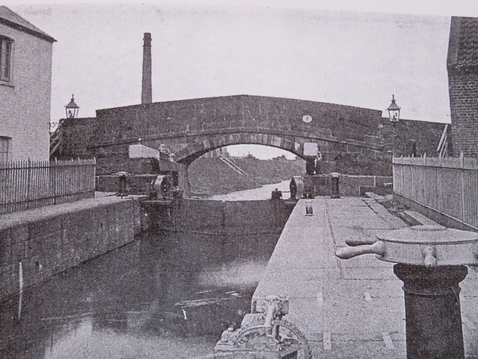
The next bridge was the problem one, Wykewell lift bridge. In the middle of September this year one of the lifting arms failed, which must have been a little scary if anybody was passing below. The bridge was closed for three weeks as the assessed the situation. Once they had sorted out how they would carry out the repairs they fitted the preventer stops to the lifting arms and were then able to work the bridge with a temporary arm installed.

 The stoppage sounds as if you need to book a passage but it seems that the C&RT man/woman is there between 0900 and 1000 and 1500 and 1600 regardless of if they have been ordered. The reason they are limiting the use of the bridge is that the temporary repair has no rotating bearing that can be lubricated so there could be wear on it. It lifted with no squeal or other signs of stress though, and just as we cleared a boat coming the other way arrived and so saved another lift.

Until bore hoes were sunk in 1911 the only deep bore holes were at the brewery and the work house. Everybody else was supplied from the canal or the River Don. The keel and barge me used to fill their water tanks in the canal between the bridges at Keadby and the railway bridge (that has now gone). It was known as 'Bonnie Ale' Reach as the water was so clear and fresh from lots of springs issuing into the canal there. There was another water tower to the north of the town but this was knocked down and was where Lidl is now. This one ca not be the original! I wonder for how much longer the Pacer Trains will still be seen in the North.? Probably decades more. In this area Dunston's, the ship builders from Thorne had part of their yard wher all the top hamper was added to the hulls as the railway bridge was fixed. The rest of the building was done at their yard near the lock but the rest had to be done after the south railway bridge.

We passed Nationwide Narrowboat Sales and this was home to the Louise and Joshua narrow boat builders for over twenty years. I think it was about 2010 that they moved on. There used to be a swing bridge a little past the yard and before the M18 was constructed most of the traffic from Hull to Doncaster would have passed over it. The delays when canal traffic was passing must have been amazing and would soon have jammed the whole town up.

Thorne is still a prominent boat building and repair area with Thorne Boat Services here since 1992, just under the road fly over bridge that replaced the swing bridge. There is also the Princess Royal swinging foot bridge that is almost under the road bridge. This foot bridge seems to have many problems and seems to be out of commission almost as often as it is in! When we passed this time it was open, indicating it was awaiting repair once more. The services and moorings are just past their base.

I have always liked this bench that is opposite Thorne Boat Services and on the landing for operating the Princess Royal swing bridge.

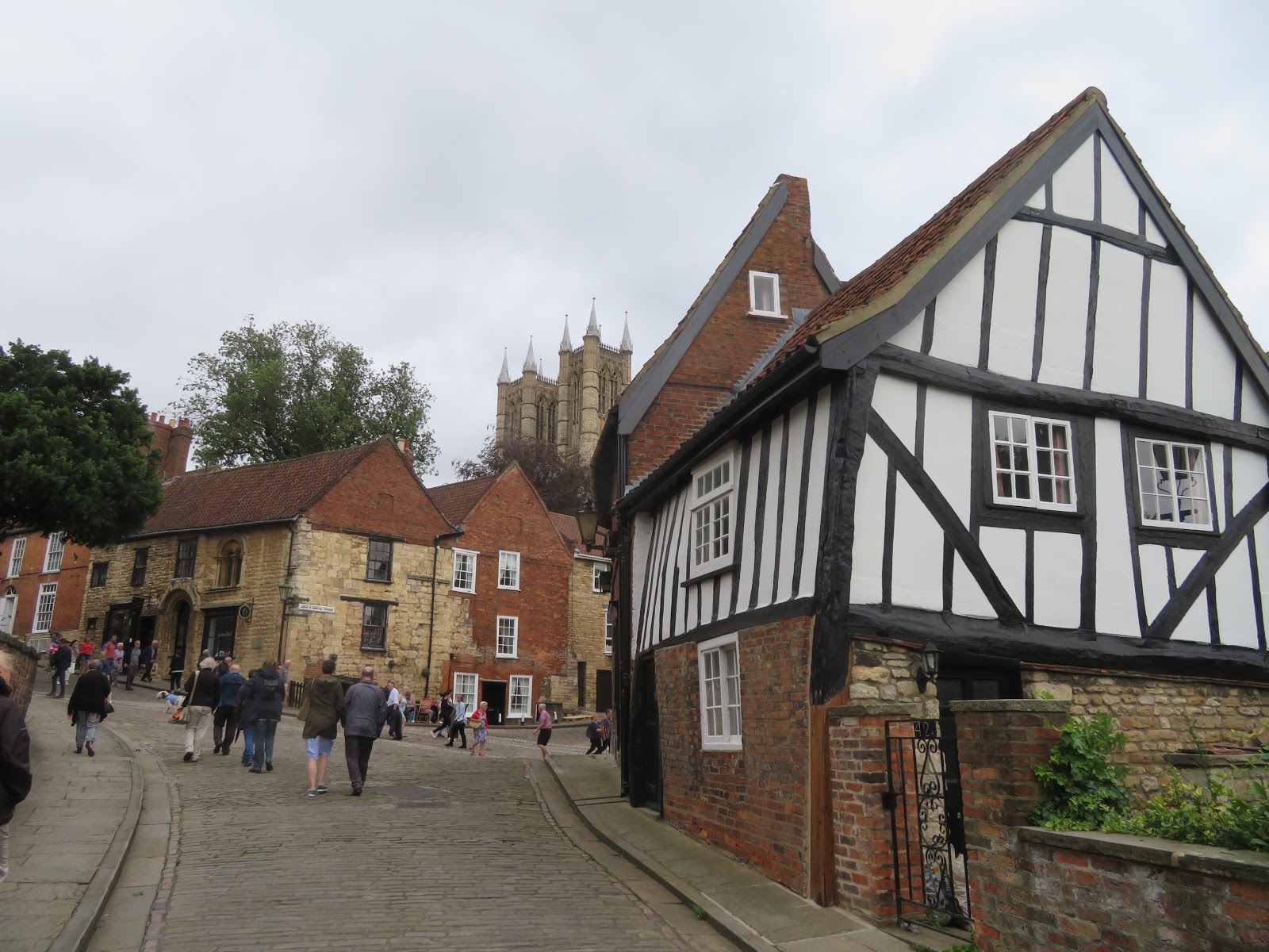
Thorne Lock looks like it should be manual operated but it has been mechanised and is easy to operate. The lock actually lifts the canal up a bank that was created in the 1600's by Vermuyden who was brought in to tame the River Don and drain the land. It is called Ashfield and runs parallel to the river all the way to Stainforth. Just below is the Sea Cadets boat house, and a little inland is their drill hall etc. This building was part of a large union workhouse built in 1763 and 'hosting' up to 150 'guests'.

We didn't have far to go as we had booked the boat in to Staniland's for a temporary mooring for a week, whilst we went home. We filled up with fuel at 85p and then found our way into the end basin and threaded down to a pontoon, just. A very tight fit. The Thorne North station is very handy and I was home and back with in three hours. We packed up and were off home.

Tuesday 20 August 2019

Coming in at Keadby and carrying on.

We were on schedule to arrive at Keadby Lock on the Trent at the time of predicted change of tide to flood and had just passed Owston Ferry.

At one time Owston Ferry was quite a busy little inland port with the keels of the Humber and canals bring in goods and taking local produce out from wharves right on the bank. There was even a crane in the 1920's. It must have been hard work running barrow loads of coal up the plank to the bank at low water. A bit easier to get the sacks of grain down from the warehouse to the hold.

As the tide fell more mud was revealed on the 'ness's' (inside of the bends) and the wading and sea birds took advantage of the chance to feed. Here on Kelfield Corner there were plenty of them. On the outside of the bend in the Kelfield 'boil' where the water turns over in a flurry of water. There was evidence of it as we passed but on bigger tides and at a different height of tide it can be quite fearsome.

To the north of West Butterwick stands the remains of another tower mill that was built in 1824. It seems to have become derelict during WWII but still had its sails just after. They do make interesting houses etc.

The breaks in the clouds allowed the sun to bring sparkle to our wake as we headed northwards.

We arrived at the M180 Motorway bridge. This motorway was started in 1977 as a bypass around Brigg following the Flixborough explosion. The last part to be completed was the Trent viaduct that was opened in 1979. The motorway is 25 miles long and runs from the M18 where via the A180 it connects to Immingham Docks, the oil refineries and Grimsby as well as the Humber Bridge. It is the longest motorway with a 3 digit number. What a claim to fame!

Once through the motorway bridge a call to Keadby lock asks us to carry on even though the tide is still ebbing. The lock keeper says that for the last few tides it has changed to flood on time. At Derrythorpe are some moorings for barges and sea going traffic with the tide board. As you can see there is only about 20cm on the gauge. In this area we used to swing and put the bow into the bank to await a rise in water after having to be so early on the tide to be able to fit under Keadby road/railway bridge on the way to Beckingham Wharf.

Keadby Bridge used to be known as King George V bridge and was built between 1912 and 1916 by the Great Central Railway Co. and replaced a bridge that had been built in 1864 for the South Yorkshire Railway that had a swing section for the passage of ships. This bridge was a Scherzer Rolling Bridge. The lifting bascule was electrically operated and it rolled and rotated on the counter balance. It has two rail tracks and a two carriageway road crossing it. It last lifted in 1956 making it quite exciting to pass under it with a ship!

We arrived off the lock to be told that the tide was still ebbing and we had to wait. We swung head to the current and had to wait about 25 minutes before were were called in to enter the lock. You can see down by the lock the other short boat that had followed us up from Torksey, also waiting for the lock. They penned up with us.

You can see we now had the green light to enter the lock that is just below the white control tower. No ships of the wharf to make life even more interesting today.

Once the gates were closed we slowly rose up the lock. Once the level was made with the canal and the gates opened we then had to wait for the road bridge to be swung to allow us to leave. We were carrying straight on so went first. There were four boats to take our place to head up to Torksey on the first of the flood tide.

There was some activity at the sliding railway bridge. It turned out that there was a little weed cutting boat work there between the closing to allow trains to pass. We waited midstream for a fair while and then following another closure for a train passing the weed cutter didn't reappear! It was 16:00 and he had knocked off and not even indicated to us. The bridge works by being winched to the side and as the tracks cross the cut at an angle it clears the water and allows passage. Just through the rail bridge is the Vazons swing bridge that is a 'normal' man-o-matic road bridge. It has definitely been fixed since the last time we passed as it was very easy to operate this time.

At Godnow Bridge the rail track is very close to the canal so the closing of the road crossing to open the canal bridge has to be coordinated with closing the road crossing of the railway so a chat with the crossing keeper ensued. It was he that told us there was a closure at Wykewell bridge closer to Thorne.

As we drew closer to our stop for the night, imposed on us as the Wykewell road bridge is only open between 0900 and 1000 in the morning and 1500 and 1600 in the afternoon, the sun was warming up and the wind was dropping so it was a pleasant evening. We stopped on the moorings by Maud's swing bridge that was for a very quiet road and just far enough from the railway line to be not unduly disturbed over night.

Thorne Moor has plenty of the wind turbines rotating away but they didn't disturb us. We had a little distance and one swing bridge to work before arriving at the bridge with restrictions so we would have a slightly early start in the morning.


Saturday 17 August 2019

Wandering about in the wind.

We moored up safe from the wind and as were were not going anywhere our daughter was popping over from Hull for the night. We had the day to kill. This weekend was to be the 1940's weekend in Lincoln. Much didn't happen as they couldn't put up tents etc. Helen was very disappointed as the RAF Memorial Flight fly past was cancelled due to the weather.

The foot bridge over the road on Waterside South gives you a great view of the cathedral. The left hand lanes were empty as further chaos was occurring due to an accident that had closed the road and traffic was stacked up all round the city centre.

This is actually the building that sits on top of the Glory Hole, the mouse hole that lets the River Witham under High Street. It was actually built in 1540 and now seems to be a tea shop where the waitresses where black and little caps like at Betty's.

There is the glory hole, or High Bridge, with the back of the building. The bridge is said to be the oldest surviving in the country and dates from 1160. A chapel was built on top of it to Thomas a Becket in 1235 but was lost in the Reformation.

These are some of the crowds at the top of Steep Hill. The house give a lovely aspect as. I wonder what the criteria is/was. you look down the slope. Steep Hill was proclaimed the 'Best Street in the Country, 2012'

They don't make them like this now as it has been dated as been built between 1170 and 1180. It is known as the Norman House for the era it was built. You do get an idea of the steepness of Steep Hill in the photo too.

From Michaelgate looking back at the Norman House and the towers of the cathedral behind (you can't see the scaffolding or sheets of plastic that shroud a lot of it at the moment) you can see what is called Crooked Cottage. It seems there was a whole row of these going down the hill behind the camera but where knocked down in the 60's. They were Alms Houses and then council houses, and there was always a long waiting list for them. Now it is a holiday home if you fancy stopping there.

This is the side entrance to the cathedraland is called the Bishop's Entrance as this is where he would enter as it was the closest to the Bishop's Palace.

The Bishop's Palace was just down the hill and set in gardens. In fact there were two here. One I think has now recently been converted to an hotel. The other was ruined but is in the hands of English Hetitage but they are doing a lot of work on it so is not open. This is looking through to the hotel

This is the entrance to Saint Hugh's Shrine that was built in the second half of the 13th Century. They basically built/extended the back of the church to make it even bigger. St. Hugh was the bishop of Lincoln and was a French Noble monk. He was made a saint very quickly after his death and was second in England to Thomas a Becket, so the shrine was a great attraction for the pilgrim pound.

I loved this window in the music school of the cathedral with the heads and shields.

Is this Arts and Crafts era? What ever it is it is quite something and I would be washing it all the time to keep it bright and shiny.

And to take us right back here is the biggest Roman Wall in England. It was actually the west wall of the Roman Basilica. Lincoln, or Lindum was a big Roman city and was on Ermine Street that actually passed up Steep Hill. Even when the Romans left a lot of those who remained made it home and so extended the life of it. 

Torksey, the Trent and timekeeping.

We had spoken with the lock keepers at Torksey and Keadby and the plan was to pen out at Torksey for about 1000 and wait on the pontoon below for a while, until the ebb was away and arrive at Keadby for the first of the flood tide.

We filled up with water and were sitting outside the lock for the allotted time, and were let in. I had just enough time to take the photo before were gently let down to the river Trent level.

I wanted to compare today's lock with that of 1905. As you will see the lock looks shorter in this photo however the bridge abutments can be seen in the new photo but the lock has been extended and a new bridge added over the the new length of lock. The iron railings have been replaced by the addition of the concrete flood wall. The ighting is modern, although the old gas lamps are still around the garden area. The brick chimney on the other side of the bridge is from the old pumping station that pumped up water from the Trent into the Fossdyke.

Torksey Castle was built in 1560 for the Jermyn family. As the family took the Royalist side in the English Civil War the house was 'slighted' by Parliamentary troops from Newark and was never restored. It is the west wall and part of the rear facade that remain. When the river banks were heightened in 1961 part of the remains were buried. The remains were stabilised in 1991 but the Grade I listed building is at risk.

Torksey Railway viaduct is also Grade II* Listed as it is regarded as the first box girder bridge. It was built between 1847 and 1849 for the Manchester, Sheffield and Lincolnshire Railway. In 1897 a central truss was added un the upper deck to add strength. In 2016 it became part of the SustRans cycle and walking routes.

The mill at Trent Port dates from at least 1799 and was working until 1927 when the machinery was removed and installed in a place in Gainsborough. The port was a busy place of trade with a malt kiln, candle and pen factories and two roperies. The houses doen by the river were prone to flooding and were demolished in the 1950's.

The Chateau was built in 1747/8 after a solicitor from Gainsborough bought an estate at Gate Burton. There had been no house so he had this built as a stop gap. The main house was built in 1768 and the chateau became a summer house and then later a shooting lodge. The building fell in very bad repair following a series iof sales until 1982 when it was offered to the Landmark Trust who renovated it and it is available to rent; £400 for 4 nights in November for 2 people.

West Burton Power Station was commissioned in 1968, taking 10 years to build, and can supply 2 million homes. In 2013 a combined cycle gas turbine power station opened next to the coal fired one and this can supply 1.5 million homes. They are both run by EDF at the moment.

Just past the power stations are a couple of very sharp bends in the river. The first is Turn Post Corner and this one is Stoney Bight. You can look down both reaches as you pass the apex.

On the outskirts of Gainsborough you pass the Kerry Mill. This is a large business that is an Irish Company. Here they mill and package flour, including the Homepride brand. The mill was built in 1962 for Spillers that imported grain via the Trent as well as by road from the local area.

Looking down river through the Trent Bridge at Gainsborough. It was opened in 1791 and the next bridge across the Trent was at Newark in those days. It was a toll bridge until 1932. The pilotage district for Humber Pilots is actually the upstream side of this stone bridge. It would have been interesting taking a ship through the bridge though.

There is a pontoon alongsid the old quay sapce in Gainsborough where you can wait out a tide. I want to go and have a look around the town but time did not afford us the chance today so we just passed by. There doesn't seem to be too many of the old warehouses and maltings left from the town's heyday though.

The Chesterfield Canal was opened in 1799 with the lock down into the Trent being the last thing to finish. It was built as a narrow canal, but was built wide from the Trent to Retford. However the last wide beam was noted in 1799.

It was quite a pleasant day with the occasional sunny periods, however the wind was cool. We saw nothing moving until right at the end when we were caught up by a boat that had followed us later from the pontoon at Torksey.

Another old tower mill that has lost its sails just outside Owston Ferry. The dome makes me think of the Kremlin for some reason!

At Owston Ferry is the mooring for the 'Trisantonia II' which must make a nice vessel to chug up and down the Trent on.

The tide was still ebbing and we just went along at the same 1700 revs. The plan was to arrive at around 1500 about 4hr 15 mins after setting off and we were on schedule.