Total Pageviews

Tuesday 30 March 2021

Lost and Found.

 Whilst looking for some other in formation I came this article in the Limerick Chronicle of 10th April 1833.

On Sunday morning last a coffin was seen floating down the river at Bally Hack, which, on being brought ashore by some boatmen, was found to contain the body of an unfortunate man named Pyne, who had committed suicide. On inquiry it was ascertained that the body, after being buried at four crossroads in the neighbourhood of Waterford, had been disinterred by some superstitious and ignorant creatures, and thrown into the river. After the body was re-interred at Ballyhack, a similar disgraceful scene occurred, the enlightened actors in which would allow no other resting place for the remains of the wretched man than the bed of the river. The Church Wardens of the parish interfered, but it is apprehended it will not long continue so.

I am assuming that the body was buried outside consecrated ground, at cross roads as the unfortunate man had been a suicide so was unable to have been buried in consecrated ground. I'm not sure why that wasn't sufficient and he had to be dug up again and cast into the river. The distance from Waterford to Ballyhack is around 9 miles, down the River Suir and into the River Barrow.

In 2019 after a flash flood in Louisiana over thirty coffins escaped their tombs as the gases of decay are sealed in to the coffin and when the water table rises sufficiently to float them they can burst out and off they go.

Not a thing you want to see after having buried your loved one. Floods in Louisiana give new mobility to these caskets.

I have never seen a coffin floating down the cut, but have seen some boats that looked like they may end up like a coffin! Things that I have seen are inflatable fenders that I have recovered and put to good use. I tend to fish out timber that may be useful for either burning or if PSE timber, that could come in useful for 'making something'. Of course from February, or is it May, you are not supposed to burn coal, or certain none approved smokeless coal and no 'wet' wood. I read that as green, but it means wood with a greater than 20% water content so fishing it out of the cut and burning it wont do. Every boater who burns wood should now be armed with a a moisture meter now.

I may not have seen a coffin but I have seen plenty of dead bodies floating in the cut, fortunately not human, although I did find one in the Humber a good time a ago. We have seen every sort of animal you can think of. On the Foss Dyke that leads from the Trent to Lincoln one time it was as though there had been a mass suicide of deer. There were around ten we passed in a short stretch. It is obviously a problem on this waterway as they have installed deer ramps, piles of limestone at the side so that they are able to scramble up the piles a straight edges. The deer obviously need a map of where they are!

The straight Foss Dyke has the deer ramps that are piles of chalk or limestone dumped just under the surface that are supposed to allow the deer to scramble out. The arrows conveniently mark them so that boaters don't collide with them. It seems obvious that the deer can't read street signs though.

Sometimes you are alerted to the presence of the cadaver before you can actually see it. That was definitely the case on the River Ouse. We had left Beverely up the River Hull and were making our way to the River Derwent at Barmby on the Marsh. We had just passed Howden Dyke Island and passed under the M62 motorway bridge when my nostrils were assailed! As I looked ahead to lign up with Boothferry Bridge I spotted it.

This cow wasn't wild swimming using back stroke of that I'm sure.

Mind you  It is not only dead animals that we have fished out of the water. I have recovered sheep, near Crick when we were looking at our boat prior to purchase, cows on the Thames that had got stuck between our boat at Lechlade and most notably a little leveret that had fallen in the canal at Beeston on the Shropshire Union on the way to Chester. We heard a very funny sound outside that we couldn't explain. I thought it maybe Macy, our cat that had fallen in, but when we went to look it was this little leveret. It id its best to prevent me fishing it out, but eventually I manged to hoick it out. We took it in and dried it off and warmed it up. It was clearly exhausted so we just kept it a box with a bit of grass etc overnight. In the morning it seemed to have recovered somewhat so we pushed over to the off side where we thought it was more likely to have come from, and released it. It instantly jumped back in the water! This time I fished it out smartly and then pushed in the right direction and it was off.

Rescued leveret at Beeston.

I'd be interested to hear what else people have fished out of the canal. I have got a lovely shifting spanner that I got out the cut, and cleaned up beautifully despite it being very rusty.


Wednesday 24 March 2021

Taking the lid off.

The weather was fine on the evening we arrived so we went for a stroll  to the Shugborough estate.

Over the Trent by the Essex Bridge across the River Trent just after its confluence with the River Sow.

It was a lovely still eveing and we could hear owls and the munching of the munching of the bullocks in the field as the sun set behind the Hall.

The Temple of the Winds was built in 1795 and is octagonal and closely resembles a temple of the same name in Athens. It has been used as a banqueting hall a gambling den and a dairy in its long life.

The next morning was again nice and still allowing the mist to linger a little until I had woken up to make the tea.

In the morning we had our BSS survey with Steve Heywood and passed fortunately. We set off quite late in the afternoon and the rain had started to fall gently. It wasn't too warm either so Helen ducked back inside after we had completed the Lock at Great Haywood.

The Shugborough Carriage Bridge is ornate as it carried the hall's traffic to the church and towards Little Haywood on the none towpath side.

Colwich lock looks pretty good in the drizzle, but is very photogenic when the sun shines. It is a shame the West Coast Main Line passes just behind the lock cottage.

This three arched bridge replaced a nine arch one that had been damaged and repaired with timber. It was constructed in 1800 by John Rennie to carry the London, Holyhead stagecoach road.

The trees on the section after Wolseley Bridge and alongside Bishton Hall have lovely beech trees that were just going over. The River Trent is close by at this point.

There is nothing left to see of Brereton Basin, and this OS map of 1921 shows it just a few years before it closed in 1924. As you can see a plateway or tramway led up hill to the south west, up to Bereton Pit. The Brererton pit opend in 1851 but there way several in the immediate area that predated it. The 3/4 mile long tramway was built around 1811/15 and was originally horse drawn and crossed Brererton Main Road via a crossing in 1882. By 1900 it passed below the road in a tunnel. This probably coincided with when it was converted to steam driven. The loaded wagons lowered on a single wire by gravity and was powered back up by a steam winch at the colliery. It was known as the Ginnies Plateway as the wagons used to carry the coal were known as ginnies. I think the basin was bought by the Cannock Chase District Council in the 1980's, but it looks like the land has not been developed and is still wooded. Brererton Colliery closed in 1960 which coincided with coming on stream of the newly sunk Lea Hall Colliery that final came on stream about this time. Brererton pit was poaching on the seams of Lea Hall mine by then. Lea Hall Colliery was directly opposite the old basin. The new pits output was taken by conveyor directly to the new power station that was built next door.

An aerial photograph of the Lea Hall Mine and the Rugeley Power station. Lea Hall mine was started in 1954, the first dug by the National Coal Board, and coal started to be produced in 1960. Rugeley A was opened in 1963. The pit produced more than 1 million tonnes every day but closed in 1991 as did the power station. When I was at school we had a 'field trip' down Lea Hall mine and I loved it. I have often thought that if I hadn't gone to sea I might have gone into mining somehow. Similar things in a away I think.

We didn't even stop for water  after the Ash Tree boat club and pub, but continued onwards to Armitage 'Tunnel'. Nothing was coming so we were able to go straight through. I can't remember ever having to stop for other traffic here.

The Rugeley End of the Armitage Tunnel around 1890-95. It is a little myustery as to why James Brindley cut through the bed of Keuper sandstone rather than just deviate a little. Maybe due to the Hawkesyard Priory people been reticent to accommodate a canal on their land.

Poor picture of the Rugeley End of the tunnel when a van crashed into the canal 13th March 1971. It clearly shows how little rock would have to be removed. In January 1965 about a 10 yard section of roof near to the Rugeley end of the tunnel fell in. The canal was drained in February to allow the fall to be removed. The arched roof profile in this section had become a square one. At this time it was found that a narrow crack extended from the recent fall to the entrance suggesting further falls, and on the face of the tunnel further cracks were found. The tunnel was closed to boats and pedestrians. Nothing happened until March 1971 when it had been decided to remove the roof of the tunnel that was only 10' of rock and soil. The plan was to have two stoppages for the canal March 1st  to April 4th ans then November to February 1972. The road would have to be diverted too.

The tunnel in 1971 as it was being opened out. Once the canal was drained to facilitate the work it was found that the bed of the 'tunnel' was also cracked, so this was repaired at the same time. Due to complaints a schedule of open and closed for passage times was to be agreed.

In August the tunnel was largely opened up and the alteration of the road bridge alignment was taking place, and causing severe disruption. This photo was taken after the canal had been re-watered but before the hand rails had been installed. The road bridge is at an angle across the canal so in its self seems like a tunnel.

Despite the roof being taken off the tunnel a 16 year old boy on an hire boat banged his head as the boat entered the tunnel at the Plum Pudding end, and was killed in July 1979. By 1982 continuing subsidence, and expected future level changes resulted in The National Coal Board footing a £450,000 bill to raise bridges and banks, and stop leaks due to the water table raising along the length of the canal on the embankment the other side of the tunnel towards, Armitage. At the tunnel the new road bridge/tunnel was expected to drop significantly so a plan was devised to raise it by building an embankment and then shifting the bridge body on to it. With the closure of Lea Hall Colliery, the last in the area in 1991 the effects of subsidence should be less over the years in future.

We arrived at Kings Bromley Marina after they had all gone home so we tied up on the fuel berth, with permission, and I got a taxi to take me to Lichfield to get the train home. Bright and early the next day I set out with the car and was back at the marina in good time for their opening. We then filled with fuel and were then shown our berth. It is always with a tinge of sadness that we pack up, especially after a short years cruising due to COVID. I don't think that we were thinking that we wouldn't see the boat for months though. With a little luck we may get to see her next week and check if she is still afloat or what the inside is like. Then there is the planning for April!

Monday 15 March 2021

Bridging the gap.

 The next day was neither dull, nor bright, and it couldn't make up its mind whether to rain or not either. We had to go as we had a schedule, so off we went.

Three locks down and we come to Longford Bridge. In the distance through the arch you can just make out the M6 Bridge. 

This section of canal almost looks as if it is running through park lands of a big house. That is because it was! Teddesley Hall was built by the Littleton Family in 1754. In 1835 the family were knighted and he became Lord Hatherton and he must of become rich, or richer, from all the coal etc found below his various properties in the area. (Including Littleton Colliery from the last blog). The house was no longer needed after 1930 and became a POW camp for 200 Germans in WWII. It was then to become the HQ for the regional Health Board, but that never happened and the property was demolished in 1953.

Park Gate Bridge is photogenically all you would expect from a canal bridge and lock. Neat towpath and offside. White painted arch and a stone set horse path up to the lock with a dribble of water from the gates. Lovely, shame it isn't sunny too.

As you approach Acton Trussell you glimpse St James' church on its own, outside the village. The original church was built in the 13th Century but like many it was enlarged and rebuilt in 1869, the work designed by G.E. Street, who also designed the Royal Courts of Justice in London. Before this rebuild the church had been closed for more than 40 years. In 1985 the remains of a Roman villa were found and subsequent work has taken habitation from the neolithic to the 4th Century.

The canal was driven through part of the moat of the old moated manor house. Acton Trussell was in the Domeday Book, but although it is an apparent affluent commuter village there are little of no shops to be found. There is Acton Moat Bridge just ahead of the boat when this picture was taken and the moat is now in the grounds of the Moat House Hotel, with a pub in the oldest part of the building. Maybe worth a walk next time we are passing.

Stafford Boat Club is built on a disused arm that once went a short distance to a brick works from around the mid 1800's but was gone by the end of WWII.

After the roar of the traffic over the Radford A34 bridge it becomes all quiet again as Baswich Bridge. The 'wich' in Baswich should tell you that there was a salt works here as well as a spa in Stafford. A thick bed of salt was discovered laying below Stafford Common and the baths were built by the river. It was opened in 1892 and demolished in 1977. Stafford Common is to the north of Stafford so the brine was piped right through the centre of town to supply the spa baths and the salt works. A Salt works opened near the common in 1893 and in Baswich 1894, just to the north of the railway line. In 1948 a factory started using the vacuum method of production rather than the open pan method. The old factory became to expensive and was closed in 1957. As Stafford had expanded and brine extraction was causing serious subsidence its extraction was banned in 1970!

Another very photogenic bridge that looks like a turn-over one. The railway line is right next to the canal at this spot, and just beyond is the busy A513, but until a train comes past you could be miles away from the rush of modern life.

Since Baswich, where the Rivers Penk and Sow joined the Sow has been supreme. The aqueduct that crosses over it has good views up and down the river and the autumn colours will be lovely. We are just a week early but still it is a special place, and worth a return to.

Tixall Lock and Old Hall Bridge along with the lock keepers house and wharf on the off side, complete with crane make this spot another delight of the Staffordshire and Worcestershire Canal.

When passing through Tixall Wide, or as it used to be called Broad Water the old Gatehouse of Tixall Hall is always photographed. However there are several other buildings that can just about be seen from the water. This one is Tixall Farm and was built at the end of the 1700's/early 1800's and is a classci model farm of the time Through the coach arch is the entrance to the quadrangle enclosed by the barns etc on the outside. There were some buildings in the quadrangle but they were demolished when the whole thing was sold for residential development. They would be neat flats. There are 17 bays along the road. The last 5 to the right are a wonderful brick Dutch Barn.


Just by the farm can be seen the roof of the Bottle Lodge at the end of the carriageway that connects Tixall and Great Haywood. Once known as the, less glamorous, Upper Lodge, it was home for tor the shepherd and his wife in the 1800's. Even better their children had to sleep over the road in the other farm buildings! It just has one room on each level. Tixall looks to be another place I will have to have a walk around.

In December 1847 the Trent Valley Railway opened fully for goods and passenger traffic. This was a line that was designed to reduce the distance and time between London and the NW of England and hence to Ireland, north and south. It had been started in November 1845 by a new company the Trent Valley Railway. A year later that company had been taken over by the London and Birmingham Railway Co, and just a month later they amalgamated with several other companies to form the London and North Western Railway Co. In a report of May 1847 there was a report on the progress of the line. It stated that other than the tunnel at Shugborough the main engineering was crossing the Staffs. and Worcs. Canal and the River Penk and its flood plain. They had done this using a wooden viaduct that raised the line above the water by 25 'to 30' for a distance of about 150 yards. The whole structure was said to remarkable in its strength and solidity, and from a distance has a light and elegant appearance. The whole thing had taken 40,000 cu ft. of timber and there was some difficulty in finding a solid footing for the piles. The whole thing had cost £7,000.

The first Baswich Railway Viaduct, opened in 1847. Note the pile drivers

All went as it should until Wednesday 25th September 1858 and the down goods train driver saw that there was a small fire on the viaduct and stopped at the Queensville level crossing as he cleared it and informed a policeman, who in turn roused the plate layer lengthsman. He made haste to the bridge an quickly realised that there was little he could do on his own. On the way back towards Stafford he met a pilot engine with an inspector and a gang of men who had been alerted by the first driver when he had arrived at Stafford. When they arrived at the scene the hand rails on the bridge were alight in three places, but no flames were seen on the track bed. The gang of men did all they could but there was a strong SW'ly wind blowing and the fire was below them. The structure was wooden and soaked in creosote. The fire rapidly spread across the structure. By now the fire engines had arrived, one from the Norwich Union Co and the other the Stafford Municipal fire engine. They concentrated at the southern end where there was access. They played their hoses at the underneath of the spans across the River Penk and the canal. In they end they managed to save the canal crossing only. The showers of sparks and flames rose high into the sky and could be seen ten miles away. By 06:30 the beams had plunged to the ground and into the water leaving a few charred stumps and the metal rails suspended above the gaps. 

The newspapers managed to make a great story out of the goods train driver who reported the fire. His names was Thompson and it claimed that he had seen the flames when he cleared Shugbrough tunnel and ploughed on, crossing the bridge through rising flames and beams collapsing as he crossed them. He was christened 'Hell Fire Jack'. The first man on the scene, the lengthsman was George Dodds.

The Railway Co. did not hang about and set to quickly to clear the site. Passengers and mail were transferred between Stafford and Colwich station via omnibus until the next Sunday by when a foor bridge had been installed and trains stopped at either end of the viaduct and walked across to continue their trip. A floating platform across the river was put in place and sheds were built for the 140 to 200 workmen on the site. The original wooden piles had survived close to water level and this fact was used to speed things up. A metal sleeve was fashioned for each of the stubs. This closely fitted the old pile and extended sufficiently to allow a new timber beam to be driven into it securely. These 'sleeves' used inch thick steel and weighed about 9cwt. After one week the piles were completed for nearly a third of the length. On Wednesday 13th October the new single track viaduct was tested by driving to heavy engines over it and was declared safe, and the line reopened, just three weeks after the fire! Unfortunately there was a death of a workman, Gibbs, died at the Stafford Infirmary having fallen head first down the saw pit. An enquiry had found that the fire was started by errant cinders from the 10:50pm train from Stafford. The next train up from Tamworth, the 11:12pm reported that there was a smell of burning, but no sight of flames or smoke.

Viaduct over the River Penk being repainted in 1934. You can see that the number of lines 

Whilst this temporary bridge was under construction the Board of the company also agreed to a permanent replacement and tests were made to find safe foundations for the new bridge. Gravel conglomerate was found at 12 to 40' and this would form the base. Despite the expense they agreed to build an wrought iron girder bridge, supported on Staffordshire blue brick piers, the bricks coming from West Bromwich. Work actually started on site in December 1858. There was to be six arches or openings of 42 ' each with two to span the River Penk and to be sited to the north of the wooden viaduct. One of the tracks was opened for traffic on Monday 14th March 1859, and the second line on Wednesday 22nd June 1859.

The two track bridge was added to by a completely new bridge next to it between 1880 and 1900 to provide two up and two down lines. The two bridges can be seen side by side in the photo above.


In August 1952 the older bridge was closed for modernisation. Staffordshire Advertiser photos.

The work consisted of replacing the brick pillars, trestles and steel girders. A precast concrete track bed was added and this was not tied to the rest of the structure. This meant that there was less vibration and noise caused by passing trains. It was said that the original elm piles used were still in excellent condition and were largely left in place. The work took just three months and was two weeks ahead of schedule. The workers were a multinational team, Poles, Ukranians, Scots, Welsh and Irish as well as some Displaced Persons. 30% of the work force were local too.

The bridges today.

Who would have thought that a bridge could be so interesting !!


Friday 12 March 2021

Downs, Ups and Downs of Industry.

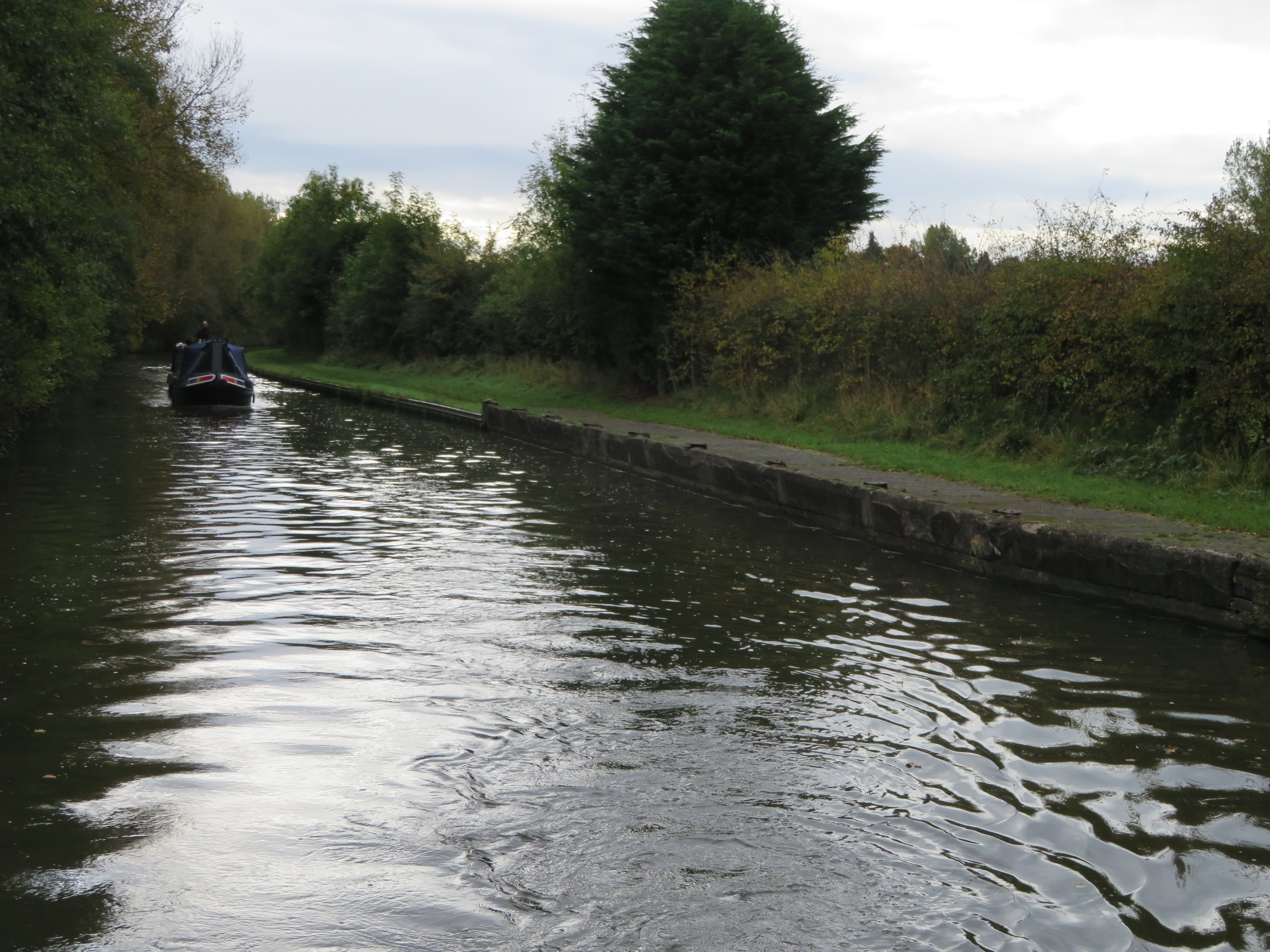
 It was a gloomy day with a bit of drizzle in the air when we left out mooring at the Fox ans Anchor near Coven. In 1974 the Staffordshire and Worcestershire Canal Society had a rally along this stretch that was 20p for two adults to enter. Children free. How much is Crick these days? Only saying.

Between the road and railway bridge at Slade Heath is this collection of buildings that must have been a wharf. I had previously looked on the 1888 map and there was no note of a wharf. I have dug further and there was a wharf at Slade Heath and it was to let in 1812 and 1818, and there was a sale of railway building equipment there in 1838. It originally consisted of a warehouse, stables, yard and small house.

As the canal meets the railway again what looks like another wharf can be seen. There is a small pumping station the other side of the railway and I thought it may have been used to bring equipment for that, but I now suspect that it was used for the electrification of the railway as a convenient point to bring equipment in by canal.

The enclosure of Coven and Slade Heaths occurred around 1851 and 1852. I assume that before then there would have been less field boundaries, but it is a very quiet rural place today too.

Hatherton Junction is now a quiet spot on the Staffs. and Worcs. but was a busy spot in its day. This end of the Hatherton Branch was constructed by the S&W canal themselves and went 3.5 miles to Churchbridge. The canal company made such good profits they didn't obtain an Act of Parliament so that they could compulsorily purchase land and raise money, they just negotiated individually with the land owners and paid for it out of profits. It was built to provide a route for the Cannock Chase mines produce. In 1860's the S&W made an agreement with the BCN to create a link via 13 locks between Churchbridge and the Cannock Extension Canal. It seems the two companies jointly purchased the land but the S&W paid for the locks over the 1/2 mile length. The link was made in around 1859/9 but the Cannock Extension Canal wasn't opened until 1863.

This would have been a busy toll station at the height of the coal period, and maybe will be again when the restoration is completed. It is perhaps the next sizable length of canal to be re-opened in the near future and see boat pass down it since its closure due subsidence in the 1950's.

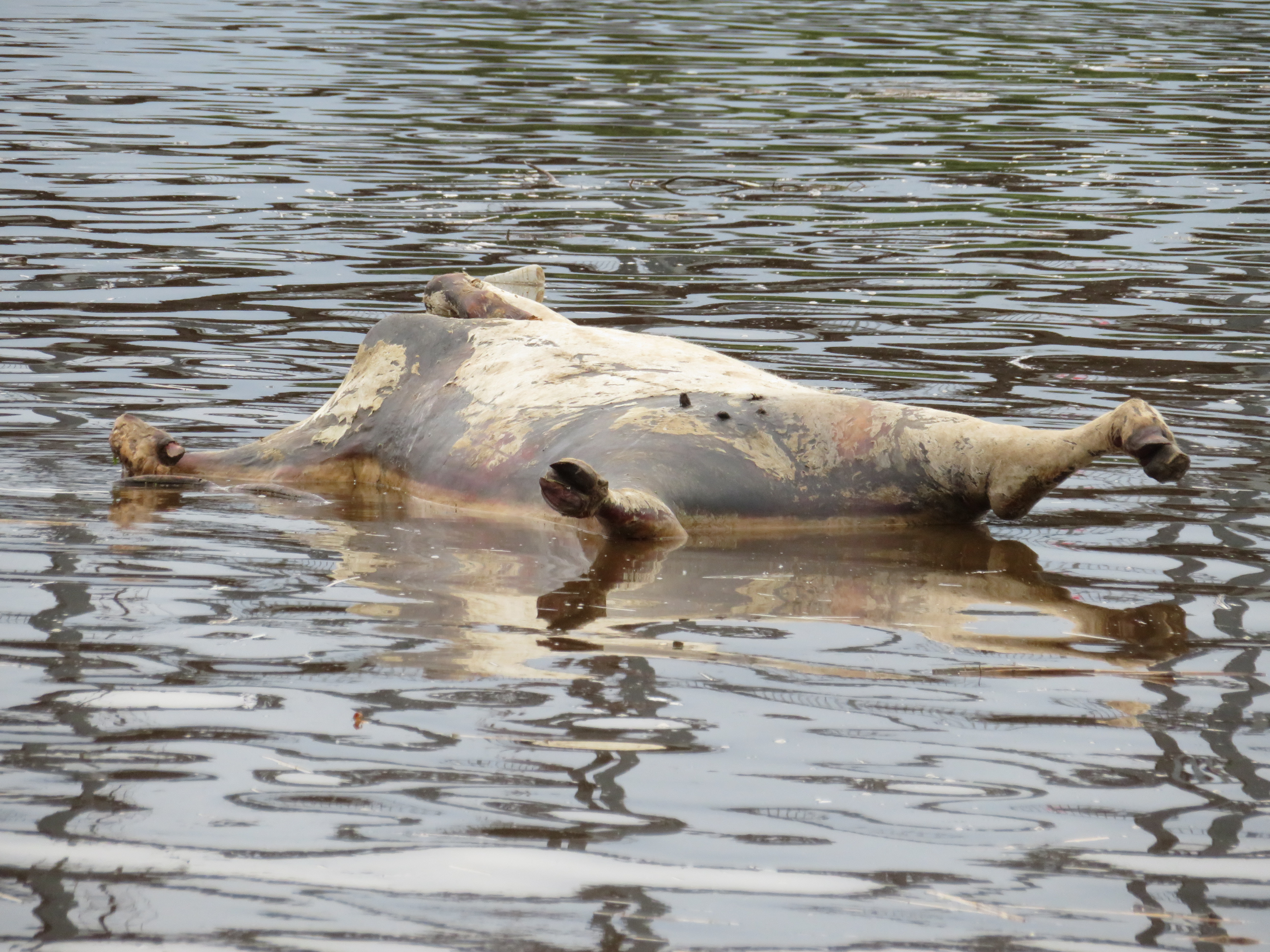
Calf Heath Chemical works has grown over the years, starting in the 1920's and is owned by the Amewrican SI company now. There is also the waste incinerator with a sedum roof next to it. There was no smell or noise when we passed so not a bad run on this dead straight section, with a sharpish bend at the end.

You are then quickly at the Gailey Lock and the much photographed round house. It was the toll clerk's office and built at the same time as the lock and wharf nearby. The wharf was very busy with the turn round of their hire fleet as we passed. We had a small wait at the lock, just long enough to top up the water tank.

After Brick's, Bogg's and Rodbaston Locks the shine on the canal is lost a little as it butts up against the M^ with the noise and bustle but we were soon coming into Penkridge where we found a mooring and settled in. I had got a bit cold, but after a while we went off to explore a little.

At the end of the length of canal that runs alongside the M6 is the Littleton Colliery Railway Bridge, No. 81A. This peaked my curiosity and had had a poke about.

In the early 1870's there was a boom in the demand for coal and several pits opened. In May 1873 seven men got together and registered the Cannock and Huntington Colliery Co. They were men who had prospered in the Victoria Age, solicitor, iron founder, iron master's clerk, iron merchant and men with a property portfolio, plus others with aspirations to equal them. They planned to raise £100,000 by selling 5000 shares at £20 each. They planned that the cost to start production would be £70 to 80,0000 and then produce 1000 tons a day with annual profits of £52,000. The big plan was to construct a plateway from the mine site to the Staff and Worcs. Canal so as to avoid the massive congestion at Hednesford, where 200 boats could be waiting to load. The other plan was to sink the shafts using a continental system, the Kind Chaudron method that was popular on the Continent, but ti would be the first time it had been used in England. This method was selected due to the of a gravel layer in the bedding before reaching the coal seam. This was flooded with water and made the sinking of the shafts very difficult. It also is where a lot of the areas water is taken from by the numerous pumping stations in the area. In 1875 an exploratory shaft was drilled and coal was found at 650ft

In 1877 a plateway was laid and horses were used to bring up material from a basin dug at the canal, a distance of a bout 21/2 miles. The Kind Chaudron method was to drill the shafts by dropping a drill bit and then lifting, turning the bit a little and dropping it again, around 25 times a minute. When enough debris had been created a spoon or grab would be exchanged for the drill bit to bring the cuttings to the surface. The shafts was lined with a double skin of and the gap filled with concrete. The pioneer shaft of 6'7" was completed to 419' by October 1871. The full size shaft was completed to 405' in April 1879. The shaft had a lining tube in it at this stage and water was allowed to fill the shaft as drilling when on as it was all done via a derrick at the surface. The tricky bit of fitting the iron ring tubing down the shaft was next. These were all constructed at the site. The lining rings were bolted together and made water tight. At this stage a false bottom was created using a 'moss box'. This was a false floor that was lowered to the bottom of the shaft such that the tube linings were lowered into it and a watertight seal was created by the weight of linings compressing moss that had been packed into the threads and seams making it water tight.  A false bottom was fixed to the bottom of the tube lings that were bolted together. This allowed them to be floated on the water in the shaft. A pipe was fitted from the centre of the false floor and extended upwards as the linings were added. By opening valves on this central pipe water could be introduced to relieve pressure and to allow the whole string of linings to sink in a controlled fashion down the shaft. Concrete was then poured into the linings and once set the water could be pumped out and as the waterlogged section had been passed through men could descend to the bottom of the shaft in the normal way.

This is Otherton Basin in 1882. The sharp bend at the head of the basin shows that it was very small gauge and it appears that there was just a shed at the wharf.

At he Cannock and Hartington No.1 shaft this is where things went wrong. In May 1879 9 or 10 sections of tubing were bolted together and allowed to sink to the bottom. As the central pipe was tried to be used to control the sinking it failed and it sank quickly and obviously damaged the moss box! The only thing to do was to recover the linings etc. through 135 yards of water. By October all the complete rings were removed then it took until October 1880 to smash the pieces up and bring them to the surface. The shaft was drilled a little further to make a new seating for the moss box and eventually, in April 1881 82 lining rings were lowered into place successfully. The linings were then filled with concrete and allowed to set for two months. They started pumping out the water but after 5 days and at 330' it became obvious that the lining was seriously leaking!

Meanwhile No.2 shaft was started a little after No.1. By October 1880 they were ready to lower the lining rings down the shaft to the moss box and 87 rings were successfully positioned. The concrete was poured and left to set and then the water removed. The reached the false floor and digging below the moss box continued by hand. A ledge of rock was left to support the weight of the tube lining but unfortunately there was a small fault in the strata at this point and as soon as the shaft was extended below it, it collapsed and the men had to evacuate.

The Cannock and Huntington Colliery Co, now tried to raise a further £20,000 and renegotiate terms with the Lord Hatherton the land owner. He was onboard so long as they could raise the extra money and he would chip in with money of his own. However by the end of 1883 they had managed to source any new capital so Lord Hatherton amicably foreclosed on the company. In August 1884 a massive auction of everything was held. 400,000 red bricks were sold from the brickworks on site as well as three miles worth of wood sleepers and iron rails from the rail line down to the basin. The Company was officially wound up in 1885.

From this map of 1882 you can see the plateway was been taken up, and the brick works in the bottom right hand corner.

Lord Hatherton, who took the surname Littleton, decided to resurrect the colliery and gave it that name. He raised £150,000 and decided to complete the shafts using 'traditional' means of pumping the water out as they went. He had appointed new mining engineers in 1897 and they decided that it would be best to start with No.2 shaft and in September 1897 the two pumps were started and three weeks later the bottom was reached. The water was coming in at 150 to 200 gals/minute. Strangely the level in No.1 shaft did not go down. The method of limiting the water was a mixture of iron tubing, brickwork and concrete linings and by February 1899 the shaft had been sunk to 1644' feet, passing through all the important coal seams of the district with around 90' of workable seams of coal.

In June 1899 work was resumed on No.1 shaft. In the end they had four new pumps working on the shaft and managed to lower the water level to 347'. It was then decided that they would have to cope with water ingress of around 2000 to 3000 gals./min and therefore they withdrew the pumps and took the decision to sink a new shaft. Work started on No.3 shaft in May 1900. By November they had reached 877' where a connection with No.2 shaft was made via a drift giving a second access and ventilation. It took another year to reach 1662', partly due to a bed of very hard sandstone that even defied blasting. The shaft had been sealed like no." with a mixture of linings. After a few months the water table rose back to normal levels and further lining had to take place. 

This map from 1900 shows that the basin and railway to the canal were not in use at this time, Equipment etc was brought to the mine via the railways.

Compare the 1900 map with this one of 1921 and you can see that production has ramped up and the use of the canal for transport of the coal is busy. The branch line that cross the canal on the bridge is the branch from the colliery that goes to the Penkridge sidings that link in with all routes. At its height it employed 2000 people.

With the mine having such a length of a branch plus the basin and sidings it had its own steam engines too. The first at the new pit was Littleton No.1 that arrived in 1901 and was still there in 

This is Littleton No,5 that was new in 1922 and was still at the pit in 1967, and has since been preserved. It looks like it is crossing that canal on the bridge as the line does not cross another watercourse, and it is a single track line.

After WWII the pit was nationalised and in 1963 it was thoroughly modernised and production rose to a million tons a year. In 1992 it was ensured that it was had been reprieved from any closures, but the following year it was closed, the last deep mine on the Cannock and south Staffordshire field with the loss of 600 jobs. The mine has been demolished and hardly anything exists to show it was ever there. The building of the M^ seems to have removed the basin too as there is nothing to see now.