Total Pageviews

Sunday, 27 August 2017

Aire today, but gone tomorrow!

After Helen going home for a work thing and me being left aboard to get on with some of those little jobs that never seem to get done, followed by a good clean through, we got under way heading towards Leeds.

The heavy rain of the previous day had given way to good weather and after the water level went up very quickly it came down just as quickly.. Needless to say the flood gates were open. The foot bridge over the lock has been closed for quite a while now it seems.

Here we are at the great divide, left to Wakefield and the Calder and Hebble and right to Leeds and the Leeds/Liverpool. It is a while since we have been to the other end of the Aire and Calder so we turned right.

At first the river has a natural flow and with the lovely sunny weather it was very picturesque with not another boat moving either.

In our old edition of Pearson's he likens the area to that of a WWI battlefield, but time is a great healer and it is a very pleasant trip today. The river is a lot quieter now than it was in working days, unlike many more southern canals. Here in the site the the loading basin of the Saville Colliery. It looks like they loaded Tom Puddings here as the jetty is very long to accommodate them in strings.

After deep mining ended in the area open cast mining continued and St. Aidan's Opencast mine was to the north of the river. In 70's the there was a breach in the navigation that flooded the mine. There remaining coal was too valuable to lose so British Coal dug a new route for the canal that cost £20 Million and it was done to a generous size too. This 'new' river has also bedded in and doesn't now look like a motorway, but the white painted  post reveal the length of it.

The first lock of the day is Lemonroyd Lock. These push button locks certainly look large when you are down the bottom of them!

We stopped to get rid of the rubbish and fill up with water at the top but quickly got going again. Just at Fleet Bridge there was a lock down to the river from the cut to get access to some mills that have long gone. The short arm was taken on by an oil depot and up until not too long ago products were delivered by water.

I thought that we had the first view of the distant hills here but it turned out to be a rubbish dump. An other worked out opencast mine had been filled in with rubbish. These days with mutlifuel power stations like at Ferrybridge, wouldn't it be ideal to use large barges to take the suitable waste from the west riding conurbations to burn there, rather than fill up every hole there is.

In the previous photo you can just see this boat. They can't have much faith in their ability to steern the boat if they need fenders like this!

This must be the ugliest boat I have seen on the canals, but as it is an hotel boat and always seems to have plenty of guests when we see it I shouldn't moan. It works between Leeds, Goole and Keadby. Perhaps not very romantic names on the canal gazetteer, but the waterways are nice and varied, plus the added bonus for the operators that there is only one lock that they will have to use muscle for, the rest are electrified.  
 
I flood closed Thwaites Mill in 1975, three years more than 100 years since it opened as a flint grinding mill for the pottery trade using two water wheels. It was later taken on as an industrial museum and now is open to the public, despite another flood a couple of years ago. On the left is the manager's house which would have been worth a look just by it's self.

At Kostrop Fall Lock the river used to be separated from the canal by an island that formed a cut with Kostrop Flood Lock at the other end. The island has now been removed and the river and canal use the same water course. I assume it is something to do with flood alleviation. You can see the old flood lock cut to the left, now now entrance and we are now using the river to the right.

The approach to Leeds starts with several mills that have been nicely converted to apartments. The service, to the left also has some visitor moorings. There are also some more a little before Leeds Lock.
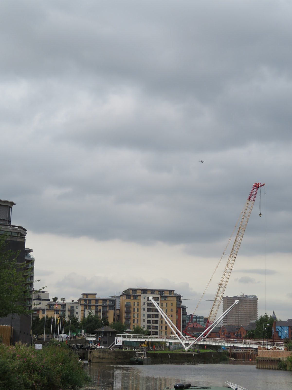
There is plenty of work going on by the Royal Armouries as you can see. They are putting in a 'moving weir' and other things to assist once again in flood alleviation. The Armouries are to the left. We were lucky to find a spot on the pontoon in the dock that was made to measure. I was disappointed to learn that several of the cruisers and a narrowboat had been on the 48hr pontoon for a week or more. Not good when the C&RT office is just over the white footbridge, and a hire boat came along looking for a mooring and was disappointed.

Once moored we called my cousin Karen and we had a good catch up and a bit to eat before heading to the Palace and then saw her off on the bus, until tomorrow.

Thursday, 24 August 2017

Back at Castleford.

We were heading up the Aire and Calder and we realised that we had never been in this direction before. It is funny how it looks so different'.

Just a reminder of the coal trade on the bank near Cow Lane Bridge. Coal would have been tipped from a rail wagon or a lorry to fill up a barge of 'tom pudding'.

The canal seems to cut through a rock outcrop and there is also evidence of quarrying alongside the cut. It seems that there is a limestone ridge here and it was used for building and lime making here at Gaggs Bridge.

It seems as if there has been a mill on roughly this site for hundreds of years. There was a windmill first. The mill belongs to Allied Mills and has survived a recent closure threat. They own 12 mills in the UK at the moment.

As you approach the lock at Ferrybridge the cooling towers of the old power stations are quite 'other worldly' as they dominate the skyline, dwarfing everything below them.

When you get closer it gets more so. We noticed that the gates are open all the way through so no stopping. The gauge looked as if the level in the canal was about 0.4 below the normal level so I was surprised that they weren't keeping water in the cut.

Once we passed under the old Great North Road and the even older bridge we could see that there was work well advanced on the new multifuel plant at the Ferrybridge site. It will burn refuse along with commercial and industrial waste that includes wood. It is a three year build and will have created 500 construction jobs and 35 permanent jobs and will produce 90MW that would be enough to supply 160,000 homes.

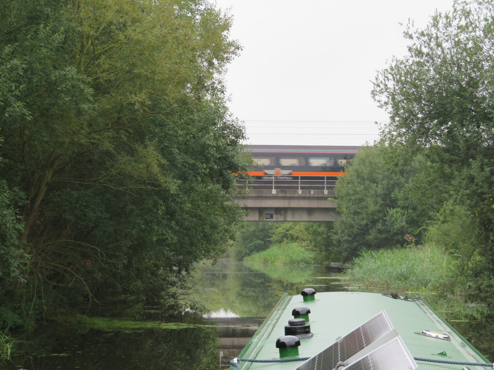
The A1M bridge is even bigger and better than the previous bridges we have passed under. We didn't see another boat on the move at all.

As we had never been this way before I hadn't realised that there was a footpath by the old railway bridge. This must mean a nice round walk from Castleford and Fairburn Ings RSPB site is possible.

I liked the look of our wake as we gently rounded the bends in the river in the very calm day. It makes it look as though we are racing along.

It looks as though more work has been done in the old Fryston Colliery Basin with concrete and railings been erected. There is no works at the bank so if there is to be a marina here you would have thought that there would have to be a flood gate on it.

The Weldale Colliery Basin doesn't seem to have been altered and it was that colliery that first started dumping slag and waste on Fairburn Ings at the request of the Aire and Calder Co to try to prevent flooding of the north bank. However subsidence made the land flood too. The railway bridge and line were put in when slag was brought from all the mines in the area.

We were soon at Bulholme Lock to find a boat coming down. Helen likes these key driven locks and we were soon up on the cut. I pulled over at the water point to pick her up and top up at the same time. We pulled over to the other side of the canal and moored up.

We walked in to Castleford as Helen had some letters to post, and so it would have been rude to not call in to the Junction for a pint. On the way we walked round the end of the dry dock at Castleford. It used to be owned by Hargreaves barge owners and would build and repair vessels for themselves. I'm not sure I have seen such a large dry dock, one that would take four narrow boats or two barges.

Wednesday, 23 August 2017

Back to familiar ground.

We retirned to the boat yesterday, but Helen had to return home for an engagement, and to drop the car back home. Whilst she was away I set about changing the engine and gearbox oil and the filter. Every time I do it I seem to do it a different way. I'm really too big for messing about in the engine hole but needs must. Once Helen returned we met up with one of my brothers and his wife for a pint and a meal at the local Weatherspoons. It is called a strange name for a pub, The Giant Bell Flower! Known locally as the 'Bell End'.

I had backed down from Selby Boat Centre through the bridge to be nearer the station etc. This morning it was dank but very warm indeed. We were away by 0930 and back through Bawtry Bridge on our trip down the Selby Canal. The Selby Canal came into being as the Leeds and Liverpool Co were talking of building a canal from Leeds to Selby. This spurred on the Aire and Calder Canal Co to push ahead with plans. They settled on the 5.5 mile canal from Haddlesey to Selby and Selby boomed.

Once we cleared the town the canal became very rural with hardly and bridges etc. Slowly but surely the duck weed dissipated too.

The Selby Canal was opened in 1778 and this is one of the original bridges that is at Burton Hall. John Smeeton and William Jessop were consulted as to the route and they will have planned these bridges.

I'm not sure whether the bridges were built as horse drawn navigation but the tow path beneath the bridge does seem to be very narrow for a horse or mule to pass. They are even a bit narrow for humans and hand rails are provided. I wonder if the canal was designed to me man hauled all along.

The East Coast Main Line cross the canal and is really the only noise that interrupts the peace of the canal.

There are several places where at first sight it looks like there is an old swing bridge site. However these are places where it seems a ditch or drain comes under the canal.

The sun has been trying to get out from behind the clouds and never really succeeded all day. It stayed very warm though. Eggborough Power station loomed out of the mist.

5.5 miles later we arrived at West Haddlesey Lock. A little before 'Sealion' had pulled of a mooring so we had a lock partner. We penned down from the canal into the River Aire but as you can see the same set of gates acts as flood gates too. It would have been a different kettle of fish if the we had had to lock up!!

Once out on the river the bends come thick and fast but the river is not quite as narrow as the Avon so is never a problem. You can see 'Sealion' heading off round one of the bends.

We arrived at Beal Lock and there was a boat coming down the lock. It turned out to be 'Waterstart' of the Sobriety Project charity that tries to prevent social isolation and exclusion. She is a wide beam boat that was working out of Thorne training people on boat handing etc but it looked like she had a group aboard who were out for a trip. Once we penned up another boat was there to drop down the look. It seemed to be rush hour! 'Sealion' was stopping here as they had won the first quiz ever at the Kings Arms in the village and were stopping to spend their voucher.

The bridge at beal seemed small scale but the buildings behind looked as though they could have been warehouses in the past.

We had a different view of Kellingley Colliery to that from the Aire and Calder we usually have. It finally closed in December 2015 and ended the era of deep mining in the UK. When you consider the wealth and work that coal mining brought to the country it is amazing to think that it has all gone, especially as there are still millions of tonnes in the ground, but not cheaply obtained at the moment.

The next and last lock on the Selby Navigation is Bank Dole Lock. There is a chemical smell in the air and Helen had stinging eyes. The lock took a fair while to drop down and then fill to make matters worse. There were flood gates to protect the river getting over the top and into the canal.

After leaving the lock we were soon at the junction at Knottingley with the Aire and Calder Canal. Harkers the barge running company bought a shipyard here in 1929 that had been making ships since 1820's when the canal to Goole was constructed. They built 316 boats before they closed in 1979. Hirst's are now carrying on the trade and there are many and varied vessels alongside.

We were back to familiar territory and heading off to Leeds.

Sunday, 20 August 2017

Docks to the north and Docks to the south.

We continued our walk from yesterday down Wapping High Street and more of the Capital's docks.

Wapping Hight Street was created in the 16th nCentury as a route to bring goods landed at the wharves in the City of London to the warehouses furtherout of town. Both side of the street are lined with old and new warehouses, must converted to apartments now. Here a company clearly owned the buildings on opposite sides of the street and built the bridges for ease of ttransporting goods between the two.

It is a lovely quiet part of the city and with these very expensive apartments mixing with some council and housing association homes it has a nice feel to the place. We had some nice chats with the locals who obviously had never moved from from where they had been born and loved the area. I like the fact that the warehousing had to follow the curve of the street.

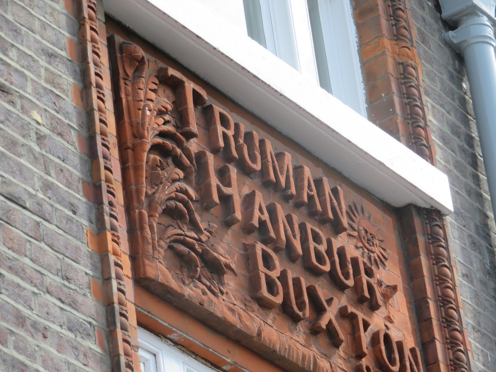
 I liked these old brick carvings on the side of an old pub. Truman's brewery was obviously Truman Hanbury and Buxton at one time. This pub was called the 'Three Suns' and was built in 1880 and was closed in 1986 but survives as a wine bar type place today.

Hidden behind a wooden fence and hedges in the old London Hydraulic Power company building. As the name suggests this building from 1890 was on a large circuit of hydraulic power pipelines that tranmitted the water around the dock system to power the lock gates, cranes and warehouse machinery right up until 1977. The Wapping Project Gallery was here at one time after the close of the hydraulic Co. but the place seems to be boarded up. A similar system in Hull worked the docks and locks too.

Further on from the Three Suns and Hydraulic Co is you come to the Shadwell Basin, the last of the basins that connetced the London Docks to the River Thames. It is a glorious spot now that now, in the summer holiday hgas plenty of school kids taking part in water sports. These areas of water certainly bring something to the area and provide good distant views of the City

Just by the Basin is St Paul's Church. Shadwell was famous in the 1700's for the number of sea captain's that lived, and died here. &5 were buried in it's vaults and there are several on the list of benefactors boards dipslyed in the church. So much so that it is known as the Church of the sea Captains. James Cook lived here and his son was baptised at the church in 1763. It is one of the 600 churches known as Waterloo Churches as it was was rebuilt after having fallen in to disrepair in 1820's following the Church Building Act of 1818.

Down by the Thames we came to the air shaft for the Rotherhithe Tunnel. It was opened in 1908 by George, Prince of Wales, who became George V. A local chap told us he used to carry his bike up and down the stairs inside to use the tunnel. There is now a big fan inside for ventilating the tunnel of exhaust fumes and no access is allowed.

The detail on the grills reveals LCC for the London County Council. This was set up in 1889 and was in existence until 1965. It covered much of what is called Inner London to day and was replaced by the Greater London Council.

They are digging up King Edward Memorial park and have started to place a cofferdam out into the river as they install the super sewer system here. There will be a shaft down to the sewer with pumps and other systems to make it all. The view back to Canary Wharf is quite stunning on a lovely day. The park will be restored, bigger and better when the whole system is completed.

At this point we decided to return to the Wapping over ground and have a walk on the other side of the river.

We got off at Canad Water, no not the name of a mixer drink, but the stop closest to Canada Dock that opened in 1876 and was one of ten on the south side of the Thames that were owned by the Surrey Commercial Dock Co. Canada Dock specialised in grain and timber that was imported from North America. There is no muck left of it now as a retail park has been built on it. A little walk past the shops brings you to Brunswick Quay and this great view of the extensive Greenland Dock. This was once the largest enclosed dock in the world and was originally called Howland Great Wet Dock when it opened in 1696. The ten dock covered an area of 150 acres and most got filled in as they became uncompetitive. Greenland Dock was first used to fit out East India Company vessels then in the 1720 was used by whaling ships and the smell must have been pretty bad as they rendered down the the blubber brought back to London. Later still it dealt mainly with grain and timber. The Surrey Commercial Dock Co. closed in 1970.

The bust of James Walker is found half way down the north quay. He was the chief engineer that was in charge of building many of the docks of London, including this one in the 19th Century. He was also responsible for several bridges and lighthouses around the country. He seems to have a bit of a 'Mona Lisa' smile about him and then I realised that most sculpture subjects have a very set face with no hint of a grin. You would think they would be smiling as they have made it well enough to be cast in stone or bronze.

Walking round the dock you pass over several footbridges like this original one where it takes you to the Thames and a closed off lock. The system is accessed by the vessels that are in the north end of the dock via a still working lock at the neighbouring South Dock via the Greenland Cut. South Dock is now London's largest marina. In WWII they built some of the units that went to make the Mulberry Harbour off the D Day beaches.

From the riverside we could look west and see the Cutty Sark at Greenwich. It is well worth a look around the south dock area as it is even quieter than Wapping and Shadwell and far enough from Greenwich to be clear of the many people there. We had decided enough was enough as we had to catch the train home. We caught a bus to London bridge and the tube back to the hotel to pick up the bag and head to Kings Cross and The Hull Trains train back to the City of Culture.