Total Pageviews

Friday, 10 August 2018

Happy in Hawne.

We had only got about half way down the surviving length of Dudley No.2 canal from Windmill End to Hawne Basin

This widening of the canal on the tow path side and new concrete  path reveals where there was a double arm that was used by Haden hill Colliery. Opposite on the off side was a short arm that served Waterfall Lane pit and next to it a large basin that was at the foot of another inclined plane bringing coal from Black Heath Colliery. Later the basin was infilled and a sawmill built over it.

By Waterfall Lane Bridge are the remains of the walls of the Lion Iron Tube works, and judging by the windows and doors open to the tow path, (now bricked up) boats would have been loaded/discharged here.

This over bridge seems to have led to a basin that appears to have been a railway transhipment basin as the tracks ran right alongside.

To speed up the traffic and save the practice of legging through the tunnel the canal company provided a towing tug that would tow them through between 1913 and the 1930's. On the left is the remains of the little dock where it was kept there was a shed above it and there are a few remains of it on the tunnel brick abutments. 
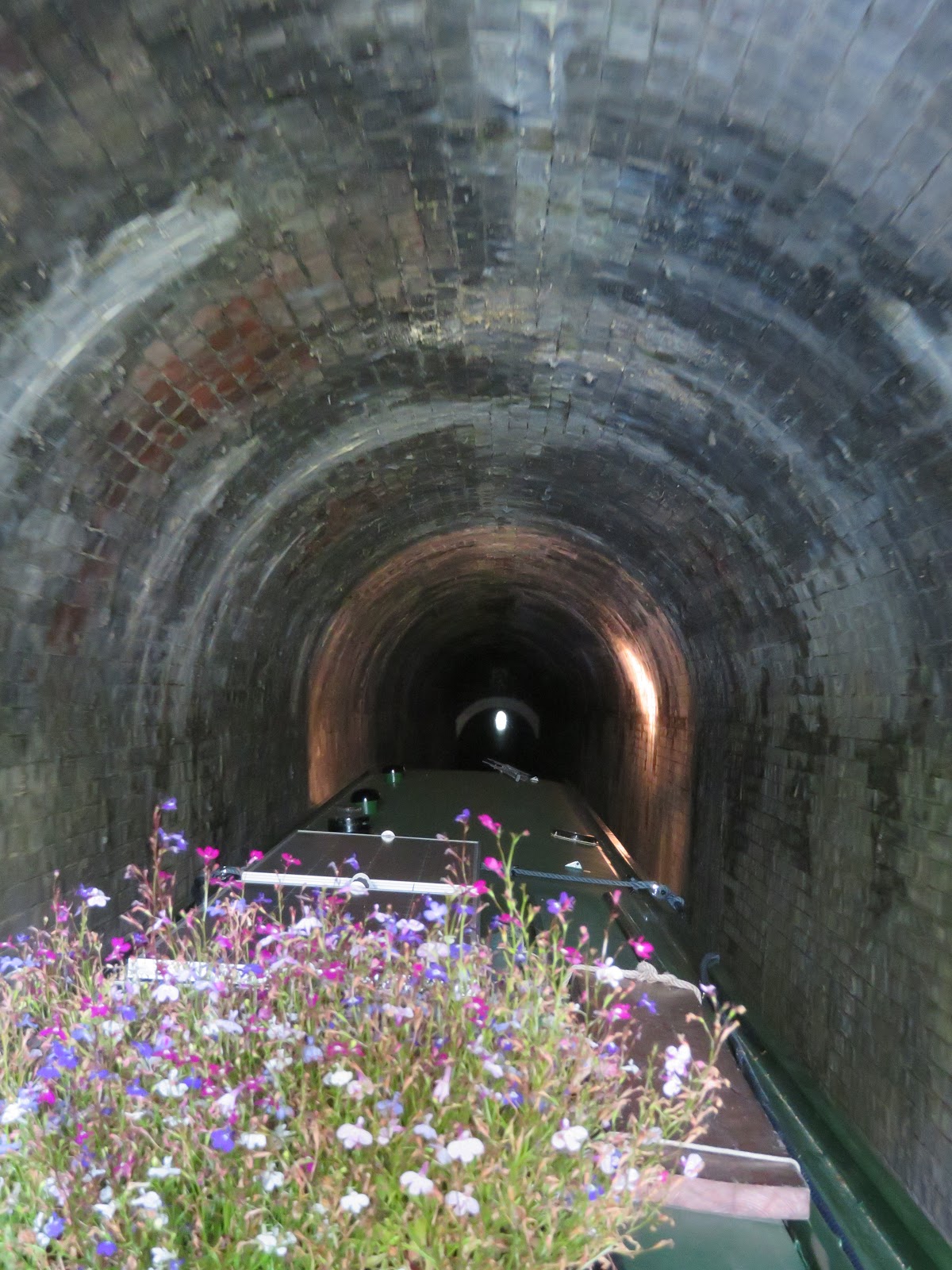
The tunnel is in three parts with two ventilators. The west end is nice and high, if narrow. It then gets much lower, but still brick lined. You can see the white paint marking the change in level. The roof then lifts a little. I'm not sure why there are three levels, maybe there were collapses or subsidence in parts and they were rebuilt higher, and only the middle section is original. All three sections are extremely shallow and you just can't go at any speed. The guys at Hawne Basin were telling me that a couple got stuck for over twenty hours when they had a log jam them in like us the other day. They couldn't run their smoky engine or light their stove!

As you come out of the tunnel there is much evidence of the Coombeswood Works and clay pits. In the 1880's it was all on the off, northern, bank. By WWI there was also works on the south side connected by three bridges. By WWII there were seven bridges and the works on either side were about the same size. Some of the bridges were overhead cranes to carry products backwards and forwards. between the sites. The main product was tubing. In 1903 Lloyd and Lloyd who had the site amalgamated with A&J Stewart to become one of the largest producers of tubing. It its height they employed 3000 people. In both wars they produced millions of shell cases for the munitions industry. In WWII they also provided the main components for the PLUTO system. the Pipe Line Under The Ocean that supplied fuel across the Channel to the Normandy Beachhead. The pipeline was spooled out from giant reels towed across the sea.

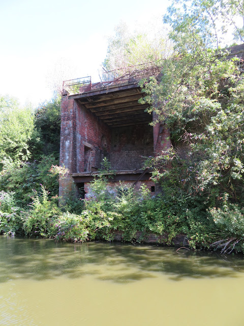
It would be great to know what all the visible remains are. This looks like it may well have been a tippler or crane unloader of coal and ferrous ore.

Now industry has largely been replaced by Industrial estate and storage warehouse it is much quieter down here than in former times, and you could even think you were in the countryside as nature starts to reclaim it for itself.


At the southern end of the Stewarts and Lloyds works can be seen these wooden ramps that lead down into the water and this is where there was a an open dock where the company fleet of narrow boats and tugs was repaired. It is probably on the site of an old brickworks

Coombes Bridge is a fairly recent addition as the original was taken away in WWII for the scrap drive. At this point there was a small aqueduct that carried the canal over a mill pond that went down to Coombes Corn Mill. The land wasn't 'reclaimed' until the 1960's when an industrial estate was built over the area.

Just before you get to Hawne Basin there was a Brick and Tile works on the tow path side in the 1880's, but by WWI there was an arm that served Coombes Wood Colliery, but there is very little evidence of it now. On the opposite side to Hawne Basin was the Lion Brick, pipe and tile works along with clay pits and a furnace. It looks like Hawne Basin was in existence at this time so was probably to house traffic awaiting cargoes etc. By WWI a branch from the mainline railway had been built to the basin and at the west side was a transhipment shed, and at the southern end was a massive goods shed. By WWII the track that ran right alongside the basin, where the service wharf is now, had been taken up as well as the smaller transit shed.

It is a tight turn into the very narrow bridge hole and there isn't much room in the basin with all the boats. Despite the sudden arrival of a fair bit of wind we managed to get through and round onto the jetty where we were soon filling up with fuel, taking on 156 litres at 65p. They are always extremely friendly and helpful here and soon had us pointing at our berth for a few days. We still had time to pop down to Black Country stoves down Hereward Rise and close to Macro to get a few bits and pieces for out stove. If you are down this neck of the woods and are short of diesel it could well be worth coming down here to Coombeswood Canal Trust. It is an interesting trip on it's own, but the lure of cheap coal, gas and derv should attract you.

I am catching the bus into Birmingham later and catching the train to Hull and then come back with the car tomorrow as we have a wedding and various other things to attend to

Thursday, 9 August 2018

Look at it now.

I had a chat first thing with a couple of boaters that had moored up astern of us for a cup of tea this morning. They were from Hawne Basin where we were heading too. We let them go first so as not to hold them up and did a bit of a litter pick before setting off.

As we approached Windmill End Junction, Netherton tunnel is straight. The canal we are on was built new for access to the tunnel. It cut off the loops of the old Dudley No.2 Canal that went off to the right to the Worcester and Birmingham Canal at Selly Oak through the Lapal Tunnel.

This is the Boshboil Arm that has been cut off from the rest of old loop, the Bumble Hole Arm

Once through the bridge there is a little arm that may well have served the  Windmill End Colliery and one of the many Breeze ovens. Breeze was the very small pieces of coal, less than 12mm, that were used to sinter iron ore before being used to make wrought iron.

The remains of a toll island sits in the middle of the canal where the traffic was regulated and charged the appropriate fee to the Canal Company.

A little further on is another basin, on the right of the basin was the No.1 pit of the Warren's Hall Colliery and to the left was an inclined plane that led from No.2 pit of the colliery. On the opposite side of the canal was Windmill End Station. The railway line crossed by the tow path bridge at the start of the arm but has been removed.

Doulton Bridge originally led into a basin for brick and tile works. On the opposite side of the canal was the Birmingham Pottery works that also had two arms off the canal. They also served Hyatt's Colliery too.  By about 1938 the brickworks had been taken over by the pottery and in the end became important for manufacture of sanitary wear, bowls, bogs and baths, and became Doulton's.

This building was the toll office at Rowley Stop. The narrowing of the canal enabled them to check the boats as they passed to keep track of the destinations and cargoes. Just after the stop the canal widens on the off side and this was where another inclined plane brought coal down from Pennant Hill Colliery. On the tow path side were two pits of the Gawn Colliery. There was a large basin for this colliery but no real sign of it survives.
Either side of Hollis's Bridge were basins leading into the Old Hill Ironworks. The one to the east survives. On the same side as the Iron Works was the Bluebell Pit and on the opposite side was Pearson's Colliery.

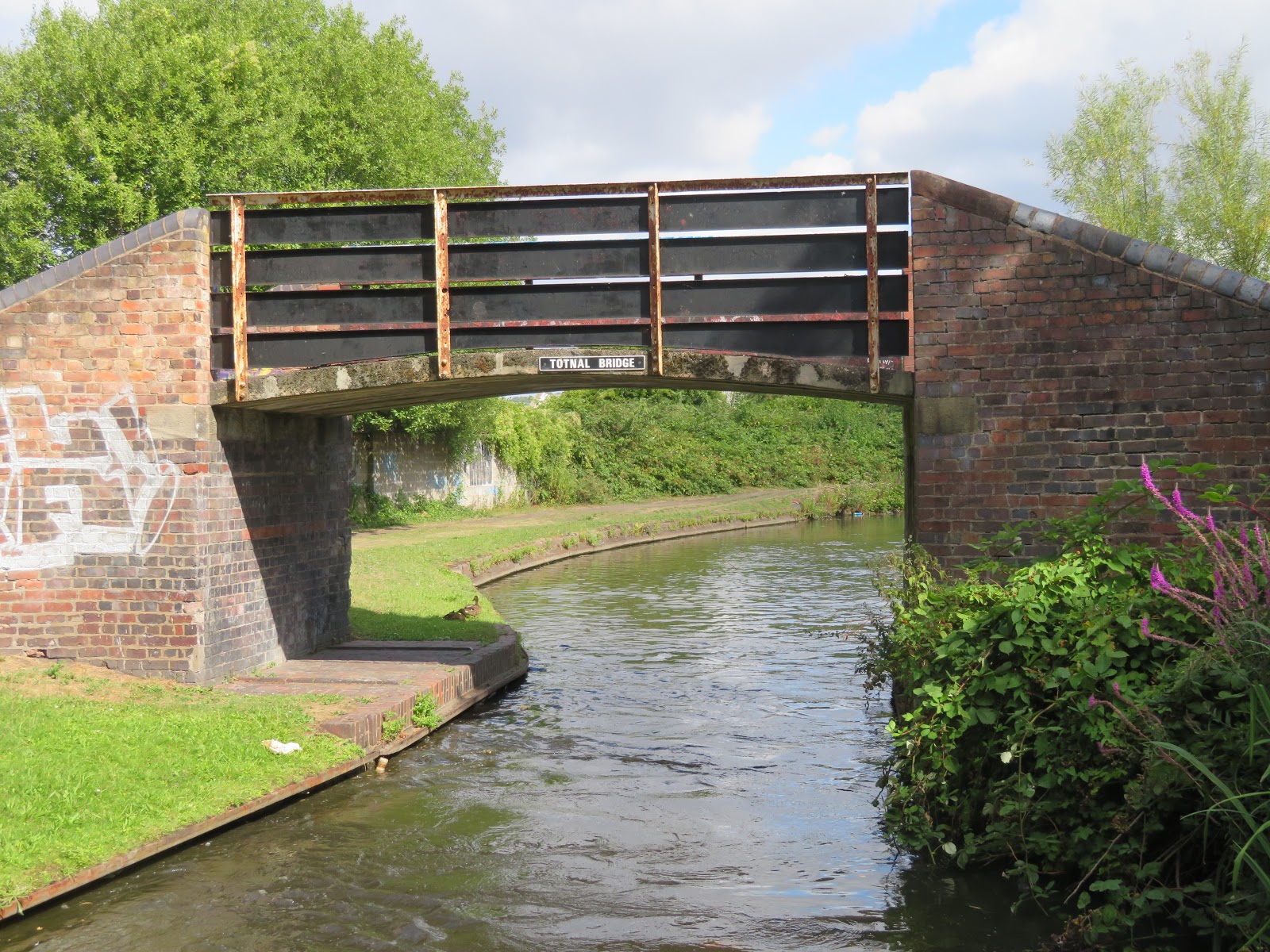
Between Hollis's and Totnal Bridges there was plenty of industry. There were limekilns and saw mills before Powkelane Bridge. There was the Tigar Chain Works on the off side along with a little arm that was for loading coal from an inclined plane from a distant pit. On the towpath was a gas works that I supose used the coal from the large Fly Colliery that had its own loading arm, next to a larger arm that was fed by a railway from more distant pits, and probably the Old Hall and Garret's Lane pits. There was an arm to the Eagle Colliery on the off side,that was abandoned in the early 1900's, and another arm to the Old Lion that was abandoned about the same time. It is no wonder the bridge was built simply to allow it to be raised when subsidence occurred.

A trip down this canal would have been very different before WWII and would have given the traveler a fantastic idea of the might of Britain's manufacturing output and the wealth that was generated, but also the poor conditions, at least as compared to today that it.

Wednesday, 8 August 2018

How times change.

We set off back to the Merry Hill Centre to have another look for wedding attire for Helen, unsuccessfully though.

I love this building, probably for the setting, or rather the architect designing it to fit in the setting. I'm not sure what it is, but it would make great apartments. I always take a picture of it. It was built on the site of the Round Oak Steel Works that closed in 1985.

A little further on there is this structure that looks as though it carried something over the cut, bu the corresponding tower on the tow path side has gone. It is from the site of the Brierley Hill Iron Works
 It looks like they had the land on both sides of the cut and the tow path side was used for raw material storage or for slag. Close by there was a cola mine in the 1920's. The tower was maybe for an internal telephone system.

We passed the shortcut cut of the Two Locks Line that cut off the bend to Dudley Tunnel from the Dudley No.2 Canal. Unfortunately the two locks were undermined by subsidence from all the local mining. The roving bridges at both ends are still in place but the line has had an industrial estate built over it. We got to Blower's Green Pump House services. It was built in the 1890's to pump water from the Dudley No.1 and No.2 Canals back up the Park Head Locks through the Dudley Tunnel to the Birmingham level. It seems that C&RT may have it up for sale but I hope they retain the services as they are a bit scattered in this area. We availed ourselves of them as we passed.

This is the Park Head flight of three locks that take you up to the Dudley Tunnel Level and we ventured up there to moor last time we passed. As we were using the services there was a rush on, two to go down the lock and one waiting to come up! Rush hour. Where are all the boats?

Another of the Finger Posts for the collection.

From Blower's Green the Dudley No.1 carried on up the Park head Locks and we are now on the Dudley No.2 Canal. It is definitely shallower than No.1 and the reeds are closing in too. However I must say that since arriving at Aldersley Junction the towpath and canal have been very clean indeed. Even when we left the rural Staffs and Worcesters for the urban Stourbridge and Dudley Canals we have been greatly impressed with the improvement in the litter. Whether this is due to the canals being adopted by community groups, as C&RT promote, the fact that they are also heavily promoting the use of the canals by others than boaters or just that folk are finally realising it is not cool, it is great to see. The fact that plastic bags have been almost banned makes a huge difference, and the sooner they have plastic and tin drinks containers with a deposit the better as they now make up the majority of the rubbish seen.

To the left is the east end of the Two Locks Line. The main canal passes round to the right.

This was formerly a tunnel that had to be cut through a seam of basalt. It was named Brewin's Tunnel after the name of the Chief Engineer. It was opened out in 1858 to reduce the delays due to having to leg their craft through. 
Lodge Farm Reservoir was built between 1835 and 1838 to capture surplus water from the canal in the winter. It would then be released back into the system when required via a sluice. It was sold to Dudley Council in 1966 who then developed it for water sports. However it still supplies water to the Dudley No.2 Canal.

On the right is the entrance to the Primrose basin that seemed to have warehouses on either side, but was not connected to the railway system. On the left is the Lloyds proving house that at one time proof loaded the chains etc that were made in the furnaces of Netherton. at One time 90% of the world's ship anchors and chains were made in the area.

These lovely quiet mooring of the Withymoor Trust were once a goods station there was a shed covering the entirety of the arm with several tracks running into it. Next to it was the In 1914 was the Dudleywood Colliery and on the otherside of the cut was the Saltwells Colliery that had already closed by then. Just alittle further on under Griffin Bridge is a bit of a winding hole with a few boats moored. There is also a boat house that seems to butt up to what may have been a bridge hole giving access to the basin of the Netherton Furnace company. On the towpath side is an accommodation bridge that gave access to the Withymoor Arm that went for some way to a brickworks.

As we pass under the iconic Toll End Works bridges of Windmill end and the entrance to the Bumble Hole Arm we can see that there was nobody moored up. We had hoped to pop over to the cafe for an ice cream but they were just packing up. The Cobb Engine House chimney is on the hill. This area was also a hive of industry.

Tuesday, 7 August 2018

More Locks to Merry Hill.

Once the boat was free we proceeded upwards and were soon flying through the locks once more.

In actually fact, but for our enforced stoppage, we would have made a record passage, for us, up the Stourbridge Locks with the assistance of John enabling us to go ahead and set the locks. We saw no other boat in the flight and luckily, other than with a few leaky locks, every lock was with us. At No.3 there was another little arm with dual purposes purhaps. 

After 16 locks we said goodbye to John and packed him up with a full bag of extras for his late lunch, ort future lunches and headed off into the interior following the winding contour canal that would have passed brickworks, foundries, coal mines etc., but now mainly new housing that we noticed were fitted with external charging points for the cars, but no solar panels on the roof! We were going to explore the Fen Pools Branch of the Stourbridge Canal, but following our delay we decided to leave it until another time.

As we passed the old site of the Ashtree Colliery we noticed these clouds. They were vertical rather than horizontal and in the main that is the way clouds usually develop. We wondered if they were the residue of con trails from aircraft but I think that it is more likely that there is a temperature inversion meaning the clouds are 'growing' vertically, but any plausible explanation is welcome.

These roving bridges served basin in works, probably the closest would be Ashtree Colliery and the further a brick works. I have not seen anywhere that has retained so many little works basin bridges as in the Birmingham canal netwrok. I'm not sure whether the likes of Manchester and London had so many and they have been lost, or they just used the main canal wharf front.

This is another flight of locks that if they had been in Northampton or Leicestershire would have been swarming with gogoozlers as the bywashes are like little Pennine waterfalls and the locks fall steeply down the 85'. There are also pubs galore in the area. Just the odd walker and cyclist to day who had seen it all before. That is until the second to last lock of the day, close to the top when this lad said he didn't envy us having all those locks to do! He obviously hadn't even realised that we were heading up!! The bottom of the Black Delph Locks is actually where the Stourbridge Canal terminates and the Dudley No.1 canal starts. They were supposed to be built almost as one bu they remained separate, although built at the same time and by a father and son team, Thomas and Thomas Dadford

The stable block near the top was provide for the boat horsed, giving them a rest for the flight. It is now used by the voluntary lock keepers , but none on today it seems.

You could almost be at Foxton Locks as it is a magnificent flight, easily worked but little known.

When you get to the last lock and look back you realise why, despite everything referring to nine locks, and the pub at the bottem being called the Tenth Lock, there actually only eight. Originally there were nine locks but the lock mines etc caused severe subsidence and the locks were always having trouble. By 1856 they decided to do away with most of the old locks, retaining the top and bottom locks and reducing the number to eight. The roving bridge is over the old route, and to this day the land of the old locks has not been developed and runs parallel to the current locks.

How many changes of name and logos have occurred since this was erected. Next to it was a board on to which stoppages could be advertised. What did we do before mobile phones, I phones or the internet? Stick up a notice!

Once out of the top lock we were very soon passing Merry Hill shopping centre. We decided not to stop at the moorings just above it, but continue on to the basin a little further. The Church of St. Andrew's on the hill at Netherton will be a constant companion for the next day or so as it can be seen from all parts until passing through the Netherton Tunnel to the other side. There is obvious signs of the parched earth and wild fires here too.

We moored up in the basin, opposite Weatherspoons and Helen was soon ready to set of into Merry Hill on the trail of wedding attire. I left her to it and headed in the other direction, to Brierley Hill to find new drinking holes.

On the way I found this little logo over a small sub station. It is very Dan Dare and dates from the 1930's. The Midland Electricity Corporation for Power and Distribution started in 1897 to supply electricity to the South Staffordshire area. In fact they were the first company to be granted statutory powers to distribute electricity over a large area. They had a power station at Oker Hill. By 1925 they were merged with several of the local councils to form the Midlands Electricity Board. That stayed intact until the privatisation of the industry in 1990. But it is a really great logo.

Monday, 6 August 2018

In a bit of a jam.

Another quiet night only broken for me, not Helen, by the call of local owls a couple of times. Mind you we did have a walk into the town to post some letters but decided to find the Royal Exchange, another Bathams pub that he had frequented previously. Just as i bought the drinks No.1 daughter called on the phone so Helen disappeared to talk to her. We were going to have a pint andf then back to hear what happened in the Archer's. She was so long I managed to squeeze in two pints of bitter and a bag of scratchings before she got back!

The end of the arm has changed for the better since we were last here. The industrial premises that was next to Joyners wharf. The area is to undergo further beautification as the area has been adopted by the local business. This was the site of the Stourbridge Iron Works that built the Stourbridge Lion, (first steam engine to run on rails in the USA, Unfortunately the rails were wooden so it was not a great success but the Lion is in the Smithsonian museum. It was interesting to hear that 5 engines were sent but the Lion was the only one that made it. The other 4 were lost in the Great Lakes!) I love the fact that the side of the jetty is made up of interlocking iron billets, like a jigsaw.

The canal seems quite deep enough until you get to Coalbourn Brook Brtidge were it definitely shallows and the channel gets restricted as above.

I had just joked with Helen that when we got to Wordsley Junction there would be a boat club waiting to go up! Not quite like that but there was a boat coming down that had spent the night in the pound above the bottom lock. We therefore inherited 'John' who is a one of that band of brothers who enjoy the canals and lock working so much they volunteer their services on a ad hoc basis, not connected to C&RT. Here we are at the bottom lock. I would like to think they were discussing tactics, but almost certainly not.

It was here at Lock 13 that we asked some workers that were building the repro. warehouse a[partments if they had an old scaffolding board we could have. They duly obliged and it is now out short plank! I love the way the new buildings have been built to copy the original, and the fact that the bywash/weir actually runs under the old warehouse.

If this flight od locks were just about anywhere else it would be teeming with gongoozlers as it is a lovely flight with plenty to see and history oozing out of every pound. Above Lock 4 is the Red House Cone that was built around 1790. It is one of only four left in the UK, and the only one that has a lehr that allows the glass to cool more slowly so preventing stresses with in it. It had been the main site for Stuart Crystal until 2009 but is now a Dudley Council Museum. Fancy one of only four in the country when the are around here would have had loads of them.

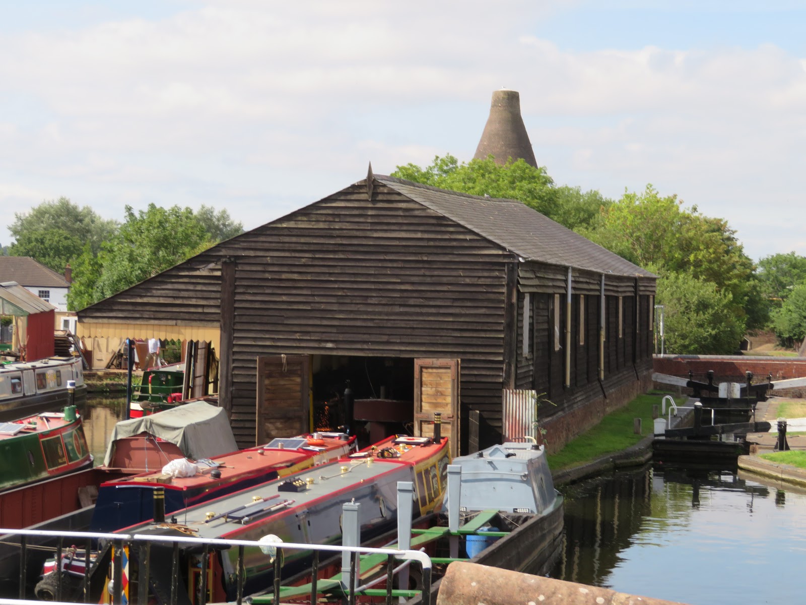
Dadford's Shed is a timber and slate building that was once a transhipment warehouse. Dadford was the engineer for building the Stourbridge Canal. There are craftsmen boat builders using the facility now. What a picture it makes as it seems to take you back about 200 years, with the glass cone in the distance.

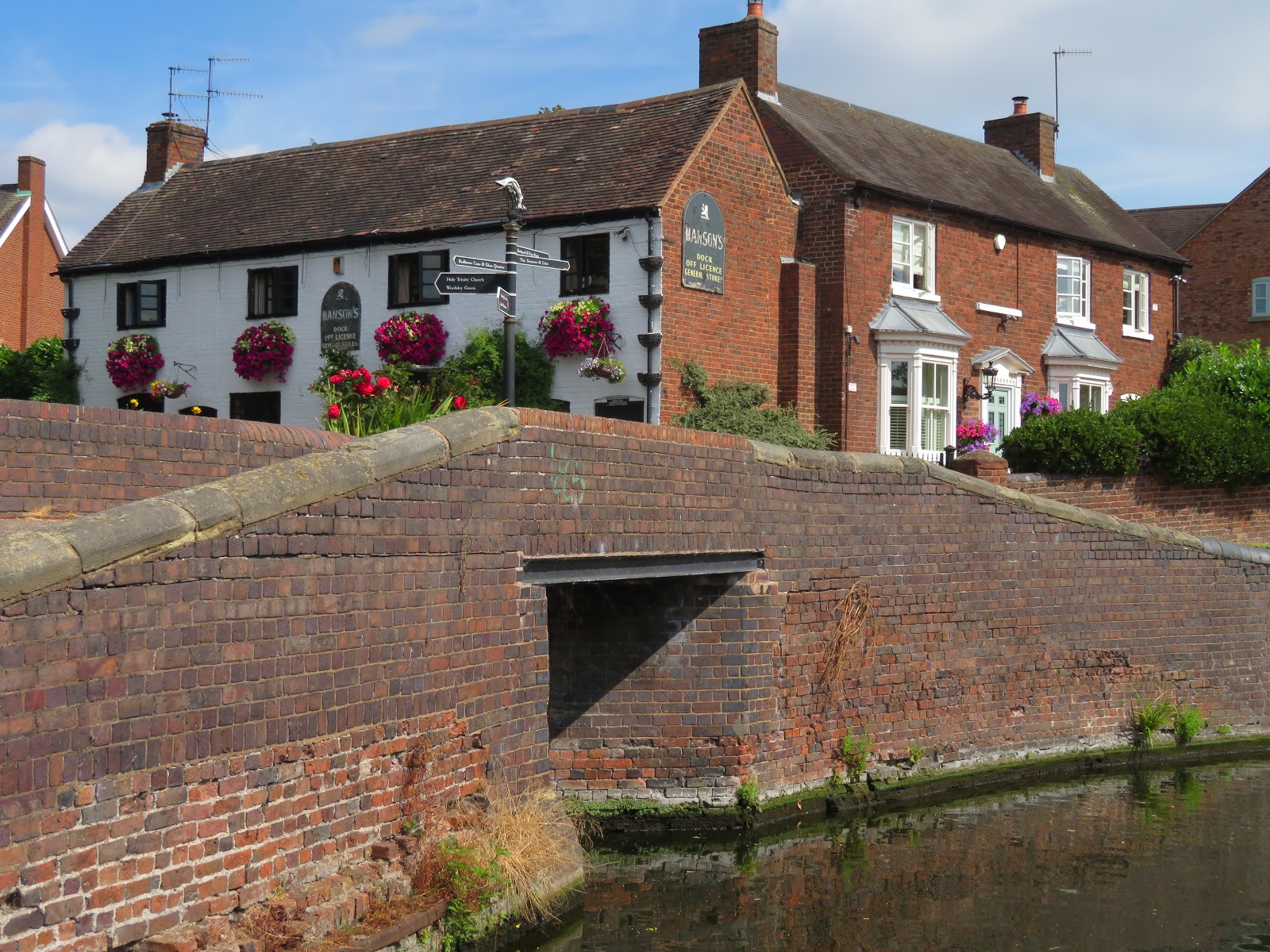
By Dadford's Shed is this little group of buildings. The Dock Offlicence must have been a pub at one time. I'm not sure if the little bridge was to accommodate a working arm of just give access for a side pound to store water. Industry was so dense in the are that maybe it served both purposes. There were several coal pits in the area.

The next lock is called the staircae, but in fact it is more like Bratch Locks where there is a very short pound between the two locks. You can see in the photo just how little room there is before the next lock.

Looking back down from the 'Staircase lock to see Dadford's Shed and the Red House Cone things were going swimmingly. I had jsut said to the lock workers that we would stop at lock 8 for refreshments as it was a hot day. We arrived at the lock after just an hour from the first lock!

Oh dear. As we entered the lock we took a port list and stuck fast! I initially thought that we had grounded on something on the bottom of the canal, but after a look around I saw the culprit was a short log that was exactly the size to jam inbetween us and the lock side, and it was solid! We tried the reverse, we tried flushing the boat out, and in the picture you can see me resorting to trying a Spanish windlass to try and winch the log out!

No luck, so as I resorted to hacking and chopping at it we called the cavalry out, C&RT. By the time they arrived, only about 25 minutes, about the same time it took us to get through to a person on the telephone on the 0303 040 4040 number!! I had just about got half way through the log by then.

He said that he had no equipment with him so if giving it another flush through didn't work he would have to be back off to get some gear. I went aft to put go astern and took John back with me for a bit of ballast. Helen and Kevin (C&RT) went to open the paddles to flush us out. After a couple of times nothing seemed to move. Kevin told Helen that he would give it a couple more times and then give it up for a bad job. The next time something moved but we were still stuck. The last chance time there was a crack and we moved back astern. We were free. When we recovered the log I had got half way through it, and that was just enough to allow it to crack and make a bit of room. You can see the crack that allowed us out of the predicament. We were delayed about an hour and 20 minuets.