Total Pageviews

Saturday, 13 January 2018

September 2017 by bridge and lock, part 3.

We had decided to head for the top of the Wigan Flight for the night and so continued on our way from Withnell Fold

We pass Chorley and Botany Bay with out stopping and on a nice lock free pound. There is plenty of interest in old mills and views to far off hills to pass the time in the sun. Not far before the Wigan Locks you come to Haigh Hall and this little basin on the off side. I have read that it was a little basin where goods for the Hall would have been brought. By the way the house grounds are now a golf club and the house a conference centre and wedding venue owned by the Wigan Council to whom mit was left in 1947. The bridge over the basin is very low so unless they had their own boats too it seems unlikely that 'normal' trading boats used it.

Here is the nice setting of the basin. I pretty lattice footbridge is n the distance and the Hall is off in open land to the left of the picture with extensive views across the River Douglas valley. The family of the 7th Earl of Balcarres, who had the house built between 1827 ans 1840, made their money from mining under their land. I wonder if the basin was therefore a loading point for tubs like the stavationers that were used at Worsley by the Duke of Bridgewater?

We stopped for the night at the top lock and had a chat with the keepers who had just helped a couple of boats up. The forecast wasn't too good for the following day but we decided to head down anyway and hope that it would clear up sooner rather than later. The good news was that another boat was heading up so altleast half the locks should be in our favour. The bad news was the voluntary Lock keeper was on holiday! The next day when the locks were opened up we were told that the boat coming up had thought better of it so we were on our own. For the first half hour it was quite heavy rain but then it just petered out and by the time we had done 18 of the 21 locks the sun was out and dried us all off. It actually wasn't too bad. Some of the lock gates were very heavy but I think it only took us four and a quarter hours.

We pushed on a little further and headed down another couple of locks to moor up by Trencherfield Lock. This is the last lock of the day, No.87 and with the nice covered dry dock to the left. The C&RT offices used to be in a modern office block to the left but have now moved into Trencherfiled Mill. We had a wander up to the Town of Wigan so as to stop our muscles stiffening up, but mostly to have a few pints and a bit to eat that would also help min the stated aim. I did sleep well at any rate.

The next day we were off again and here we are passing under Pottery Road bridge, just past our overnight moorings. Straight through the bridge is the Orwell pub and to the right the covered moorings of the terminal warehouse. A little further on is the 'Way we Were' museum. It seems that the regeneration of the areas canal buildings has not worked out as the pub and museum seem to be derelict and the buildings falling into disrepair. It is sad to see and it is to be hoped that another use can be found for them.

At Gathust, Deans Lock there were mines and an explosives factory but it is now one of those places where yo have the canal, a railway and a road (M6), all crossing in the same place. I was lucky enough to catch a train going over, but the snatched shot means that it was a bit out of focus, so no, you don't need to go to Specsavers. (Other opticians are available!).

At Apperly Locks there were once two routes. I'm not sure which came first. On the right is one lock that is 12' deep and is the one in use today. To the left are two locks of 6' that are now derelict. I understand one or the other were put in to be able to work traffic up and down at the same time. The two lock arm makes a nice quiet mooring nowadays.

As you arrive in the pretty setting of Parbold you get a nice scene of the old windmill overlooking the canal. Just to the left, out of the picture is the site of an old dry dock. There are some nice shops and cafes in the village and the windmill has been an artists gallery for many years and is always worth a wander in to see what he is up to.

We were nearly at out destination and heading into October, but I'm afraid you are going to have to wait to reach the end with me.

Friday, 12 January 2018

September 2017 by bridge and lock, Part 2.

After a week away we headed back to the boats and continued our exploration of darkest Lancashire and headed even more down hill.

After Nelson we headed over the Straight Mile Burnley Embankment and moored up at the Weavers Triangle. We were just up from the covered warehouse seen here. In the distance can be seen the old bridge that has the two story toll house built on it. There is a little museum open in the toll house that is periodically opened by volunteers and it is well worth a visit to see some of the old photos to compare with the scene today.

The building to the right with the pub sign was originally a warehouse but has been for a while. Unfortunately they had just recently closed and were looking for a new tenant. The covered berths were a couple of warehouse where thousands of cotton bales must have been handled. It was alovely area and well preserved. At one time they would have knocked it all down and built nondescript flats in their place!

I love this footbridge that was put in after the mills were built in the Weavers Triangle to facilitate the workers getting too and from work. It goes through the corner of the Trafalgar Mill and you can look into the weaving sheds as you pass. There is a leaflet for a walk round the Weavers Triangle that can be obtained from the old Toll House and is well wort the time to go around to see the history and design of this unique area which has largely been saved.

I find these old accommodation bridge quite bewitching as they are left open and disused indicate that they are no longer required, even as a footpath. However in the past they canal company had to go to the expense of building a bridge as they route was in use. There were several mines and chemical works in the area of Clayton Le Moors but much has disappeared and returned to pasture. A landscape much changed over a relatively short period of history.

We had a night at the half way distance of the canal near Church and then carried on, past the wonderfully evocative Enfield Wharf, where all the warehouse, toll house, workshops and managers house are all empty and stayed a coupl of day at the top of Blackburn Locks. There was no room at the covered warehouses at Eanam Wharf. Blackburn is another place that deserves exploration there is much to see despite the local tourist information office making it difficult to get any information. You would have thought they were trying to put of wanderers from the east. After our R n R we headed down the locks. (A few days later we would have been stuck as there was a massive fire close to where we had moored and the can was closed for several days. In the distance can be seen the buildings of Nova Scotia Wharf where there were stables for boat horses. There is rubbish and water where we loaded one and ditched the other. I love these old quadrant arms on the locks. I would expect that it may well be the original gear and works perfectly smoothly still.

We moored just by this bridge on the visitor moorings at Withnell Ford and had a walk into the little settlement that was made for the workers of the paper mill here that was opened in 1883 by one who went under the glorious name of Thomas Blinkhorn Peake. He built houses and a school etc for his workers. Not quite on the scale of Sir Titus Salt but a creditable attempt anyway that makes a lovely little community to this day. Not much sun, but the lack of wind gave a great reflection of Bridge 88.

The next day we were at the Johnson's Hillock Lock and still little sun but no wind so good to go. E were hopeful of a lock buddy as we were waiting at the top lock to see if anybody would happen along, and fill up with water, but they pulled in to a berth. So we set off alone. Here we are half way down just coming to the fourth lock of the day and the next four are all nice and close together to work.

By the time we got to the bottom lock the sun had made it out and we had a nice group had just arrived at the bottom lock in a day boat asking us all sorts of questions. It seems they weren't allowed up the locks in their boat so they were just looking to see how it was done.

To the right is the bottom lock chambver and to the left the bridge is over the Lancaster Canal. This is where the canal originally went towards the Ribble Valley. The plan was to build a massive aqueduct over the river and connect it to what we now know as the Lancaster Canal. Instead they transshipped cargoes and reloaded them at Preston Basin. That aqueduct would have been a great feature to cross but now the Ribble Link is open you can access the Lancaster via a trip out on the Ribble itself.

Thursday, 11 January 2018

September 2017, by bridge and lock. Part 1.

Whist at Gargrave we had decided to catch the Dales Bus to Malham. The day started wet and dull and I was expecting to have a bit of a miserable day. I should have had more faith in the weather forecast as 'it turned out nice again'.

Not strictly a bridge (more of a cave I suppose), but I have added this as we have followed the route of the River Aire from it's junction with the Ouse near to Bootferry Bridge, down some of it's length on the Selby Navigation, and again on parts of the Aire and Calder, right up to it's source. I suppose to be perfectly accurate we should say the source is actually Malham Tarn, rather than the foot of Malham Cove, but it is here that it starts to flow.

This is the last sight of the River Aire that the Leeds and Liverpool has been following since Leeds. About a mile to the west of Gargave is Stegneck Lock and Priest Holme Aqueduct and here is the Aire crossing from the south to the north side and heading to its birth place. The direct route is about 60 miles but the river takes a leisurely 90 miles to make the trip and drops a height of 1300 feet on the way.

The next locks come across are the delightful Bank Newton Locks. I think we are mid way up here and enjoying the quite. We topped up with water at the bottom of the flight and were soon at the top. There was a very nice voluntary lock keeper but he left us to it after the first look and went off on his bike to help at the top end. 

Another of those features on a canal that is photographed by everyone that passes. The famous East Marton double arched bridge. The moorings just to the east are welcoming with a nice cafe for a bite to eat, and the old coaching Inn on the main A59, the Cross Keys with it's own beers makes it very tempting. The double arches are just the result of the upsurge in the use of road transport in the 20th century. The trunk road had to be upgraded and the simplest way to do it was to add a bridge above the old one to lessen the dip down to make a more level road surface!

There are some wonderfully curvaceous lengths of canal between Bank Newton Locks and Greenberfield Locks, where you almost meet yourself coming the other way. Even at the Greenberfield locks there is quite a bend so that you can actually see the top lock from the bottom and even see a canal bridge that spanned the old route of the canal that was a staircase of three locks that were time consuming and wasteful of water until they were replaced with the current three single locks in 1820. The old bridge can be seen at the middle right of the photo, and directly above it is the new top lock. We are now on the summit pound with a dizzying 487 feet above sea level. It is all down hill from here. (And it is nothing to do with being in Lancashire either!)

I would recommend a walk into the village of Barnoldswick as the village centre, found by passing the Silentnight, bed factory, the ESSE range factory and Rolls Royce plants, is as though it is a moorland village rather than surrounded by housing estates. Just outside the town we went to find the Rain Hall Rock Canal. There is not too much to see from the canal, but a little 'inland' the cutting can be seen along with a high level bridge. Above the bridge it has all been filled in with rubbish. The canal was made to access the stone and was enlarged as it was taken. The bends by the well known Anchor pub (very large servings of food) are 'interesting' and on a busy summers day I expect a bit of sport would be had by any gongoozlers.

After passing through Foulridge Tunnel that is one way, with 30 mins each hour for each direction, you soon come to the Barrowford Locks. This is the start of the down hill slalom, seven locks taking you down nearly 70' so that your nose stops bleeding with the altitude! As an added bonus there are good views across to the east of Colne and the Barrowford Reservoir. Any excess water from the summit pound is not wasted down the by-washes but is stored here for use at a later date.

After the peace and quiet of the summit you are now descending in to urban areas. After a diet of sheep and trees it can be a nice change to pass by mills and buildings once again. The ornate Carr Road bridge and the old covered loading bay of a warehouse that is now office for an Healthcare group. We moored up on the offside a little further on and had a walk into Nelson which had some lovely buildings from its golden age when cotton was king and money was available for civic pride. It is well worth a walk if you get a chance. Plus there is every known form of take away shop you can imagine.

The bridge in the distance is strong evidence that the area was known for mining in the past. These simply designed bridges were very easily (and cheaply) elevated to provide the request head room when the land had subsided due to mining operations below. And indeed Reedly Marina is close to the site of several mines at which the local boats loaded coal for power stations on the cut. We put the boat up for a well earned rest whilst we headed home with cat and budgie for City of Culture duties.

Monday, 8 January 2018

August 2017, by bridge and lock, part 6.


The next locks were Dobson 2 rise staircase with the Apperley Bridge Maintenance yard setting it off. We filled up with water and dumped the rubbish as we left.

Next comes the Field 3 Rise staircase and at the top of it a disused railway bridge. I think it was p[art of the rail system that was used around the massive Bradford sewage works nearby at Esholt. I think that 'products' from here were taken by barge to Kostrop on the Aire and Calder and thence to Goole where they were taken out to sea and dumped until the early 1990's.

This is Gallows footbridge in Shipley and we have just passed the old junction of the L&L Canal with the disused Bradford Canal. It had to be closed a couple of times in it's working history due to excessive pollution but, as with most disused canals, there is a group who are hoping to re-open the length. In the distance is St. Paul's Church.

A little further on and we were at Saltaire where Sir Titus Salt set up his new factory and model town starting in 1850. I squeezed it is as there is a nice bridge that connects the two banks and the River Aire running by below. We just managed to get to the Shipley Glen Cable Tramway that takes you up to the top of the valley. I had wanted to ride on it for years. One to tick off the bucket list! 

Saltaire is a World Hetitage site and a highlight on any trip, but the next day we had a slow build up to the main event with regard to the canals. First we went through Hirst Lock then through the two rise staircase at Dowley Gap, just perfecting techniques it seems, as the next set of locks is Bingley 3 Rise which is overlooked by the lovely Damart Mill. We had found a lock buddy so things were nice and easy as we rose up. Now for the next challenge.

Unfortunately there is no four rise set of locks before you get to the Bingley 5 Rise locks. That would have been a full house! There was nobody waiting and we were soon talking with the keepers and heading up. There were plenty of people walking up and down, but it was heaving when we got to the top as there are moorings and a cafe. We managed to squeeze in and top up with water before carrying on as we wanted to get to Riddlesden to visit East Riddlesden Hall.

We had a very nice visit to the Hall with friendly volunteers, and then a walk down by the river. Next day we were off once again and first off was just another swing bridge. This one sort of marks the leaving of built up valley and out into the countryside more.

After passing through the lovely little villages of Farnhill and Kildwick, where it seems you are heading down one of the streets, you come to another swing bridge in a beautiful setting. Up on the hill is a beacon, called the Jubilee Tower, that was set up to commemorate Queen Victoria's Golden Jubilee in 1887. It is very similar to the White Nancy at Bollington on the Macclesfield Canal.

We had a nice couple of days in Skipton and a nice walk into the hills before we carried on, ever up hill with some locks and more swing bridges. The first lock from Skipton is Holme Bridge Lock that has these few words on the lock beams. The views of the distant hills are as good as you will get anywhere on the system.

We headed up a couple more locks to the moorings at Gargrave. I love the variety of paddle gear and these cloughs are interesting to use. I wonder how much more maintenance they take compared to the more usual ones that are metal construction as they must get broken more often by boaters. We found a mooring in the sun and decided to have a couple of days here. We planned to head off on the bus to Malham Cove for a walk the next day.


Sunday, 7 January 2018

August 2017, by bridge and lock, part 5.

We had the best part of a day in Leeds as we were going to meet up with a cousin living locally and some of her grand children. It gave us a chance to have a look around the Royal Armouries and the environs.

From the main tower stairwell we could look down on the Leeds Lock. It is the first small one as the commercial traffic for which the canal was enlarged for only got as far as the Leeds oil terminal which was the Leeds side of Knostrop flood lock. Just before the lock were the warehouses, included bonded and container terminal

After lunch with passengers aboard we set off out of Granary Wharf and onto the River Aire for the last time this trip. We passed under the Crown Point Bridge and then approached Leeds Bridge that if you look closely you can see the city coat of arms. The central motif is a hanging fleece as this was a wool town. The three stars and owls are taken from coats of arms of local families and the motto is 'Pro rege et lege' or for King and the Law!

The next bridge is Victoria Bridge and this marks the end of the Aire and Calder Navigation and the start of the Leeds and Liverpool Canal. The first lock of the L&L, River Lock, can be seen through the bridge with the water taxi that runs from Granary Wharf to here frequently and I think it is free. We waited for the taxi to clear before heading over to land folk to open the gates. The Dark Arches, where the river runs in tunnels below the railway station and there are shops and car parks is off to the right.

With several locks to pass through you also pass a variety of buildings such as mills, factories along with Kirkstall PrioryThere is a great variety of lock gear on the L&L and here at Kirkstall is one I haven't seen on any other canal. In fact this example isn't working but is retained for show. We met up with the local C&RT bloke who told us that we would just make it through the two sets of three rise locks before they were closed for the night. Iy seems that in years gone past there has been much trouble over night at these locks, but no so far to us passing. They even had a security guard there. As we had a lock buddy who was travelling on we continued on.

Here we are just coming up either Forge or Newlay 3 Rise locks with the passengers surveying the scene. We stopped just after Newlay 3 rise as we could then walk to my cousins where we were rewarded with a lovely meal and a drink at the Abbey Inn near Fall Wood Marina.

The next day we started off along the canal and soon came to the first of the many swing bridges that cross the canal before you get to Liverpool. It is bridge 219 at Ross Mill. There weren't many that were difficult to move for either Helen or me.

A little further on we approached Apperly Bridge and as we passed Swiftcraft's yard we saw Thornhill Bridge as seen above. This was part of a grand scheme that was started to run a road in a cutting right through Calverley Wood. Much would be in a sandstone cutting and it would create a new, more direct road than the original packhorse road that was then in use. The idea was to open up the woods for a very grand housing scheme for the rich. It didn't really work as people didn't use the new road as, although more direct it was much steeper. We get a very ornate bridge out of it though.

As we approached the electric swing bridge before the staircase lock at Dobson 2 rise it did not look good. The cabinet was open and a couple of blokes were peering at the innards. However it was only a minute before they needed to have a test run and as it worked they allowed us through, There were a couple of boats on the other side who had been waiting a while so we just timed it well.

Saturday, 6 January 2018

August 2017, by bridge and lock, part 4.

After out excursions down the Humber, River Hull, Driffield Navigation, Ouse, Derwent, Pocklington Canal, Ure, Ripon Canal and Selby Canal, all new waterways for us, we were now back on familiar ground, or water, as we have often been on the Aire and Calder.

There is always an interesting collection of craft at the yard opposite the junction of the Aire and Calder and the Selby Branch. It used to be the Harkers ship yard where many barges were built and repaired between 1929 and 1979. In the distance can be seen Shepherd's Bridge and the way towards Ferrybridge and to the left is the way to Goole and the South Yorkshire Navigations.


Ferrybridge is a flood lock that lets you down onto the Aire proper. I love the way that the cooling towers overlook the lock.

Just through the lock and out on to the river you pass under the new A1 road bridge. The original road bridge is the stone one beyond and again it can be seen just how much road transport has grown so helping to reduce the use of the waterways, even this 'motorway' of a river/canal system. There is even another addition to the great trunk road system further along the river as a further bridge has been erected to carry the A1M over the river.

The railway bridge at Fairburn still takes traffic from Castleford towards York and also has a footpath walk way for crossing the river that can be seen on the south side of it.


At the other end of the Fairburn Ings nature reserve is the old railway bridge that was last used to bring slag and ash to the pits at Fairburn. It is now disused. I have been told that you should always check mthat there is nobody above as you pass under as once a fridge was dropped from the bridge like a bomb! Personally I always look to see if there is any sort of a threat from above as we pass under any bridge.

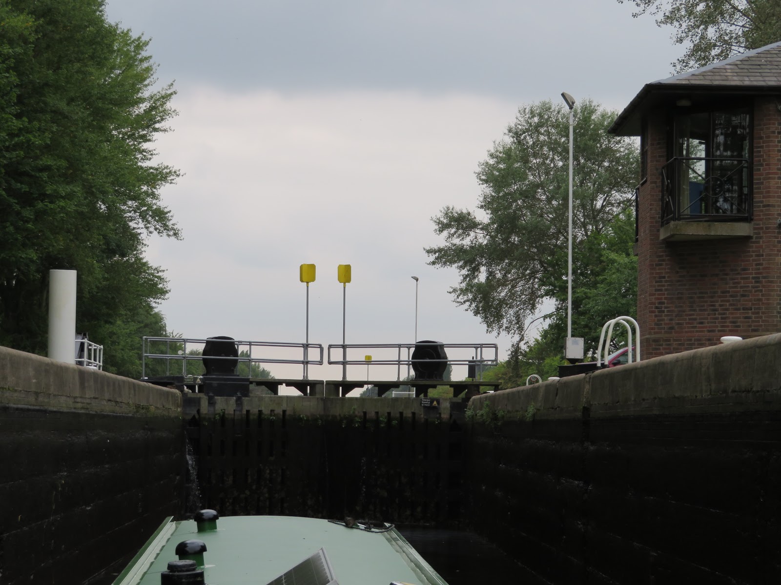
Bulholme Lock takes youn up from the river Aire into the Castleford cut. The lock keepers bungalows are on stilts to keep them from flooding. The yellow markers on the gates are there so that commercials (and hence all vessels) can see whether the lock gates are open or closed from a good distance away.

After stopping for a night or two at Castleford with a visit to the Junction pub, where all beer is served from the wood, we continued on our way passing through the Castleford flood lock and back onto the River, and turning right to continue up the River Aire towards Leeds.

It was a lovely day for a river cruise and between Castleford and Lemonroyd Lock much of the river has been rerouted in an artificial cut to enable cola to be extracted using open cast mining. More was built when the workings flooded and the route of the river had to be better defined. For some reason Lemonroyd lock looks much larger than the ones we have passed through already.

Just above Lemonroyd Lock is Fleet Bridge and an oil terminal that was fed by barge at one time. It was also the site of a lock down into the river, called Kippax Lock

The next lock is Woodlesford Lock and I think it is here that John Sergeant was filmed opening a lock side garden during one of his 'Barging round Britain' TV programmes in 2015. It is still well kept. There are always people to chat to on this stretch as there seem to be plenty of walkers about.

This concrete bridge was built to provide railway access to the Skelton Grange Power station that was on the north bank of the navigation and to the west of the M1 that can be seen through the old rail bridge.

There has been big changes at Knopstrop flood lock to prevent future floofing. In the past the river ran right next to the canal. This picture has 'Holderness' running in the river. The canal used to pass through the flood lock that was where the three pipes on the left was. There were many modern warehouses in the area too.

There are moorings near the services below Leeds Lock but we decided to see if there was any room inside the old Potato Wharf, now called Granary Wharf by the Armouries. Here you can see the top gates of Leeds Lock in the bottom right with the river running to the right. The height of the weir is being made adjustable to assist with flood elimination. The entrance to Granary Wharf is on the left just after the flags. The picture is taken from the Armouries museum that I had never been to before.