Total Pageviews

Friday, 5 January 2018

August 2017, by bridge and lock, part 3.

After our couple of days in Ripon we had to make our way back down the Ripon Canal to the River Ure. The section

This footbridge just a little above the Aldwark toll bridge is for the use of the golfers at Aldwark Manor club, but can also be used by local walkers. We saw more kingfishers on this stretch of river than we had seen in total for the other years cruising. It was a good year for them it seems.

We stopped for the night at Linton Lock. There is a long pontoon for moorings, but much ot it was taken up with permanent moorings. Linton Lock house was restored along with the lock island in 1998. After the navigation was built in 1767 it was run by the Linton Lock Commissioners who charged tolls to pay for the upkeep. Once the toll revenue fell low due to the lack of commercial traffic things got run down. They were then allowed to charge pleasure boats but after the 1998 refurbishment the rights were transferred to British Waterways to ensure the upkeep in the future and add to the national network.

We went straight through from Linton to Naburn and the next day were heading out of the lock bound for Selby once again. Naburn large lock was having a chain block to assist in closing the gate asx wer left.

Cawood swing bridge was open as we passed to facilitate further maintenance on it. The guy in the rescue boat was still laying there sunning him self!

The turn in the flowing river and into the lock at Selby was accomplished with no major emergency and we moored up at the Selby Boat Centre for another visit home to the City of Culture 2017.

After out time away it is always nice to be on the move again and we headed down the Selby Canal to try out a different river. Well not a different river, but a different part of one we had been on before. The canal opened in 1778 so I was quite surprised to see this bridge hole as the tow path can not be wide enough for a boat horse to pass the abutments. It also looks like the iron handrail has been added afterwards. maybe the bridge is much newer but would have to have been added in the 20th century when the motor boat had taken over from the horse powered boats.

At the other end of the Selby Canal is West Haddlesey. One end is the Ouse and this end is the Aire. Hence the huge lock gates as the river is liable to flood and it needs to be kept out of flooding back into the canal. We met up with a boat just before the lock so were able to share.

The river between West Haddlesey and the next lock is extremely bendy and it is a pleasure to be at the tiller as we head round the bends and get occasional views across the fields. The next lock is Beak Lock. All the people on the lock threw us a little but it turned out to be a charity boat trip. 

There are moorings in the lock cut, and this is where our companions stopped as they had won a meal at one of the two pubs close by. I reckon we will be back here for a look about. Beal is Old English for a 'nook of land in a river bend', so is well named. It appeared in the Domesday Book of 1086 as 'Begale'.

A couple of miles further on is the last lock on the Selby system that gets you back to the Aire and Calder main line. Bank Doles was once a hive of industry with mines and chemical works etc, but now is a forgotten back water with not much traffic passing through. You can see the river was quite benign as we passed through but with a couple more metres of water it would be fun, and there would be no red boards in the 'old days'.

Thursday, 4 January 2018

August 2017, by bridge and lock. Part 2.

After a great couple of days in York in which we acted as tourists to see many of the things that we don't when coming shopping for the day from Hull we set off in cold and drizzly weather. Luckily for us it cleared up quite nicely later on.

We thought that there would be few rowers out on the river on a weekday and in weather like this mornings, but they were just getting ready to leave the boat house. In fact this was the second wave as when we got outside of the built up area we caught the earlier starters on the way back! The first bridge of the day was Scarborough railway bridge that carried the track between York and Scarborough. It had a footpat between the two tracks but not the footpath is on the south side close to the camera.

A little more than three miles from our moorings you come to Skelton Railway Bridge. This is actuallu two bridges. The original stone bridge was built in 1839. It is now the route of the East Coast Main Line. This is accommodated on a newer wrought iron bridge with two tracks to itself. In February this bridge is having a refurbishment that will get rid of the speed restriction on traffic that has been in place since 2014. The track has been down since 1972!

After about 10 miles we were at the lock at Linton. The river comes down a weir on the left of the picture above and recently a 280KW Archimedes Screw generator has been installed. The red buoys mark the no go areas due to shallows.You can see the old mill on the lock island between the lock and weir. In the 1980's the island and lock became unstable and over £1 million had to be spent to stabilise it all.

Looking back from the lock you can see the pontoon for landing crew and also the current from the weit that brings down silt in times of spate that causes the shallows below the lock. You can also see the way the walls of the lock narrow towards the bottom and how deep it is. There is a 3 months closure on the lock until March 2018.

Aldwark toll bridge replaced a ferry in 1772 and was privately built it. costs 40p each way for a car today but this saves a 25' diversion round it. It seems that the bridge deck is made of timber, as when a vehicle crosses it sounds as though the beams are rattling

The river is now called the Ure, rather than the Ouse and the next lock is found just before Boroughbridge. Milbay Lock had a volunteer helping, but I suspect he was there with a maintenance team. We stopped on the moorings on the cut near to Boroughbridge weir. We had a great day here as the town has plenty of history to it and some pleasant walks around. It is one of those places that people pass when on the A1 and never stop.

The A1 is now two bridges with a bridge to each direction of traffic. It just goes to show the increase in the number of motor vehicles there has been. Again I have a warm glow as I pass underneath basking in the rural feel of the river that I am lost in very quickly and not been noticed at all by the speeding vehicles above.

Westwick Lock is in a lovely setting and I like the extending arms on the lock beams to give you an extra bit of push to open the bottom gates. We chatted to a couple of groups of walkers who said the normal thing we have been hearing this summer, 'we don't get many boats up here'!

At Oxclose Lock we enter the Ripon Canal and leave the River Ure. The gates are leaking quite badly so assume so special baffles have been provided to try to reduce the loss of water to enable you to make a level in the lock. Again in flood the river level is about level with the top of the lock!!

There are a couple of marinas between Oxclose Lock and Ripon as well as a couple of locks. The first lock is lovely named Bell Furrows Lock and the next one Rhodesfield Lock. We managed to find a space on the visitor morrings near the head of navigation and spent a great couple of days exploring the city of Ripon.

Wednesday, 3 January 2018

August 2017, by bridge and lock. Part 1

Well here we are in 2018 and a busy couple of weeks. My pocket lighter by a few pounds, but my body making up for it, being a few pounds heavier!! Still, more reason to get out and about now that the days are lengthening. I thought I had better crack on with the picture summary of 2017 in pictures of bridges and locks. You left us having arrived back in Selby after a trip up the Derwent to Melbourne Basin on the Pocklington Canal from Beverley and back down to Selby.

The next part of the trip this year was to explore the Yorkshire Ouse to York and beyond. The Selby Canal opened in 1778 to miss out the difficulties of the River Aire and Selby grew on the strength of the trade. You can see that the duck weed was still a bit of a problem bu the weed boat had been out in the canal it's self. We are getting used to the popping out of secure canal lock and pitting our wits against tidal waters and currents, and it was a nice day to boot.

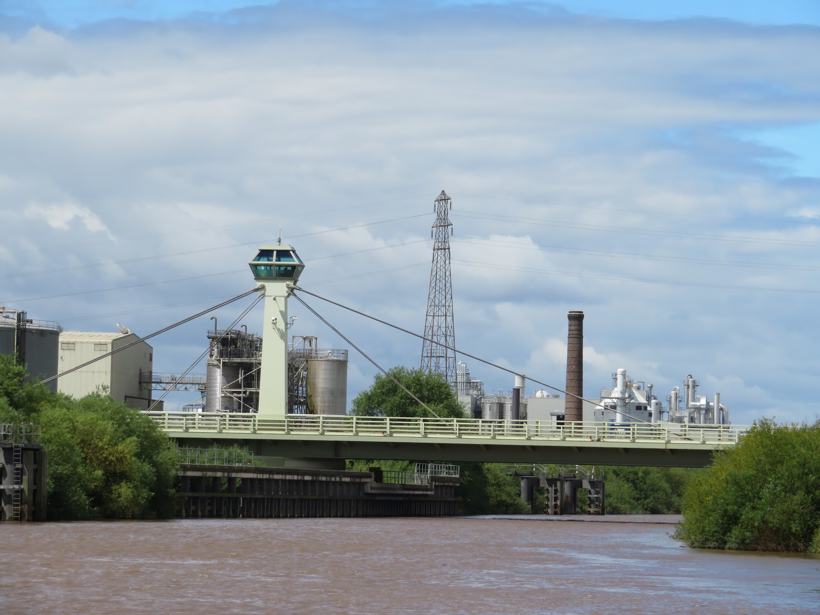
I had heard that C&RT had been out in the river collecting much of the larger debris that can present a bit of a hazard to boats as they drift up and down in the this area on the tides. Nothing was around as we passed under the railway swing bridge. The bridge was opened in 1891 replacing an earlier one. It actually has 5 spans over  river roads and footpaths. The opening span is 130' wide and opens on 24 cast steel rollers. The pivot is not in the middle, spans of 45' and 85' so a counterweight of 83.5 tonnes is used. The bridge looks very like Willmington bridge over the River Hull as it has a similar control cabin above it. The red painted bridge beyond is the road swing bridge. This was built to replace an earlier bridge and a toll was collected until 1991 when the local council bought the bridge. When open the road bridge provides a clear span of 11m.

The next bridge, or anything really, comes at Cawood which is about half way between Selby and Naburn Lock. It was opened in 1872 and it is hard to believe but in the floods of 2015 the river level was higher than the deck of the bridge. That may be why it is closed to traffic and is being refurbished. The guy in the saftey boat on the pontoon was taking it easy. I commented on the fact of the job and he said it is not great when it is howling and freezing with rain and snow. Good point, well made.

We got to Naburn Lock just about at high water and had a little wait for the boats that had passed us on the way up. It is a nice spot and in the summer months a trip boat comes down to here from York. Must be a nice trip. It seems that they are refurbishing the lock workshops on the island and making a small museum/visitor centre. We moored for the night on the cut from the lock to the river further up.

The next day we set of once more. After passing Acaster Malbis and Naburn with it's large marina for cruisers we came to the old railway bridge that carried the York - Selby railway. It was opened in 1871 and carried the route until 1983 when the line was diverted. It is now a cycle routs and part of the Trans Pennine cycle route. It is called the fisherman's Bridge due to the addition of the sculpture of the fisherman, his bike and dog (with cocked leg) in 2000.

This nondescript bridge is added as I love the way that despite the main A64 York By-Pass cross the river, few people up there will notice and non will realise that it was, and is an important navigation.

As we come to the built up area of York there is the Millenium Bridge that was actually opened in 2001. It is a pedestrian bridge and forms a nice circular walk from York up and down both banks.

On the right in the above photo is the entrance to the River Fosse. There is a lock that is operated by the IWA with 4 days notice for free but I don't think there is any winding hole after it's 1.5 mile length to Monkbridge. There are mooring just before the lock though. We carried on to the city centre.

Skeldergate Bridge was built between 1878 and 1881 and was a toll bridge until 1914. The small arch at the other end of the main span was made to open to allow vessels to moor up at the wharves in the centre of York. It is beautifully ornamented and very pleasing to the eye.

We were begining to think we would have to carry on out of York as the moorings in the cnetre were full and as we passed the Museum Gardens moorings  we saw that they were under water as there was plenty of fresh water in the river. We found an old quay at the west end of the gardens, at the bottom of Marygate and it was just our length so we had a perfect spot for our day of several days in York. Looking back to Lendal Bridge in the evening sun the stone work looked lovely. The bridge joins Lendal and Barker Towers and was opened in 1863. It was designed by Thomas Page in the Gothic Revival style. He also designed Westminster Bridge.

Saturday, 9 December 2017

July by bridge and lock, part 2.

You left us heading up the River Derwent. It is a shame that there is no passage to Satmford Bridge anymore as that would have been a nice trip to make and a bit of an adventure. It would be nice to think that the various responsible bodies could get their acts together and restore Sutton Lock and open up the route once more. It would be a relatively cheap way of restoring another 10 miles to the waterways.

When you arrive at Cottingwith Junction, where the arm off the river heads towards the Pocklington Canal you have to keep your eyes open as it is not at all obvious. The trees were much overgrown and it could easily have been missed. When we came back out this way we saw a sign that was mostly hidden. After a little way you come to Cottingwith Lock. They are fitted with the wheel type paddle gear but otherwise all seemed normal. As we arrived there was another boat going up ahead of us.

We had been warned by others that there could well be a weed problem and after a very short distance we realised that we had underestimated the problems as we had never really encountered weed to this extent. The first couple of miles was the worst and I think it was really because there were no trees shading the canal so the heat and sun light had really boosted the growth. It was just a matter of perseverance, going in reverse to try to rid the prop of weed until it didn't work anymore and then getting down the weed hatch to do a 'proper' job. After Haggs Bridge it got a bit better and quicker progress was made. This picture of the bridge was taken on the way out again.

Also in the two miles were a couple of swing bridges, aptly called No.1 and No.2! I think this is No.1 but they are the same design. This gave some relief from the weed pushing and also another opportunity to go down the hatch and clear the prop one more time. Unfortunately the weed cutting boat is out of action as it needs some expensive alterations.

By the time we reached Gardham Lock things were moving along more quickly but not clear of weed by any means. The lock has a swing bridge across the middle of it like Fenny on the Grand Union. Just another little quirk on this canal.

 After several hours of pushing weed to complete the 5 miles we arrived at swing bridge No.7. Just the other side of this is the entrance to the Melbourne Arm and our moorings for a while, kindly lent to us by a member of the Pocklington Canal Amenity Society. It is a pretty idyllic spot, nice and quiet with fish aplenty, walkers and boat trips to occupy you for some of the day but very peaceful for the rest of the time. In the above photo you can see there is plenty of weed and rush on the canal. This section is not open to navigation at present.

The next lock up on the non navigable stretch of 4 miles is Thornton Lock and it has just been refurbished. This weekend they were having an open day to the public. We had a sneek preview and an interesting chat to the C&RT guys there. You can see above the lock the waterway is chocked with weed. It actually wouldn't take too much get this open again and through to the Canal Head about a mile short of Pocklington.

After a few days back at home we followed our route back to the barrage at Barmby. We stopped for a night on the pontoon at Barmby and had a great meal at the King's Head in the village. We also had a great meal at the pub in Melbourne so we will be back to both in the future I'm sure. I had been to see the lock keepers and they had given me a time to be at the lock for our pen out on to the Ouse fro the next part of our trip. They keep the whole area in tip top condition. In this photo you can see the floating fence that prevents going over the barrage and the piles that mark the lock entrance.

The tide was flooding up when we popped out of the lock. We were heading for Selby which was only about 6 miles away. It would obviously be beneficial to arrive when much of the flood tide had abated so we were in no rush at all to get there. In fact we spent most of the trip in neutral just putting 'Holderness' in gear to straighten up and get round the bends! Saving fuel I suppose but got a little funny when the tide started setting us down on to the banks of the bends. We were soon approaching the Selby bypass swing bridge. I was interested to see that a set of pontoons had been placed either side of the bridge to allow vessels waiting for the bridge to hang a rope up to rather than have to dodge about in the river.

Once more having never been this way before it was quite difficult to spot the entrance to the lock for the Selby Canal from any distance, but was obvious when you arrived. We were soon round and shaping up to make our entrance. As usual it seems there were several folk standing waiting so you mess up, of maybe watching and learning to see how you do it. There is slack water just inside the knuckle of the lock so once you have angled in at a nice slow speed over the ground a little kick to get the bow round into the lock is all that was needed. I managed not to disgrace myself once again.

There was just us coming up and we were soon towering above the river level. In the summer months the Selby Canal is full of weed and the first clue you will have of the lock from the river is the banks of weed that are flushed out every time the lock is used. As you can see the weed is so think it does look like a lawn and the coots and moorhens are in there element as their big feet mean that they can walk on it and not have to swim.

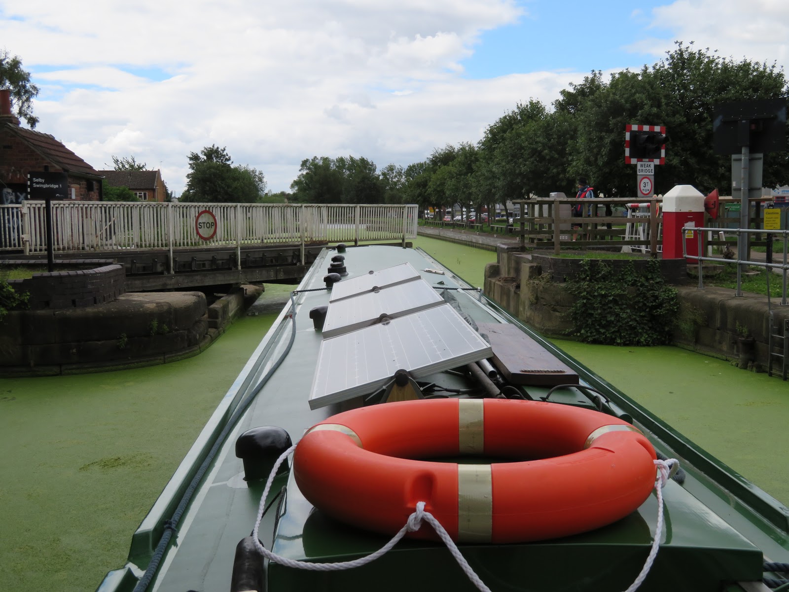
There was no room at the basin area near the lock, but we had booked a berth at the Selby Boat Centre as we were heading home again. The weed continued all the way to our allocated slot and we had to literally dig our way in to the mooring as we came alongside to get right flush to the wall. Before that there is one more obstacle of an electric swing bridge. This road must be a short cut to an estate or something because every time we used it we held up loads of traffic! That's Helen working the controls despite being dressed as a C&RT volunteer!

See where we get to in August in the next exciting episode of Bridges and Locks.


Monday, 4 December 2017

July by bridge and lock, part 1.

The trip down from Beverley to Hull was the reverse of the way up, in as much as it was just the reverse of the bridges on the way up. Instead of worrying about not being able to fit under the last bridge, the navigational problem was to ensure that we cleared the River Hull as early as possible to give us plenty of time to get right up the Ouse, but to ensure that we had enough water to float when in the River Hull. We left Beverley about 2 hours before LW Hull and despite some 'slight' adventures we got to Sammy's Point by The Deep 3 hrs later, so an hour after LW. I reckon we could have easily left 30 mins later and we would have meet the incoming tide a little further up the Hull.

Once we got on the Humber there was a bit of a wind from the west that had a bit of a chill. Pretty soon it came round to the east, as forecast and it became a pleasant day. We decided to take the northern channel that is not buoyed but on a rising tide would mean we there would be no problem and we would have a different view of the Humber. Passing under the Humber bridge is always a thrill as it may no longer be the longest in the World, but it is pretty beautiful.

Not really knowing how long everything would take we maintained a good speed and made the junction of the rivers Trent and Ouse at the Apex Light in two and a half hours so at an average speed of 6.7kts. We were now on the Ouse and heading to Goole. It was very calm and peaceful and pleasant. We passed Goole an hour later so making a speed of about 10 kts. As we passed the port we had a good view of the old Ouse lock, to the left that you can see is disused due to the bank of mud in the mouth of it, and Victoria Lock that is in use and whilst not quite as wide as Ocean Lock, it is nice and long. We were able to slow down even more as the closer to HW at Barmby Barrage the better as there would be less flow on the river.

The next obstacle was Skelton Railway Bridge. We had been informed of an outward bound vessel from Howdendyke, and on the radio we could hear that we were going to meet around the bridge. The bridge was built in 1869 and over the years has had a few strikes from shipping. There is a slight bend at the site of the bridge and the current doesn't flow directly through the bridge, so setting you onto the structure. It was nice to see a commercial ship on the river.

After passing Hook Ness, making sure you take the right side of the island as one side dries out, but no problem for us on a rising tide. Round the bend and the M62 motorway bridge comes into view. This is the next bridge across the Humber/Ouse after the Humber Bridge, and there is no toll. The bridge was opened in 1976.

Juyst through the motorway bridge you come to Boothferry Bridge which was the lowest bridge to cross to the north bank until 1981 when the Humber Bridge was opened. There was usually a big tail back due to the bottle neck. The Bridge Master came out to give us a wave

We arrived off Barmby Barrage 90 mins after passing Goole at 1645, about 45 mins before HW at Barmby. There was still a good run on the river, but it is nice and wide and swinging round, head to current is not much of a problem. The barrage is to the right of the picture and it was designed to maintain the level of water in the River Derwent and prevent flooding of the valley. The control cabin controls the lock and the barrage. The water levels in the river are watched and altered all automatically.

We had spoken to the Lock Keeper on the way up to keep us informed of our progress and he had said that he would have the lock open for us, but if he wasn't there, just to give him a ring once we were in the lock as he only lives close by. We swung round and started dodging in towards the lock which is separated from the barrage by the piles. This photo is actually from when we left as my camera battery had gone flat on the way in. There doesn't seem to be much room but you can get close to the knuckle, you can  just see some stone below the sign at the waters edge, and there the is slack water so you can 'bend' her in when close to it. The lock keepers are very friendly and helpful and the pontoon a little further up the river is just a nice walk to the village.


After a day on the pontoon and a walk into the village for a safe arrival pint we set of the next day to explore more new ground. The first bridge on the Derwent is the Loftsome road bridge. The small photo above was the toll bridge that was in place from 1804 until 1930's when the present road bridge was opened. It is quite a pleasant stretch of the river.

Not much further up the river is the railway bridge at Wressle. the Hull and Selby Railway was opened in 1840 and soon after Wressle Station was opened. Just through the bridge is the remains of Wressle Castle which was home of the Percy family from 1390's. The house was badly damaged in the Civil wear and then largely burned down in 1796 and what is left is just one wing.

This bridge has been in place since 1793 and was a toll bridge until 1936. It replaced a ferry that was dangerous at times. It has not been enlarged and has traffic lights to regulate traffic. Apart from the three main arches the road way is held above the flood plain by lower flood arches to either side. There are few places to stop and moor on the Derwent so we continued onwards, so more of that on the next blog.